Safle Claddu Nant y Caws (SN 468 174) & (SN 469
174) and Cae Mawr (SN 462 175)
There has been confirmation of a Summit Relocation
to a hill that is now listed as a Dual Summit in the 100m Twmpau and Y Trechol –
The Dominant Hills of Wales, with the summit height, bwlch height and their
locations, the drop, dominance and status of the hill derived from LIDAR analysis
conducted by Myrddyn Phillips.
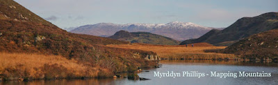
%20-%20LIDAR%20hill%202.jpg) |
| LIDAR image of Cae Mawr (SN 462 175) and Safle Claddu Nant y Caws (SN 468 174) & (SN 469 174) |
The criteria for the two listings that this summit
relocation applies to are:
100m Twmpau - Welsh hills at or above 100m and below 200m in height that have 30m
minimum drop, with an accompanying sub list entitled the 100m Sub-Twmpau, with
the criteria for this sub category being all Welsh hills at or above 100m and
below 200m in height with 20m or more and below 30m of drop, with the word
Twmpau being an acronym standing for thirty
welsh metre prominences and upward.
 |
| 100m Twmpau by Myrddyn Phillips |
 |
| Y Trechol - The Dominant Hills of Wales by Myrddyn Phillips |
Dual Summit hills:
A
hill classified as a Dual Summit is defined as one which has an extant natural
summit coupled with that of a higher artificial summit, with the latter that
can be described as stable in character.
In the main, these recent man-made constructions are the result of
quarrying activities producing spoil tips, or as in this instance a landfill. These recent man-made constructions are
treated differently to ancient man-made constructions such as hill forts and
tumuli, as if the latter are deemed stable and of an earthen character their
age dictates that they can be viewed as being permanent in nature and are now
effectively a part of the hill. For
those bagging Dual Summit hills, a visit to either the natural high point or
the elevated man-made high point is sufficient to claim an ascent of the hill. With the Dual Summit classification being a
relatively new category and fist instigated in January 2018 for a Dual Summit
Pedwar.
The name the hill is now listed by is Safle Claddu Nant y Caws for the higher man-made summit and Cae Mawr for the lower natural
summit, and it is adjoined
to the Mynydd Sylen group of hills, which are situated in the southern part of South Wales (Region B,
Sub-Region B5), and the two summits are
positioned with the A48 road to their north and a minor road to their
south-west, and has the town of Caerfyrddin (Carmarthen) towards the north-west.
When the original 100m height band of Welsh P30 hills were published on Geoff Crowder’s v-g.me website, the natural summit was
included in the main P30 list with a 155m summit height, based on the spot
height adjoined to a triangulation pillar positioned at SN 46405 17608 that
appears on the contemporary Ordnance Survey 1:50,000 Landranger and 1:25,000
Explorer map.
%20-%201%2025000.jpg) |
| Extract from the Ordnance Survey 1:25,000 Explorer map |
After the sub list was standardised, and
interpolated heights and drop values also included the details for this hill
were re-evaluated and it was then separated in to its two component parts, with
the man-made summit listed with an estimated c 59m of drop, based on an
estimated c 156m summit height positioned at SN 46909 17343 and an estimated c 97m
bwlch height, with both heights based on interpolation of 5m contouring that
appeared on the interactive mapping hosted on the OS Maps website. With the lower natural summit listed with a
155 summit height and the bwlch between these two summits estimated as c 138m,
which if separating these hills would give an estimated c 17m of drop.
However, it was not until LIDAR became available
that the details for these summits could be accurately re-assessed. The LIDAR (Light Detection & Ranging)
technique produced highly accurate height data that is now freely available for
much of England and Wales.
%20-%20LIDAR%20summit%206%20x%202.jpg) |
| LIDAR summit image of Cae Mawr (SN 462 175) and Safle Claddu Nant y Caws (SN 468 174) & (SN 469 174) |
LIDAR analysis gives the highest ground at the
man-made summit as 163.8m positioned at SN 46899 17416 & SN 46900 17411, and this
compared to the originally listed summit which LIDAR gives as 155.1m positioned
at SN 46268 17566 comes within the parameters of the
Summit Relocations used within this page heading, these parameters are:
The term Summit Relocations applies when the high
point of the hill is found to be positioned; in a different field, to a
different feature such as in a conifer plantation, within a different map contour, to a
different point where a number of potential summit positions are within close
proximity, when natural ground or the natural and intact summit of a hill is
confirmed compared to a higher point such as a raised field boundary or covered
reservoir that is judged to be a relatively recent man-made construct, or a relocation
of approximately 100 metres or more in distance from either the position of a
map spot height or from where the summit of the hill was previously thought to
exist.
Therefore, the height produced by LIDAR analysis to
the higher of the two Dual Summits is 163.8m and is positioned at SN 46899 17416 & SN
46900 17411, and this for listing
purposes is the prioritised summit and it is not given a spot height on the contemporary
Ordnance Survey 1:50,000 Landranger and 1:25,000 Explorer map, and is
approximately 630 metres east south-eastward from where the originally listed summit
is positioned.
The full details for the
hill are:
Group: Mynydd Sylen
Name: Safle Claddu Nant y Caws (artificial Dual Summit) and Cae Mawr (natural Dual Summit)
OS 1:50,000 map: 159
Summit Height: 163.8m (artificial
Dual Summit) and 155.1m (natural Dual Summit) (LIDAR)
Summit Grid Reference (New Position): SN 46899 17416 & SN 46900
17411 (artificial Dual Summit) and SN 46268 17566 (natural Dual Summit) (LIDAR)
Bwlch Height: 98.5m (LIDAR)
Bwlch Grid Reference:
SN 39491 11374 & SN 39493 11375 (LIDAR)
Drop: 65.3m (artificial
Dual Summit) and 56.6m (natural Dual Summit) (LIDAR)
Dominance: 39.89% (artificial
Dual Summit) and 36.50% (natural Dual Summit) (LIDAR)
Myrddyn Phillips (July 2024)
%20-%20LIDAR%20hill%201.jpg)

%20-%201%2025000.jpg)
%20-%20LIDAR%20hill%202.jpg)

%20-%201%2025000.jpg)
%20-%20LIDAR%20hill%202.jpg)


%20-%201%2025000.jpg)
%20-%20LIDAR%20summit%206%20x%202.jpg)
%20-%20LIDAR%20hill%202.jpg)

%20-%201%2025000.jpg)
%20-%20LIDAR%20hill%201.jpg)

%20-%201%2025000.jpg)
%20-%20Draft%20Surveyors%20map.jpg)
%20-%20Tithe.jpg)
%20-%20apportionments.jpg)