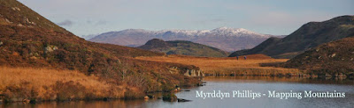
Coed Abergwynant (SH 677 178)
There has been confirmation of a Summit Relocation to a hill that is listed in the 30-99m Twmpau, with the summit height, bwlch height and their locations, the drop and status of the hill derived from LIDAR analysis conducted by Myrddyn Phillips.
%20-%20LIDAR%20hill%201.jpg) |
| LIDAR image of Coed Abergwynant (SH 677 178) |
The criteria for the list that this summit
relocation applies to are:
30-99m Twmpau - Welsh hills at or above 30m and below 100m in height that have 30m
minimum drop, with an accompanying sub list entitled the 30-99m Sub-Twmpau,
with the criteria for this sub category being all Welsh hills at or above 30m
and below 100m in height with 20m or more and below 30m of drop, with the word
Twmpau being an acronym standing for thirty
welsh metre prominences and upward.
 |
| 30-99m Twmpau by Myrddyn Phillips |
The name the hill is now listed by
is Coed Abergwynant, and it is adjoined to
the Cadair Idris group of hills, which are situated in the south-western part of North Wales (Region A,
Sub-Region A3), and it is positioned with the
A493 road to its south-east, and has the town
of Dolgellau towards the east.
When the original 30-99m height band of Welsh P30 hills were published on Geoff Crowder’s v-g.me website, this hill was included
in the main P30 list with a non-interpolated summit height of c 90m, with the
prioritised summit positioned at SH 681 177, with an accompanying note stating;
Three points of same height – other at SH
679 178 and SH 676 177, a reference to the three uppermost 90m ring
contours that appear on the contemporary Ordnance Survey 1:25,000 Explorer map.
When the sub list was standardised, and
interpolated heights and drop values also included the details for this hill
were re-evaluated and it was listed with an estimated c 51m of drop, based on
an estimated c 97m summit height positioned at SH 67728 17847 and a 46m bwlch
height, based on the spot height that appears on the contemporary Ordnance
Survey 1:25,000 Explorer map.
%20-%201%2025000.jpg) |
| Extract from the Ordnance Survey 1:25,000 Explorer map |
However, it was not until LIDAR became available
that the details for this hill could be accurately re-assessed. The LIDAR (Light Detection & Ranging)
technique produced highly accurate height data that is now freely available for
much of England and Wales.
LIDAR analysis gives the highest ground on this
hill as 97.1m positioned at SH 67725 17843, and when compared to the original
prioritised summit position this comes within the parameters of the Summit Relocations
used within this page heading, these parameters are:
The term Summit Relocations applies when the high
point of the hill is found to be positioned; in a different field, to a
different feature such as in a conifer plantation, within a different map contour, to a
different point where a number of potential summit positions are within close
proximity, when natural ground or the natural and intact summit of a hill is
confirmed compared to a higher point such as a raised field boundary or covered
reservoir that is judged to be a relatively recent man-made construct, or a
relocation of approximately 100 metres or more in distance from either the
position of a map spot height or from where the summit of the hill was previously
thought to exist.
Therefore, the height produced by LIDAR analysis
to the summit of this hill is 97.1m and is positioned at SH 67725 17843, this position is not
given a spot height on the contemporary Ordnance Survey 1:50,000 Landranger and
1:25,000 Explorer map, and is approximately 390 metres westward and placed in a
different map contour compared to where the original prioritised listed summit
is positioned.
The full details for the hill are:
Group: Cadair Idris
Name: Coed Abergwynant
OS 1:50,000 map: 124
Summit Height: 97.1m (LIDAR)
Summit Grid Reference (New Position): SH 67725 17843 (LIDAR)
Bwlch Height: 46.7m (LIDAR)
Bwlch Grid Reference: SH 68287 17879 (LIDAR)
Drop: 50.4m (LIDAR)
Myrddyn Phillips (July
2024)
No comments:
Post a Comment