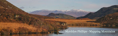
Cae Cenfas Ucha (SN 751 118)
There has been a Significant Name Change to a hill that is listed in The Welsh P15s, with the summit height, bwlch height and their locations, the drop and status of the hill derived from LIDAR analysis conducted by Myrddyn Phillips.
%20-%20LIDAR%20hill%201.jpg) |
| LIDAR image of Cae Cenfas Ucha (SN 751 118) |
The criteria for the list that this name change applies to
are:
The Welsh
P15s – Welsh hills with 15m
minimum drop, irrespective of their height, with an accompanying sub list entitled the Welsh Sub-P15s,
with the criteria for this sub category being all Welsh hills with 14m or more
and below 15m of drop. The list is authored by Myrddyn Phillips, with the
Introduction to the list appearing on Mapping Mountains on the 10th
May 2019.
 |
| The Welsh P15s by Myrddyn Phillips |
The hill is adjoined to the Mynydd Du group of
hills, which are situated in the southern
part of South Wales (Region B, Sub-Region B5), and it is positioned with a minor road to its west and south,
and the A4068 road to its east, and has the community of Y Gurnos towards the
south-east.
When the listing that became known as The Welsh P15s was being compiled, this
hill was not included as with an uppermost 170m contour and bwlch contouring
between 160m – 170m that appear on the contemporary Ordnance Survey 1:50,000
Landranger and 1:25,000 Explorer map, it was judged not to meet the criterion
for the main P15 or the accompanying P14 sub list.
%20-%201%2025000.jpg) |
| Extract from the Ordnance Survey 1:25,000 Explorer map |
However, it was not until LIDAR became available
that the details for this hill could be accurately re-assessed. The LIDAR (Light Detection & Ranging)
technique produced highly accurate height data that is now freely available for
much of England and Wales.
LIDAR analysis gives the natural summit of this
hill as 182.8m, and with a 164.5m bwlch height, these values give this hill 18.3m
of drop, which is sufficient for it to be classified as a Welsh P15.
As the summit of this hill used to comprise
bounded land the details for it were examined on the Tithe map. The
term Tithe map is generally given to a map of a Welsh or English parish or
township and which was prepared after the 1836 Tithe Commutation Act. This act allowed tithes to be paid in cash
rather than goods. The Tithe maps gave
names of owners and occupiers of land in each parish and importantly for
place-name research they also included the name of enclosed land. This enclosed land is usually based on a
field system, however not every field is given a name, but many are and especially
so in Wales.
%20-%20Tithe.jpg) |
| Extract from the Tithe map |
The enclosed land where the summit of this hill is
situated is given the number 1302 on the Tithe map, this can be cross
referenced against the apportionments; it is these apportionments that give the
name of the owner or occupier of the land as well as the name of the land. The land where the summit of this hill is
situated is named as Cae Cenfas Ucha in
the apportionments, with the details on the Tithe map appearing
in the parish of Llan-giwg and in the county named as Glamorgan.
%20-%20apportionments.jpg) |
| Extract from the apportionments |
Therefore, the name this hill
is now listed by in The Welsh P15s is
Cae Cenfas Ucha and
this was derived from the Tithe map.
The full details for the hill are:
Group: Mynydd Du
Name: Cae Cenfas Ucha
Previously Listed Name: unclassified
OS 1:50,000 map: 160
Summit Height: 182.8m (LIDAR)
Summit Grid Reference: SN 75108 11870 (LIDAR)
Bwlch Height: 164.5m (LIDAR)
Bwlch Grid Reference: SN 75202 12488 (LIDAR)
Drop: 18.3m (LIDAR)
My thanks to Aled Williams for advise relating to the listed name of this hill
Myrddyn Phillips (May
2024)
No comments:
Post a Comment