Mynydd Morfil (SN 040 313) – Sub-Trichant addition
There has been confirmation of an addition to the list of Y Trichant – The 300m Hills of Wales, with the summit height, bwlch height and their locations, the drop and status of the hill derived from LIDAR analysis conducted by Myrddyn Phillips.
%20-%20LIDAR%20hill%202.jpg) |
| LIDAR image of Mynydd Morfil (SN 040 313) |
The criteria for the list that this addition
applies to are:
Y Trichant
– The 300m Hills of Wales – Welsh
hills at or above 300m and below 400m in height that have 30m minimum drop, with an accompanying sub list entitled the
Sub-Trichant, with the criteria for this sub category being all Welsh hills at
or above 300m and below 400m in height with 20m or more and below 30m of
drop. The list is authored by Myrddyn Phillips with the
Introduction to the list and the renaming of it appearing on Mapping Mountains
on the 13th May 2017, and the Introduction to the Mapping Mountains
publication of the list appearing on the 1st January 2022.
 |
| Y Trichant - The 300m Hills of Wales by Myrddyn Phillips |
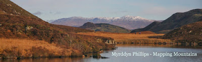
The name the hill is listed by is Mynydd Morfil,
and it is adjoined to the Mynydd Preseli group of hills, which are situated in the south-western part of
South Wales (Region B, Sub-Region B1), and it is positioned with the B4313 road to its north and a minor road
to its south-west, and has the town of Abergwaun (Fishguard) towards the north-west.
When the original 300m height band of Welsh P30 hills were published on Geoff Crowder’s v-g.me website, this hill was not
included in the Hills to be surveyed
sub list, as it was considered not to meet the criteria then used for this sub
category.
After the sub list was standardised, and
interpolated heights and drop values also included the details for this hill
were re-evaluated and it was listed with an estimated c 23m of drop, based on an
estimated c 301m summit height and an estimated c 278m bwlch height, with both
heights based on interpolation of 5m contouring that appears on the Ordnance
Survey 1:25,000 Explorer map.
%20-%201%2025000.jpg) |
| Extract from the Ordnance Survey 1:25,000 Explorer map |
However, it was not until LIDAR became available
that the details for this hill could be accurately re-assessed. The LIDAR (Light Detection & Ranging)
technique produced highly accurate height data that is now freely available for
much of England and Wales.
Therefore, the confirmation of the addition of
this hill to Sub-Trichant status is due to LIDAR analysis, resulting in a 300.4m
summit height and a 278.1m bwlch height, with these values giving this hill 22.2m
of drop, which is sufficient for it to be classified as a Sub-Trichant.
The full details for the hill are:
Group: Mynydd Preseli
Name: Mynydd M0rfil
OS 1:50,000 map: 145
Summit Height: 300.4m (LIDAR)
Summit Grid Reference: SN 04057 31302 (LIDAR)
Bwlch Height: 278.1m (LIDAR)
Bwlch Grid Reference: SN 04718 31316 & SN 04723 31318 (LIDAR)
Drop: 22.1m (LIDAR)
Myrddyn Phillips
(September 2024)
No comments:
Post a Comment