Showing posts with label Cymanfynydd Fach. Show all posts

Wednesday, 20 December 2023

Mapping Mountains – Significant Name Changes – Y Trichant – The 300m Hills of Wales


Cymanfynydd Fach (SN 562 615) 

There has been a Significant Name Change to a hill that is listed in the Y Trichant – The 300m Hills of Wales, with the summit height, bwlch height and their locations, the drop and status of the hill derived from LIDAR analysis conducted by Myrddyn Phillips. 

LIDAR image of Cymanfynydd Fach (SN 562 615)

The criteria for the list that this name change applies to are:

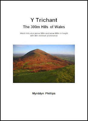
Y Trichant – The 300m Hills of Wales – Welsh hills at or above 300m and below 400m in height that have 30m minimum drop, with an accompanying sub list entitled the Sub-Trichant, with the criteria for this sub category being all Welsh hills at or above 300m and below 400m in height with 20m or more and below 30m of drop.  The list is authored by Myrddyn Phillips with the Introduction to the list and the renaming of it appearing on Mapping Mountains on the 13th May 2017, and the Introduction to the Mapping Mountains publication of the list appearing on the 1st January 2022. 

Y Trichant - The 300m Hills of Wales by Myrddyn Phillips

The hill is adjoined to the Mynydd Bach group of hills, which are situated in the western part of South Wales (Region B, Sub-Region B1), and it is positioned encircled by minor roads, with the B4577 road farther to its north, the B4337 road farther to its west, the B4342 road farther to its south and the B4576 road farther to its east, and has the town of Aberaeron towards the west.

The hill appeared in the original 300m height band of Welsh P30 hills published on Geoff Crowder’s v-g.me website, under the invented and transposed name of Bryn y Hafodhir, with an accompanying note stating; Name from buildings to the South-West.

During my early hill listing I thought it appropriate to either invent a name for a hill, or use a name that appeared near to the summit of the hill on Ordnance Survey maps of the day.  My preference was to use farm names and put Pen, Bryn or Moel in front of them or as in this instance transpose the name of a farm and add the words Bryn y to it.  This is not a practice that I now advocate as with time and inclination place-name data can be improved either by asking local people or by examining historic documents, through this form of research an appropriate name for the hill can usually be found. 

Extract from the Ordnance Survey 1:25,000 Explorer map

As the summit of this hill comprises bounded land the details for it were examined on the Tithe map.  The term Tithe map is generally given to a map of a Welsh or English parish or township and which was prepared after the 1836 Tithe Commutation Act.  This act allowed tithes to be paid in cash rather than goods.  The Tithe maps gave names of owners and occupiers of land in each parish and importantly for place-name research they also included the name of enclosed land.  This enclosed land is usually based on a field system, however not every field is given a name, but many are and especially so in Wales. 

Extract from the Tithe map

The enclosed land where the summit of this hill is situated is given the number 957 on the Tithe map, this can be cross referenced against the apportionments; it is these apportionments that give the name of the owner or occupier of the land as well as the name of the land.  The land where the summit of this hill is situated is named as Cymanfynydd Fach in the apportionments, with research conducted by Iwan Wmffre for the composition of this name with his work detailed in the books entitled The Place-Names of Cardiganshire published by the British Archaeological Reports Oxford Ltd, with the details on the Tithe map appearing in the parish of Llanbadarn Trefeglwys and in the county named as Cardiganshire. 

Extract from the apportionments

Therefore, the name this hill is now listed by in the Y Trichant – The 300m Hills of Wales is Cymanfynydd Fach and this was derived from the Tithe map with the language protocol used for part of the name. 


The full details for the hill are: 

Group:  Mynydd Bach 

Name:  Cymanfynydd Fach 

Previously Listed Name:  Bryn y Hafodhir 

OS 1:50,000 map:  146

Summit Height:  315.6m (LIDAR)                                                           

Summit Grid Reference:  SN 56285 61520 (LIDAR) 

Bwlch Height:  274.95m (LIDAR) 

Bwlch Grid Reference:  SN 55869 60212 (LIDAR) 

Drop:  40.7m (LIDAR) 


My thanks to Aled Williams for advise relating to the listed name of this hill

Myrddyn Phillips (December 2023)


Friday, 15 December 2023

Mapping Mountains – Summit Relocations – Y Trichant – The 300m Hills of Wales


Cymanfynydd Fach (SN 562 615) 

There has been a Summit Relocation to a hill that is listed in the Y Trichant – The 300m Hills of Wales, with the summit height, bwlch height and their locations, the drop and status of the hill derived from LIDAR analysis conducted by Myrddyn Phillips. 

LIDAR image of Cymanfynydd Fach (SN 562 615)

The criteria for the list that this summit relocation applies to are:
Y Trichant – The 300m Hills of Wales – Welsh hills at or above 300m and below 400m in height that have 30m minimum drop, with an accompanying sub list entitled the Sub-Trichant, with the criteria for this sub category being all Welsh hills at or above 300m and below 400m in height with 20m or more and below 30m of drop.  The list is authored by Myrddyn Phillips with the Introduction to the list and the renaming of it appearing on Mapping Mountains on the 13th May 2017, and the Introduction to the Mapping Mountains publication of the list appearing on the 1st January 2022. 

Y Trichant - The 300m Hills of Wales by Myrddyn Phillips

The name the hill is listed by is Cymanfynydd Fach and this was derived from the Tithe map, with research conducted by Iwan Wmffre for the composition of this name with his work detailed in the books entitled The Place-Names of Cardiganshire published by the British Archaeological Reports Oxford Ltd, and it is adjoined to the Mynydd Bach group of hills, which are situated in the western part of South Wales (Region B, Sub-Region B1), and it is positioned encircled by minor roads, with the B4577 road farther to its north, the B4337 road farther to its west, the B4342 road farther to its south and the B4576 road farther to its east, and has the town of Aberaeron towards the west.

When the original 300m height band of Welsh P30 hills were published on Geoff Crowder’s v-g.me website, this hill was included in the main P30 list with a summit height of 316m that appears as a spot height positioned at SN 562 615 on the contemporary Ordnance Survey 1:50,000 Landranger and 1:25,000 Explorer map. 

Extract from the Ordnance Survey 1:25,000 Explorer map

However, it was not until LIDAR became available that the details for this hill could be accurately re-assessed.  The LIDAR (Light Detection & Ranging) technique produced highly accurate height data that is now freely available for much of England and Wales.

LIDAR analysis gives the highest ground on this hill as 316.2m positioned at SN 56277 61518.  However, this is a part of a raised field boundary and protocols dictate that as this is deemed a relatively recent man-made construct such ground is discounted from the height of a hill. 

LIDAR summit image of Cymanfynydd Fach (SN 562 615)

The height produced by LIDAR analysis to the highest remaining natural ground of this hill is 315.6m positioned at SN 56285 61520, and this position in relation to the raised field boundary comes within the parameters of the Summit Relocations used within this page heading, these parameters are:

The term Summit Relocations applies when the high point of the hill is found to be positioned; in a different field, to a different feature such as in a conifer plantation,  within a different map contour, to a different point where a number of potential summit positions are within close proximity, when natural ground or the natural and intact summit of a hill is confirmed compared to a higher point such as a raised field boundary or covered reservoir that is considered a relatively recent man-made construct, or a relocation of approximately 100 metres or more in distance from either the position of a map spot height or from where the summit of the hill was previously thought to exist.

Therefore, the summit height produced by LIDAR analysis is 315.6m and this is positioned at SN 56285 61520, this position is close to where the 316m spot height appears on the contemporary Ordnance Survey 1:50,000 Landranger and the 1:25,000 Explorer map, and is approximately 8 metres eastward from where the high point of the raised field boundary is positioned. 


The full details for the hill are:

Group:  Mynydd Bach 

Name:  Cymanfynydd Fach 

OS 1:50,000 map:  146

Summit Height:  315.6m (LIDAR)                                                           

Summit Grid Reference (New Position):  SN 56285 61520 (LIDAR) 

Bwlch Height:  274.95m (LIDAR) 

Bwlch Grid Reference:  SN 55869 60212 (LIDAR) 

Drop:  40.7m (LIDAR) 


Myrddyn Phillips (December 2023)