
Black Acre (SN 292 146)
There has been a Summit Relocation to a hill that is listed in the 30-99m Twmpau and Y Trechol – The Dominant Hills of Wales, with the summit height, bwlch height and their locations, the drop, dominance and status of the hill derived from LIDAR analysis conducted by Myrddyn Phillips.
%20-%20LIDAR%20hill%201.jpg) |
| LIDAR image of Black Acre (SN 292 146) |
The criteria for the two listings that this summit
relocation applies to are:
30-99m Twmpau - Welsh hills at or above 30m and below 100m in height that have 30m
minimum drop, with an accompanying sub list entitled the 30-99m Sub-Twmpau,
with the criteria for this sub category being all Welsh hills at or above 30m
and below 100m in height with 20m or more and below 30m of drop, with the word
Twmpau being an acronym standing for thirty
welsh metre prominences and upward.
 |
| The 30-99m Twmpau by Myrddyn Phillips |
Y Trechol – The Dominant Hills of Wales – Welsh P30 hills whose
prominence equal or exceed half that of their absolute height. With the criteria for Lesser Dominant status
being those additional Welsh P30 hills whose prominence is between one third
and half that of their absolute height.
The list is authored by Myrddyn Phillips with the Introduction to the start of the Mapping Mountains publication of this list appearing on the 3rd
December 2015, and the list is now available in its entirety on Mapping Mountains in Google Doc format.
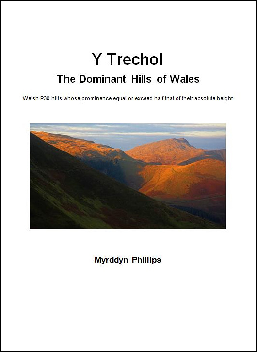 |
| Y Trechol - The Dominant Hills of Wales by Myrddyn Phillips |
The name the hill is now listed by is Black Acre
and this was derived from the Tithe map, and it is adjoined to the Mynydd
Pencarreg group of hills, which are
situated in the south-western part of South Wales (Region B, Sub-Region B1),
and it is positioned with the
A40 road to its north, the A4066 road to its west and a minor road to its east,
and has the small town of Sanclêr (St Clears) towards the north-west.
When the original Welsh 30-99m P30 list was published on Geoff Crowder’s v-g.me website, this hill was listed with a summit
height of c 60m, which is the uppermost Ordnance Survey map ring contour that
appears on the 1:25,000 Explorer map.
%20IMG_0546A%20-%201%2025000.jpg) |
| Extract from the Ordnance Survey 1:25,000 Explorer map |
However, it was not until LIDAR became available
that the details for this hill could be accurately re-assessed. The LIDAR (Light Detection & Ranging)
technique produced highly accurate height data that is now freely available for
much of England and Wales.
LIDAR analysis gives ground on a raised field
boundary as the highest on this hill, however protocols dictate that as this is
deemed a relatively recent man-made construct such ground is discounted from
the height of a hill.
%20-%20LIDAR%20summit%203.jpg) |
| LIDAR summit image of Black Acre (SN 292 146) |
The height produced by LIDAR analysis to the
natural summit of this hill is 61.3m positioned at SN 29283 14648, and this
position in relation to the raised field boundary comes within the parameters of
the Summit Relocations used within this page heading, these parameters are:
The term Summit Relocations applies to when the
high point is positioned in a different field, to a different feature such as a
conifer plantation, within a different map contour, a different point where a
number of potential summit positions are within close proximity, when natural
ground or the natural and intact summit is confirmed compared to a higher point
such as a raised field boundary or covered reservoir that is considered a
relatively recent man-made construct, or a relocation of approximately 100
metres or more in distance from either the position of a map spot height or
from where the summit of the hill was previously thought to exist.
Therefore, the summit
height produced by LIDAR analysis is 61.3m and this is to the natural summit of
the hill which is positioned at SN 29283 14648, this position is not given a
spot height on the contemporary Ordnance Survey 1:50,000 Landranger and
1:25,000 Explorer map, and is approximately 20 metres south-eastward from where
the high point of the raised field boundary is positioned.
The full details for the hill are:
Group: Mynydd Pencarreg
Name: Black Acre
OS 1:50,000 map: 159
Summit Height: 61.3m (LIDAR)
Summit Grid Reference (New Position): SN 29283 14648 (LIDAR)
Bwlch Height: 29.6m (LIDAR)
Bwlch Grid Reference: SN 29308 15527 (LIDAR)
Drop: 31.8m (LIDAR)
Dominance: 51.80% (LIDAR)
Myrddyn Phillips (October
2022)
No comments:
Post a Comment