Showing posts with label TMS. Show all posts

Wednesday, 11 November 2015

ARD film available on-line


Toward the end of July of this year G&J Surveys joined members of The Munro Society in Scotland to film scenes with a German production company named ARD (full name:  Arbeitsgemeinschaft der öffentlich-rechtlichen Rundfunkanstalten der Bundesrepublik Deutschland).  ARD wanted to film scenes relating to Munros which would form part of a programme on Scotland which is due to be broadcast this month (November). 

This film is now available on-line and our part in it takes up approximately 3 mins 30 secs.  The link to the film appears below with the sequence relating to the Munros being from 5 min 10 sec – 8 min 42 sec.  The link relating to the blog post detailing the day’s filming also appears below.


Saturday, 12 September 2015

UKHillwalking Article - Creag na Caillich and Mullach Coire nan Cisteachan

UKHillwalking have published an article on the survey of Creag na Caillich and Mullach Coire nan Cisteachan conducted by G&J Surveys.  The original article and a link to it on the UKHillwalking website appear below.
These two hills were previously surveyed by Alan Dawson and our results confirmed his findings.  As a result the Scottish Mountaineering Club has amended the list of Munro Tops with Creag na Caillich taken out of the list and Mullach Coire nan Cisteachan included as a new Munro Top.

One New Munro Top Found; Another Is Demoted

by John Barnard, Graham Jackson & Myrddyn Phillips 11/Sep/2015

G & J Surveys, the team of hill surveyors behind several well publicised revisions of mountain heights, have been busy in the Scottish highlands. The result is one brand new Munro Top, and one demotion. Mullach Coire nan Cisteachan above Drumochter is the first new Munro Top to be identified since the last official revision of Munro’s Tables in 1997. However one hill's gain is another's loss, and a survey of Creag na Caillich on the Tarmachan Ridge has led to its removal from the list. For now then, the total number of Tops remains the same at 255 (in addition to the 283 Munros). Here's how they came by their results. 


When, in 1891, the Scottish Mountaineering Club (SMC) published what is now known as Munro’s Tables, the highlands of Scotland and their 3000ft mountains were first listed. This list comprised 538 hills and differentiated between Separate Mountains (with 283 listed) and their Subsidiary Tops (with 255 listed). These are known nowadays as Munros and Munro Tops respectively.
Over subsequent years Munro bagging has become very popular with over 6000 people now officially registered with the SMC as being 'compleatists' [sic], and probably many more that staunchly keep their completion between themselves and good friends.
Using a level and staff to determine the high point of Creag na Caillich, formerly a Munro Top

Our surveying in the Scottish Highlands has concentrated on The Munro Society’s (TMS) Heighting Project with many of the heights of marginal Munros and high Corbetts now having been measured accurately by us. Since we invested in our GNSS (Global Navigation Satellite System) surveying equipment that is capable of height measurements to a precision of 5cm or better, the Scottish Highlands has also attracted the attention of Alan Dawson, who invested in similar GNSS equipment in 2012. Alan is well known as a hill list compiler with a multitude of prominence based lists to his credit, including the Marilyns, and his surveys are focussed on improving the accuracy of these lists. It was the results from surveys of Creag na Caillich and Mullach Coire nan Cisteachan that were conducted by Alan that interested us this time, since both these surveys also suggested status changes to the list of Munro Tops. 
Nb. The latter name of Mullach Coire nan Cisteachan was adopted by the SMC through local enquiry and map study, as the hill is unnamed on current Ordnance Survey (OS) maps. It has also been known as  Carn na Caim South Top.
Creag na Caillich (NN562376) is positioned at the western end of the Tarmachan Ridge and is easily accessible via a track that gains height around the southern part of the ridge. The day we ventured onto this hill proved almost ideal, as only an occasional shower materialised over the mountains and these were quickly pushed eastward by a brisk breeze. We parked on the minor road close to the position of the now demolished Ben Lawyers visitor centre, and set off along the excellent track. The route essentially traverses west under the southern flank of the Tarmachan Ridge before reaching an old quarry. At this point it was a question of finding the most suitable route up the steep grassy flanks to reach the col and the summit ridge path to the east of our target. This was tough going with all the equipment, and we very much contributed to the already high humidity, but one could not avoid admiring this lush green corrie!
John Barnard at the summit of Creag na Caillich


The summit of Creag na Caillich is quite pronounced and is an excellent view point to look back along the ridge and also to admire the great scenery in this part of the Highlands. As we knew the measurement would be critical, we first used a level and staff to determine accurately the highest point before assembling our Leica GS15 over it. This now remained in place for the minimum two hour data collection period required by OS for them to verify the data. The summit was surprisingly windy and we were pleased to be sheltered behind a small rock outcrop while the all-important data were being collected. Once the job had been completed it was a return to the car by the same route and, with more time, a chance to admire some of the flora and fauna as well. A rare butterfly, called a Mountain Ringlet, was just one of the highlights. 
The following day we had arranged to meet representatives from the SMC and members of TMS just off the A9 for an ascent and survey of Mullach Coire nan Cisteachan (NN663806) currently on OS maps with a height below 3000feet. The SMC were represented by Rab Anderson and Andy Nisbet and TMS by a number of members including Iain Robertson who had instigated the Heighting Project for TMS.
Immersed in a bog - surveying the bealach of Mullach Coire nan Cisteachan


The ascent of this hill is straightforward as a vehicle track ascends one of the bulky westerly whaleback ridges to within a few metres of the summit; so it’s a question of heads down and go for it! Many would agree that Drumochter is not the most scenic part of the Scottish Highlands, but the altitude of the A9 does mean fairly short ascents. Weather conditions on the summit were perfect with clear conditions and a light breeze. Again once the high point had been located accurately with level and staff, the Leica GS15 was set up for its two hour data collection. During this time a number of the party took the opportunity to visit the parent Munro of Carn na Caim, whilst we inspected the area of the bealach, or col if you are a Sassenach. A key factor for the SMC in deciding the status of a Munro Top is “topographical significance”, although the drop of a hill was something that Munro never took into account in the creation of his Tables. Topographical significance was based by Munro on subjective judgment rather than any formulaic method.  e also planned to confirm the drop from the summit to the bealach which Alan had previously measured to be over 30m.
The bealach consists of an unsavoury looking peat bog, which although sticky in places and messy on our footware, never proved too difficult to negotiate, and nobody disappeared into it! Once our initial inspection was complete we returned to the summit and waited the few remaining minutes for the two hours of data to be collected before taking the surveying equipment back down to the bealach. Using the level and staff in the bog proved interesting particularly for the holder of the staff who finished the survey six inches taller! However, the critical position of the bealach was located as before and the Leica GS15 was set up over it to collect GNSS data. All that remained was to retrace our steps back over the summit and down to the A9 where our cars awaited.
The results for these surveys were sent to OS who subsequently verified the data and maps will be accordingly updated with the Creag na Caillich result of 914.3m being rounded down to 914m on maps, and the Mullach Coire nan Cisteachan result of 914.6m being rounded up to 915m on maps.

This information was forwarded to the SMC and as the all-important figure of 3000ft for Munro Top status is 914.4m, it means that the SMC has taken Creag na Caillich out from the list of Munro Tops. But more pleasingly as one hill departs the list another enters, and the SMC will include Mullach Coire nan Cisteachan into the list of Munro Tops. This is the first new Munro Top to be identified since the last revision of Munro’s Tables in 1997.
Here are two videos of the hill survey days:


Please click {here} to see the original article published on the UKHillwalking website


Wednesday, 19 August 2015

Mapping Mountains – Trimble Surveys – Drumochter Hills


30.07.15  Mullach Coire nan Cisteachan (NN 663 806)    

Mullach Coire nan Cisteachan (NN 663 806)

Mullach Coire nan Cisteachan rises to the east of the A9 as it speeds its way past Dalwhinnie.  The hill has recently been surveyed by Alan Dawson with his Leica RX1250 with the result being that the hill was measured as 914.56m high, as this height is over 914.4m / 3,000ft the hill is a candidate for the Scottish Mountaineering Club (SMC) to consider for Munro Top status.

As the Heighting Project instigated by Iain Robertson on behalf of The Munro Society (TMS) has now finished we thought it appropriate to finalise those lose ends of hills that have not had two hours of data gathered from their high points.  Mullach Coire nan Cisteachan is one of these hills, and our aim was to survey its summit in conjunction with the SMC and TMS.

We met in a large lay-by beside the A9 close to where a track accesses this hill’s north-western slopes.  By the time we arrived David Batty was brewing up and passed a hot mug of tea to Alan Brook who was parked in front of David’s camper van.  Soon afterward Iain Robertson closely followed by Eleanore Hunter, Ian Collie and John Rogerson arrived.  As Bill Wheeler pulled up I had my boots laced up and was walking toward the gate and the track.  I needed a start on these fitter and quicker people, as although all are older than me they seem to speed up the hills.  As I walked over the road I noticed that Rab Anderson was turning into the lay-by, he and Andy Nisbet were representing the SMC and would liaise with Derek Bearhop who instigates any reclassification to Munros Tables.

The track made steady progress up toward the grassed slopes of the hill and wound its way directly up one of the broad north-westerly whaleback ridges that descend from the hill’s western slopes.  The gradient proved sufficiently steep not to tax and within 25 minutes of setting off I looked behind and noticed the first of a number of small figures on the lower part of the track, I thought I stood a chance of gaining the upper slopes before being overtaken.

As height was gained the views opened up and a slight breeze dampened the warmth of the sun, this proved ideal for the ascent.  The track splits higher up near to a small quarry which is indicated on the map, when I arrived at this point I could hear John and Rab’s voices approaching and as I swung left to walk along the track toward the summit of the hill they quickly caught up with me and we proceeded to the summit together.  The others soon appeared with Alan taking over tripod carrying duties which I was thankful for.

On the upper part of the track

Once at the summit we set up the level on the tripod and proceeded to take a number of readings close to the obvious high point which is positioned just to the left of the track when approaching the hill’s summit from the south-west.  These readings were taken from the north, west, south and east at increments of 5 metres out to 25 metres from the level, this gave us the lay of land around the summit.  A near rock proved slightly higher than our favoured natural high point, but consensus of opinion was that this was put there by man and so it was discounted from the summit measurement.

Shortly afterward the Leica GS15 was set up on the tripod and just before starting to gather data we had enough time to take a number of summit photos with the team of surveyors and SMC and TMS members gathered round.

Summit photo:  (L-R) Bill Wheeler (TMS), John Rogerson (TMS), Eleanore Hunter (TMS), Alan Brook (TMS), Rab Anderson (SMC), Andy Nisbet (SMC), Ian Collie (TMS), Graham Jackson (surveyor), David Batty (TMS), John Barnard (surveyor) and Iain Robertson (TMS)

When Alan surveyed this hill he also surveyed its connecting bealach to the adjoining Munro of Carn na Caim, the drop value from these two surveys came to 30.3m which may form a part of the deciding factor in the possible reclassification of this hill by the SMC to Munro Top status, if Alan’s measurements were confirmed with the Leica GS15, which we were sure that they would.  Therefore after the GS15 started collecting data John, Graham and me walked down to the hill’s connecting bealach to inspect the lay of its land.  In close pursuit were a number of people all heading off to bag the summit of the Munro; Carn na Caim, with Iain along with David volunteering to remain with the equipment at the summit of the south Top.

When we arrived at the bealach we were met by an unsavoury expanse of peat laden, mud splattered bog.  This we spent a number of minutes squashing around in and assessing the land and its direction from a number of positions.  The conclusion being that the critical point of the bealach probably lay in one of a number of peat runnels that crossed the bealach in a valley to valley direction.  Although I took two data sets with the Trimble, one near to where Alan had set up his Leica and one a few metres away in one of the peat runnels we decided that we should level and staff the bog once the two hours of summit data had been collected.

The first data set with the Trimble at the bealach was very close to where Alan took data from with his Leica RX1250

As the Trimble gathered its second data set John and Graham headed back to the summit and as I followed them after packing the Trimble away I met Iain as he walked down the path heading toward the summit of Carn na Caim.  I arrived back at the summit with about 30 minutes remaining of the two hour vigil and spent much of the time flat out on the ground nestled out of the breeze munching on a sandwich and chatting with Eleanore and listening to the varied conversation of the others.  All too soon it was ready to pack the equipment away and head back down to the connecting bealach.  As we did so Andy and John headed south to bag more hills, whilst David had already descended and Eleanore, Bill and Ian decided to wait for Iain to come back from the summit of Carn na Caim before heading down toward the cars.  This left John, Graham, me, Alan Brook and Rab to venture down to the delights of the bog invested bealach.

The second data set with the Trimble at the bealach was where the Leica GS15 would eventually be positioned

Alan, Graham and John heading from the summit down to the delights of the bealach

Meeting Iain on his way back from the Munro summit of Carn na Caim, which is in the background

Over the next hour we had fun in the bog laying two rows of flags, one from the hill to hill direction and the other from the valley to valley direction, we then followed one of the peaty runnels on the valley to valley direction and by doing so we pinpointed where the critical point of the bealach lay, this was where I had taken the second data set with the Trimble.

As Graham was the lightest we decided that he should venture out into the bog and operate the staff and lay the lines of flags

The next hour was spent in brightening conditions as the Leica GS15 gathered an hours’ worth of data, I then repeated the previous Trimble survey and gathered another five minutes of data.

Graham, John, Alan and Rab beside the Leica GS15 at its set-up position at the critical bealach of Mullach Coire nan Cisteachan

The third data set with the Trimble at the bealach repeated its second data set

After all the equipment had been packed away we walked back up to the summit where I gathered another five minute data set with the Trimble, and proceeded down the track in warming late afternoon sunshine to the awaiting cars below.

Gathering data with the Trimble from the summit of Mullach Coire nan Cisteachan

Descending the track after another good day on the hill

It had been a good three full days in Scotland with Tuesday’s filming by ARD with TMS members, and the unexpected bonus of surveying Creag na Caillich on Wednesday and now a two hour summit and one hour bealach data set from Mullach Coire nan Cisteachan. 


The results of these surveys will be sent to Ordnance Survey for their verification and the results forwarded to the SMC for their assessment.


Survey Result:

Mullach Coire nan Cisteachan

Summit Height:  914.6m (converted to OSGM15, Trimble GeoXH 6000) 

914.6m (converted to OSGM15, Leica RX1250) 914.6m (converted to OSGM15, 

Leica GS15) (prospective new Munro Top, now confirmed)

Summit Grid Reference:  NN 66386 80690

Bealach Height:  884.3m (converted to OSGM15 and average of two surveys, 

Trimble GeoXH 6000) 884.3 (converted to OSGM15, Leica RX1250, with 

0.07m height compensation for position) 884.2m (converted to OSGM15, Leica 

GS15)

Bealach Grid Reference:  NN 66970 81301

Drop:  30.3m (Trimble GeoXH 6000, using average of two bealach surveys) 

30.3m (Leica RX1250) 30.4m (Leica GS15)

Dominance:  3.32% (based on Leica GS15 result)


For further details please consult the Trimble survey spreadsheet click {here}

Saturday, 15 August 2015

On Location with ARD


Introduction:

The Munro Society (TMS) was approached a number of weeks ago by ARD (full name:  Arbeitsgemeinschaft der öffentlich-rechtlichen Rundfunkanstalten der Bundesrepublik Deutschland) who wanted to film scenes relating to Munros which would form part of a programme on Scotland which is due to be broadcast this upcoming November.
 
As ARD is a joint organisation of regional public-service broadcasters in Germany the programme will be broadcast in that country.  However, we hope to have a DVD of the programme and the part about Munros may be put on the Mapping Mountains site if permission to do so is given.  ARD also expressed a keen interest that the surveyors who were involved in The Munro Society’s Heighting Project should also be present for the filming.

Filming:

We met at the car park on the opposite side of the road to Ben Lawers above the town of Killin in the Highlands.  The weather forecast for the day was not good with rain predicted to fall during the morning and afternoon.  However, when Iain Robinson and Peter Willimott greeted us it was still dry, within a few minutes Stewart Logan had joined us.  It was good to see Iain, Peter and Stewart again as friendships have been built since our involvement in the Heighting Project first began.

The location that had been chosen was ideal as the car park gave access onto Beinn Ghlas with Ben Lawers beyond.  These are big mountains with Ben Lawers being the 10th highest in Britain and with the plan to visit its summit and film we hoped that the forecast would be incorrect as inclement weather is not ideal for standing around waiting for discussion and re-takes.

Soon after we arrived a large van pulled into the car park and within a few minutes the ARD film crew of Joachim, Alexander and Oliver were introducing themselves.  They were accompanied by Katherine who was their assistant.  Katherine was based in Scotland and had arranged much of the organisation and logistics before the film crew flew in to Glasgow.

Surveyors, TMS members and the ARD film crew

As Stewart had been TMS’s liaison with ARD, Joachim and Alexander wanted him miked up, he had also revised his Ben Lawers history as had we.  The plan was that we should walk up the mountain and talk about the Munro’s and the Heighting Project, empathising details about Sir Hugh and the origins of the list, the formation of TMS and the surveys conducted since the Heighting Project was initialised.  Therefore they wanted one of the surveyors also miked up; John and I quickly volunteered Graham who stepped forward for his day in the limelight.

Stewart miked up and ready for action

Graham getting miked up

We set off up the path toward Beinn Ghlas and waited as the film crew wanted a number of shots of us approaching their camera position and then walking past them on the continuation of the path.  Each take would be repeated until the Producer was happy.  The path led up into forestry which forms part of a circular nature walk, ahead lay the mountains with their upper ground cloaked in clag which occasionally rose to reveal darkened high ridges.

We stopped for quite some time next to the Burn of Edramucky which formed a good foreground for filming.  As Oliver wanted our reflections in the water he crouched down and filmed us as we walked over rocks through the stream to the other side.  This was done three or four times until Joa and Alex were happy with the footage.  By this time intermittent showers were breaking out and a grey silkiness of sky heralded what was to come.

On the way to the Burn of Edramucky

Waiting patiently - (L-R) Iain Robertson, Peter Willimott, John Barnard, Graham Jackson and Stewart Logan

Filming us walking over the Burn of Edramucky

We wondered how far up the hill we would go as the gear Joa, Alex and Oliver were carrying was extremely heavy and also bulky.  We soon found out that they had summit fever as they asked us to walk up the steep path toward a prominent rock where we would rest, eat and talk about the Munros and the Heighting Project.  As we continued up they filmed from above as the heavens opened with heavy rain soaking all involved, they then filmed us heading toward the prominent rock where we waited.

The next part consisted of us chatting about the Munros, TMS and the surveys whilst we rested and ate our lunch time snack.  By this time Peter had ate all his sandwiches so he had to borrow one of Graham’s for the filming, this he duly ate.

Filming at our lunch stop

Above us the path continued at a steep gradient to the south ridge of Beinn Ghlas, thankfully during our lunch break the sun had miraculously materialised and the rain had stopped, but as we were asked to continue up toward the south ridge the rain came back with a vengeance and set in for the next hour.  I decided to pack my camera gear away at this stage as although it would have been good to document the wet conditions I didn’t want dampness pervading the delicate lenses of my camera.

By now it was evident that Joa and Alex had their sights on the south ridge, we couldn’t imagine that they would want to go any higher as the conditions were foul, thankfully when we huddled on the ridge and they joined us the verdict was that this was far enough.  This was a wise decision as water had started to invade their camera and sound gear.  However, they now wanted us to walk back up to the high point we had reached, which we did so on three occasions as they filmed.  Happy that they had got enough footage on the hill they said that we could descend and that they would meet us back at the cars.  By now I was shivering as we had stood around for about 20 minutes in sodden gear in cold conditions, as indeed had they.  Their perseverance was something to be admired as they had a goal to achieve and even though the Scottish weather did its utmost to dampen proceedings, they continued filming until what they wanted had been digitally saved.

Once back at the cars they now wanted to film us with the surveying gear, therefore Iain and Peter got into dry clothes and said their goodbyes.  This now left John, Graham and me and Stewart.  We drove further up the road and found a soggy lump which would pass as the summit of a small hill and proceeded to carry the surveying gear to its top.

The next 30 minutes were spent with John taking imaginary readings to the staff that Graham was holding whilst all was being filmed.  After the imaginary high point had been determined we set the Leica GS15 up on the tripod and Graham then chatted about what we had done and how the equipment works.  The last shot was of him and Stewart talking about the Munros whilst looking at a map and then staring contentedly into the camera.

Graham with the staff ready to be filmed

By now we were all well and truly wet!  Stewart looks on as Graham and John describe the fineries of surveying hills

It had been an interesting, albeit very wet day on the hill.  I wonder what we’re all going to sound like when dubbed into German?


The ARD film crew were:

Joachim Bräuninger – Producer

Alexander Stenzel – Producer

Oliver Staubi – Camera

Katherine Brown – Assistant


Thursday, 11 June 2015

Mapping Mountains – Trimble Surveys – Cairngorms


27.05.15  Meall Gaineimh (NJ 166 051)    

Meall Gaineimh (NJ 166 051)

The Cairngorns are renowned as being some of the most committing hills in Britain with a high plateaued area comprising many of the highest mountains in the land.  Although I had seen these hills before, albeit from afar, this would be my first visit to their inner depths.

Our main purpose for visiting was to survey Meall Gaineimh which is positioned at the end of the north-easterly ridge that continues from Ben Avon down toward the Builg Burn and River Avon.

This survey had been arranged for Iain Robertson who is the instigator behind the heightings programme undertaken by The Munro Society (TMS).  It was this programme that initiated independent absolute height surveys in Britain using Differential GPS equipment; it was also this programme that initiated the surveys of Sgurr nan Ceannaichean and Beinn a’Chlaidheimh, resulting in the Scottish Mountaineering Club (SMC) reclassifying each from Munro to Corbett status.  This heightings programme has now ended, but as a sign of our appreciation toward Iain and TMS we offered a survey of their choice, the hill decided upon was Meall Gaineimh.

The reason for choosing Meall Gaineimh is that it has a 912m spot height beside the cairn on its summit area, however Jim Bloomer had previously assessed this area with an Abney Level and concluded that the granite tor which is positioned approximately 100 metres from the cairn, is at least 2m higher than the ground beside the cairn, meaning that if the spot height is accurate the hill is close to the 914.4m / 3,000ft benchmark height for it to be considered by the SMC for Munro Top status.

We met at the parking area below Corgarff Castle to the east of the hill, having overnighted at the Smugglers Hostel in Tomintoul, which is highly recommended for a base to investigate the eastern part of the Cairngorms.  John had been given permission for us to drive as far as Inchmore by the Balmoral Estate which reduced our walk from 18 to 12 miles.  This was important as we carried all necessary surveying gear with us and the weather forecast from mid-afternoon on was not conducive for surveying, with a low pressure system predicted to hit this part of Scotland with 30-40mph winds and heavy rain. 

There were eleven of us setting off up the hill; John, Graham and me as surveyors, with TMS members being Iain Robertson, Alan Brook, David Batty, Anne Butler, Bill Wheeler, Peter Willimott and John Rogerson, with Rab Anderson also present representing the SMC.  With a further four people; Laurence Rudkin, Ian Rudkin, Katy Thompson and Harry Lowe cycling in from the north and planning on joining us on the summit after visiting Ben Avon.

The team, (L-R) Iain Robertson, Alan Brook, Graham Jackson, Rab Anderson, Anne Butler, Bill Wheeler, David Batty, Peter Willimott, John Barnard and John Rogerson

The Balmoral Estate had also given us permission to drive as far as their boundary fence with the next estate which is owned by the Sultan of Brunei, therefore Anne dropped five of us off a further mile up the track before driving back to Inchmore, this gave John, Graham and Alan an opportunity to set off ahead with the surveying gear, and for Iain and me to plod up at a steady pace behind.

Walking up the track to collect our gear

Having never visited the Cairngorms before I was surprised to find them clad in heather, their rolling ridges reminiscent of my local hills; Y Berwyn in mid-Wales, but their scale is vast and seemingly unending. 

Once we collected the gear that Anne had kindly dropped off as far up the track as she could safely drive, we continued by foot on the track as it contoured around the northerly expanse of Cairn Culchavie toward the boundary fence between the two estates.

All around were heather clad hills rising from elongated glens with larger dominating hills in the distance, these still had large amounts of snow sticking firmly to their corried eastern edges.  Sometimes on these surveys time is of the essence, and with the predicted weather worsening in the afternoon we could not linger, but I had a sense of vast openness in these hills, especially so the higher I got, as the landscape then truly opened up showing a land stretching out to a cloudy western horizon, with lower glens bisecting the hills, it seemed a landscape of solitude, but one that had to be respected as the distances were relatively vast when compared to the ones I was used to in Wales.

Looking west with large amounts of snow still on the hills
Our first view of Meall Gaineimh from the descent to Inchrory

The track led down to Inchrory which sat beside the River Avon looking rather grand and somewhat misplaced; however a metalled private road leads to this estate house from the north.  As we approached the estate house Laurence, Katy, Ian and Harry appeared around the corner having cycled in from the north.  They soon continued over the bridge that spans the Builg Burn, I followed with the knowledge that one by one the quicker members of our party would overtake me as we started up the track and continuing path that weaves its way up the northern flank of Meall Gaineimh.

Inchrory, looking rather grand
Laurence, Katy, Ian and Harry crossing the Builg Burn

Knowing what the forecast was I had set off in full waterproofs, but as the ascent of the hill started I felt as if I was walking in a sauna, I stopped and packed my Goretex coat and over trousers in my rucksack and continued up the hill.  One by one people passed me, this is not uncommon and as long as I steadily make progress at my own pace I’m happy enough.

Rab, John and Alan starting the ascent of Meall Gaineimh
John Rogerson on the upper section of Meall Gaineimh

The views were now opening up with cloud skimming some of the higher tops out to the west and banks of snow still in evidence on their sides.  As I approached the summit the granite tor rose up from the rounded summit area and John and Graham were already busy at work positioning the tripod.

Another view west onto a land of remote hills
Setting the Leica GS15 up on the summit tor of Meall Gaineimh

The highest part of the granite tor was on the lip of a four metre vertical drop to its base on its eastern side, because of this the tripod could not be positioned over the high point, therefore a measurement offset was taken between the set-up position and that of the high point.  A staff reading was also taken from the high point to the ground at the base of the cairn which was positioned approximately 100 metres away, the height difference is 2.7m.  This meant that if the height and positioning of the 912m spot height was accurate the summit of Meall Gaineimh was 914.8m high and would surpass the 914.4m / 3,000ft benchmark height by 0.4m.  However, photogrammetry has a margin of uncertainty of +/- 3m and the height may have been spotted to the top of the cairn, this would be relatively easy to do as a photogrammetist is viewing a 3D image from above and the construction of a cairn has similarities to that of a small rock outcrop.

Once the Leica GS15 had been put in place we positioned a number of rocks at the base of the tripod legs to secure it, pressed the button and started collecting data.

Graham beside the Leica GS15 on the summit tor

The tor was ideal for shelter as it proved chilly on the summit with a keen westerly wind, and as we left the equipment gathering data we descended the tor to join everyone on its eastern side, well sheltered from the brisk wind.

Sheltering on the eastern side of the summit tor

A number of people had either headed further west toward the continuing ridge to bag more hills before joining us on the summit, or they now did so.  Now began the long wait, as the Ordnance Survey require a minimum two hour data set to verify the result and this wait can prove a chilly affair on high hills in Scotland.  Thankfully, the predicted rain had not yet arrived and at times even the brisk wind lessened to a slight breeze.

Curve of snow

During this wait we checked the position of the ten figure grid reference for the 912m spot height and confirmed that it is beside the large cairn, I also took a five minute data set with the Trimble at the summit.  This would give us two data sets for the summit and a ten figure grid reference for the highest point of the hill.

Gathering summit data with the Trimble

I spent a number of minutes wandering around the tor taking photos and stood on its lower southerly part admiring the hills to my south and west, the land looked welcoming but a teense wild as the distances were large in comparison to the ones I am used to.

The southern part of the summit tor with Peter heading off to investigate the land beyond the connecting bealach

Once the first hour of data collection had passed we prepared to descend to the connecting bealach and gather data with the Trimble to give the hill an accurate drop value.  On our way down we met Peter who was on his way back up, he’d been out investigating the land beyond the bealach, and we stopped and chatted for a few minutes before continuing downhill.

Meeting Peter on our way down to the bealach
Graham nearing the bealach

The bealach has a small dried up puddle on it and is relatively tight on the hill to hill traverse, as we assessed the ground Alan Brook appeared like a wild man coming out of the wilderness, he was full of smiles and stayed with us as we chose the spot for the Trimble placement.  Once five minutes of data were gathered John, Graham and Alan headed back up the hill and I headed down as I expected those on the summit to catch me up and overtake me on the descent.

Alan Brook emerging out of the wilderness
The set-up position for the Trimble at the bealach

The path that we had followed up the hill does not continue to the summit of Meall Gaineimh, as it continues to its bealach, it was this path that I now followed as it swept around the northern flank of the hill before heading straight down it.  After sorting my gear out and packing the Trimble away I headed down on the path and looked back toward the bealach and the opposing granite tor as the sky turned a foreboding murky grey colour which heralded the incoming rain.

One last look back toward the bealach as the sky turns an ominous grey

I wanted to pace myself on the downhill as we had commented that the inward descent to Inchrory would be a slow uphill grind at the end of the day on our outward journey.  It was good not to think that I had to try and keep up with faster hill walkers on my descent, it was also good to be in such landscape on my own where the hills can take over in preference to conversation.

As I approached the lower section of the hill a party of horse riders were on the track heading for the bridge across the Builg Burn.  Once on the track I slowly made my way over the bridge toward the deciduous wood and the grounds next to Inchrory, and looked back toward Meall Gaineimh as it climbed into the sky heather bound and rounded. 

Horse riders approaching the bridge across the Builg Burn

I stopped for a while to admire the scene of river and hill and watched as five birds flirted across the sky as they flew up stream.  Slowly I plodded up the track beyond Inchrory and was buzzed by a Lapwing as it darted 
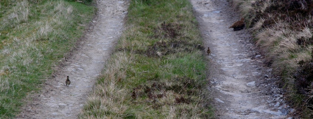
across the landscape.  We had earlier spotted Black Grouse when starting our walk and I now encountered a Red Grouse and her young chicks nestled on the path, as I approached the mother ran off with her chicks in close pursuit, I contentedly watched as the young scampered off down the track and eventually into the surrounding heather.

Taking flight
Meall Gaineimh and the River Avon
Trying to catch my dinner!

By now the sky had turned a silken grey and I noticed that I had instinctively quickened my pace.  As I approached the boundary fence between the two estates a few rain drops were cast down in the breeze, these were on my back and almost unnoticed except for their touch upon puddles that I passed.  I hoped that I may be able to out-pace the incoming rain and set a brisk pace down the continuing track, but the rain increased and when larger drops started to fall and the land infront as well as behind had turned grey I decided it was time to stop and put on my waterproofs.

It seemed a longer journey out of the hill than into it, but slowly the metres disappeared behind me and at last the welcome sight of the cars parked beside Inchmore came into view.  I hoped that I could find shelter either inside this house or beside it, not unexpectedly the front door was locked, but around its eastern side were breeze blocks stacked up to make a relatively comfortable seat which was a welcome surprise.  I spent 30 minutes happily seated here out of the rain as it blew in from the west, waiting for the others to arrive.

It had been an excellent walk, my first into Cairngorn country, which proved an impressive land of rock tor, glen and wild hill.


Survey Result:


Meall Gaineimh

Summit Height:  913.6m (converted to OSGM15, Trimble GeoXH 6000) 913.6m (converted to OSGM15, Leica GS15) (Corbett Top status confirmed)

Summit Grid Reference:  NJ 16683 05113

Bealach Height:  843.9m (converted to OSGM15)

Bealach Grid Reference:  NJ 16431 05220

Drop:  69.7m (Leica GS15 summit and Trimble GeoXH 6000 bealach)

Dominance:  7.63%


For further details please consult the Trimble survey spreadsheet click {here}