14.05.16
The Smalls (SM 466 088), Emsger (SM 651 226) and Daufraich (SM 661 236)
 |
| Emsger, also known as South Bishop (SM 651 226) |
The coast around
Pembrokeshire has a reputation for beautiful scenery comprising secluded coves,
cliffs, sea stacks and islands. The islands
are many, with Ynys Dewi (Ramsey), Skomer and Skokholm being three of the largest
in area. However, dotted around these
three islands are a myriad of smaller ones, many are rocky, some have
lighthouses situated on them and all are of interest.
Over the last couple of
years Adrian Rayner has organised a number of ‘island adventures,’ usually
these are to islands that are not on the tourist trail where daily boats are
scheduled to visit and drop people off for a set number of hours before picking
them up and whisking them back to the mainland.
The islands Adrian concentrates on are those that are seldom visited and
which require a skilled crew to get to, and drop off, and pick up any budding
ascensionist. These island adventures
require diplomatic and logistical skills to organise and thanks should be
expressed to Adrian for arranging them, as all I have been a part of have been
great fun, packed with interest and variety.
Today’s little adventure comprised a visit to The Smalls, Emsger (South
Bishop) and Daufraich, with the first two of these islands having lighthouses situated
on them.
We met at St Justinian’s
which is situated to the west of St David’s and is the departure point for the
RNLI Lifeboat, as well as the departure point for Ynys Dewi (Ramsey). During the previous night a northerly weather
front had descended south and left a slight northern breeze which meant that
landing on each island was under debate by the crew of our RIB. The original departure was arranged for
8.00am, and it was nearing 9.30am when the proverbial thumb was lifted in to
the air signifying that the adventure was on.
 |
| Our RIB for the day |
 |
| Ayako heading down to board the RIB |
As we skimmed across the
water toward the southern part of Ynys Dewi the sky was grey and the sea
relatively becalmed. Our first landing
destination was The Smalls which as their name implies are a small group of
islets, wave battered and remote, and an approximate 12 miles from the western
coast of Pembrokeshire. This small group
of islets are the furthest west of any land in Wales, few people visit and even
fewer people land. On our way we
approached the landing steps on Emsger and the skipper judged that landing was
feasible after visiting The Smalls as the incoming tide would enable us to land
higher on the carved out steps that give access to the upper part of the island.
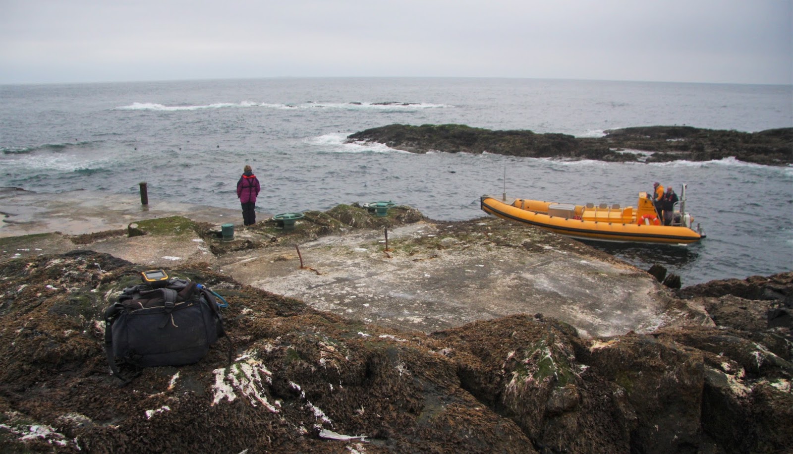
 |
| The landing steps on the northern side of Emsger |
Leaving Emsger for later
that morning we skimmed off west in to a literal sea of seemingly nothingness,
the only rock visible was Gwales (Grassholm) and its adjoined West Tump to our
south, these are the remotest P15 summits that Wales has to offer and are
perched seven miles west of Skomer, they looked weather beaten and almost
forgotten except for their colony of Gannets.
As the RIB made progress a small stick stuck out of the sea, just
visible it shimmered its presence and as the RIB continued west the stick grew
forever larger and slowly took on the shape of a lighthouse, still and grey it
stood forlorn, a last vestige of man’s presence before Ireland is reached.
 |
| Gwales, also known as Grassholm (SM 598 093) |
 |
| The Smalls (SM 466 088) - the furthest westerly point of Wales |
The Smalls lighthouse
has a fascinating history as an incident here in 1800 when one man died and the
other lived in sight of his corpse for the following three months before rescue,
initiated future three keeper manning.
As the RIB pulled up and
lodged its front end against the steps leading on to the slime of copious
amounts of seal poo, we clambered off one after another for our all too brief
stay on this small but unique part of Wales.
 |
| Approaching The Smalls. Seated are (L-R) Rob, Sarah, Bob and Jon |
The highest natural
piece of rock still visible was agreed upon by a number of people and soon the
Trimble was positioned on it gathering its customary five minutes of data. During this time most people roamed the islet
finding evidence of the old wooden piles still embedded in the rock that had
formed a part of the older lighthouse.
 |
| Sheila looking out to sea |
 |
| Gathering data at the summit of The Smalls, with (L-R) Jon, Bob, Sarah and Rob in the background |
Standing on The Smalls
felt rather empty, somewhat of a void, our stay was only brief and because of
this we all pottered round investigating what the islet had and doing so as
quickly as possible, when this happens time is taken up as is concentration,
but even compensating for this the islet is still a forgotten place, an end of
something rather than a beginning, a flatbed of wave battered emptiness that
must be hell on earth during storms, the thought of manning the old lighthouse
that supposedly shuddered during storms fills me with dread.
 |
| Wave battered and forlorn, the last vestige of land before Ireland |
 |
| Sheila joining Adrian on the RIB with Sarah and Bob waiting their turn. These steps were covered in seal poo and extremely slippy |
Once back on the RIB we
headed toward Emsger, which has at least two rows of carved steps signifying a landing
place, we approached the ones on the island’s north. On the way I spotted the first Puffins that
to my knowledge I’ve ever seen, I was struck with how cute and small they are,
almost like a sea budgie with little wings flapping ten to the dozen and with tiny
little bodies.
 |
| (L-R) Daufraich, Emsger (South Bishop), Carn Llidi (mainland Pembrokeshire) and Carn Ysgubor on Ynys Dewi (Ramsey) |
As we approached Emsger
(South Bishop) the cloud had broken revealing patches of blue sky which
according to the sea mariners aboard the RIB would herald choppier sea
conditions. Again the RIB was manoeuvred
in to place with its front end lodged relatively firmly against the rock next
to the landing steps and one by one we clambered on to the rock. This island forms a part of the chain known
as the Bishops and Clerks which stretch northward and take in Daufraich, Carreg
Rhoson and North Bishop, with the latter two aligned south-west to north-east
as rocky lumps of ribbed islets.
 |
| The south-eastern side of Emsger |
 |
| Daufraich (SM 661 236) |
 |
| Carreg Rhoson (SM 667 254) |
 |
| (L-R) North Bishop, Carreg Rhoson and Daufraich |
 |
| Emsger (SM 651 226) |
The carved rock steps
led steeply up toward the island’s lighthouse which was constructed in 1839,
with it being automated and demanned in 1983.
The whole upper part of the island is now a part of the lighthouse and its
surrounding ground, any vestige of natural earth or rock was on the periphery
of this, with the natural high point of the island long since gone with it
either buried under the construction or levelled due to the impending
construction of the lighthouse.
Consensus of opinion gave the remaining high point as a scrub bit of
earth adjacent to a corner at the base of one of the walls, this at least was
convenient for Trimble placement and within a few minutes it was gathering data
perched on the wall 0.99m above the patch of earth.
 |
| Bob getting on to dryish land on Emsger |
 |
| Bob and Sarah heading up the steps |
 |
| Rob and Adrian on the final steps to the lighthouse |
 |
| Gathering data 0.99m above the highest remaining natural ground that was found |
After the Trimble was
closed down and packed away I walked down to the helipad which was constructed
in 1971. This gave views back up toward
the lighthouse and across the carved westerly steps toward the remainder of the
Bishops and Clerks. By now our stay on
Emsger was nearing its end and as I clambered back up the steps and round the
lighthouse to the steps on the island’s northerly section people were making
their way down to the RIB which had been circling the island during our stay. Emsger is a great lump of rock which if not
for the steps up to its lighthouse would prove a difficult place to get to the
top of; it stands squat in the sea as an up thrust of rock with its beacon now
signalling its position.
 |
| Adrian on the helipad with our RIB circling the island |
 |
| Looking toward the lighthouse from the helipad |
 |
| Beyond the westerly steps with North Bishop, Carreg Rhoson and Daufraich in the background |
 |
| The RIB approaching to pick us up from Emsger |
Once we were all safely in
the RIB we headed toward Daufraich and approached it from its north. The main island of Daufraich consists of two
parts, with the most easterly given a 20m spot height on Ordnance Survey maps,
this looked relatively easy to get to the top of once landed, however the
higher 21m map heighted part of the island is its westerly section and this
looked decidedly harder to get to the top of, although it did look doable. As the RIB approached we still didn’t know if
the skipper would take us in to attempt a landing, and as we neared the rock it
suddenly came apparent that the go ahead had been given and Jon, Rob, Adrian
and Bob all made a move toward the front of the RIB, with Ayako, Sheila and
Sarah all wisely staying put, not wanting to be put off by a bit of wave
battered steep and scrambly rock which for one slip would mean a decidedly wet
and somewhat dangerous immersion in the Irish sea, I followed.
 |
| Approaching Daufraich |
 |
| Our route went up somewhere just left of centre |
Thankfully the rock
proved relatively dry and was not slippy, this gave us all good purchase and
although the going was steep there were adequate hand and foot holds to be
found. My confidence on rock is not as
it once was, partly because I rarely have necessity to scramble on it these
days, and therefore when confronted with 20m of scrambly rock perched above
bottomless depths my mind and body goes AAARRRGGGHHHHHHH. However, all was fine, fine, fine and I
followed the others up to the summit.
 |
| Somewhere below was the route we'd just come up |
The westerly part of
Daufraich has two summits, both given the same 21m spot height on Ordnance
Survey maps and ideally both needed surveying but time dictated that only one
could, and all present agreed that the higher summit was the one that we were
standing on, and as the others went over to visit the other 21m map heighted
top I positioned the Trimble on what looked to be the true summit and it beeped
away perched on its rock as gulls circled overhead and the RIB slowly manoeuvred back toward our landing spot.
 |
| Gathering data at the summit of Daufraich |
 |
| Carreg Rhoson (SM 667 254) |
 |
| The Trimble set-up position at the summit of Daufraich |
As the Trimble gathered
its data I walked over to the other summit and joined Jon, Rob, Adrian and Bob
as they assessed which was higher, it was a close call, but the one where the
Trimble was positioned received our vote for being the higher.
 |
| Jon checking his hand-held GPS near the summit of Daufraich |
 |
| Heading toward the second 21m map heighted summit that consensus of opinion gave as slightly lower |
 |
| Jon at the summit of Daufraich |
It was now time to go
and I walked back to the Trimble to close it off, take a few photos of its
set-up position and set off down the rock to join the others on our downward
route. Rob and Bob partly guided me down
and I’m thankful that they did, and after a few minutes of nerve jangling
perched over the watery depths we were safely seated in the RIB and the skipper
span it round and headed toward the southerly coast of Ynys Dewi (Ramsey).
 |
| Jon, Adrian and Bob at the start of the scramble down |
 |
| Safely back on the RIB and leaving Daufraich |
The southerly coastline
of this island proved wonderful to see with steep and rock chopped islands
butting out of the sea, set against the crumbled cliff line of Ynys Dewi. The RIB was taken between many of these
smaller islands and underneath their sheer cliffs, many plunging directly down
from small grassed summits above. It
proved a wondrous place to see as we slowly meandered past the sculptured
islands and through a cave where sunlight glimmered across the rock and sea.
 |
| The eastern cliffs of Carn Llundain |
 |
| Rounding the southern part of Ynys Dewi (Ramsey) |
 |
| Heading through the cave |
 |
| Being watched |
All that remained was a
speedy whizz across the sea past The Bitches rocks toward our departure point
at St Justinian’s. It had been another
fantastic experience visiting places that few people ever get the opportunity
to see let alone stand on, and thanks to Adrian for organising the trip and to
Venture Jet for their professionalism and taking us to some of Wales’ more
remote islands.
Survey Result:
The Smalls
The summit data for The Smalls
did not process, the first data set that has not done so with the Trimble, with
the following remark appearing whilst processing: A
position has been detected that is not compatible with the current coordinates. Perhaps an Irish base station was picked up
during data logging or perhaps The Smalls are just so far out in the Irish Sea
that coordinates do not exist for processing data!
Summit Grid Reference: SM 65116 22619
Bwlch Height: N/A (island)
Bwlch Grid Reference: N/A (island)
Drop: 33.8m
Dominance: 100.00%
Daufraich
Summit Height: 21.7m (converted to OSGM15)
Summit Grid Reference: SM 66199 23673 (summit relocation)
Bwlch Height: N/A (island)
Bwlch Grid Reference: N/A (island)
Dominance: 100.00%

%20-%20hill%201.JPG)

%20-%201%2025000.jpg)

%20-%20hill%201.JPG)


%20-%201%2025000.jpg)