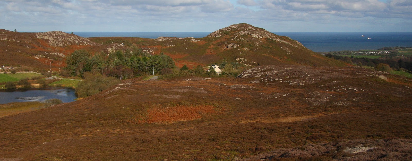
28.10.18 Yr Arwydd (SH 472 854), Pen y Castell
(SH 468 853) and Barclodiau (SH 466 848)
 |
| Yr Arwydd (SH 472 854) |
I’d looked out on the
hills comprising Mynydd Bodafon six days prior to today’s visit and had then
hoped to reach them, but daylight hours, or lack of, dictated that I could not,
and with their rock strewn profiles now edged in my memory I did not need a
second chance to visit. However, as I
wanted to survey three summits and also then visit and survey Mynydd Eilian
further to the north, I could not linger and although the afternoon and its
sunshine was one to savour, a more investigative visit to these hills would
have to wait for another day, as today it was going to be a quick up, down, up,
down, up and down visit, but even with this mentality these hills did not
disappoint.
Arriving beside Gors
Fawr; the small lake at the base of these three hills, is like stepping back to
a land stilled in time, where the ebb and flow of life is taken more leisurely,
where the tranquil surrounds of water and hill also add and accentuate the
beauty of such a place.
 |
| Gors Fawr |
Sometimes when writing
posts’ relating to my Trimble surveys it is hard to find new things to say, I
also ask myself if this matters as I endeavour to treat each post as a separate
entity, but still, on occasion one post does seem to merge in to another. It is also hard to create quality when so
many posts are written, I sometimes wish that I had more time to concentrate on
these posts, to re-draft and edit, but time is a premium I seldom have, and
therefore I suspect my writing on this occasion will not do the land of this
place justice as the hills comprising Mynydd Bodafon and its surrounds are a thing of compact
beauty. If given the chance please
visit, it is well worthwhile.
These three hills are
rugged in nature with rock, heather and gorse dominating. I knew paths existed but was unsure exactly
where, but as most hills have paths on them, and as most of these paths aim toward
the summit I did not have much concern about where to find them.
I set off having parked
my car beside Gors Fawr and wandered up a track leading to one or two houses
that dot the landscape hereabouts.
Leaving this track I followed a path heading north-east toward the base
of the highest of these three hills; Yr Arwydd, which forms a part of the larger Mynydd Bodafon.
The path brought me to a
small car park where a path carved its way upward through the vegetated
hillside. Although only a short ascent I
thought I made good time and soon arrived at the summit, which is crowned with
a trig pillar. On my way toward the hill
I’d seen a few small figures on its high point but no one was there when I
arrived, which reassured me for the survey I was about to conduct, as having to
ask someone if they would be good enough to stay away from the summit for
however many minutes whilst the Trimble gathers its allotted data is not one of
my favoured things to do.
The high point of this
hill is beside the trig pillar and consists of rock, and it was relatively easy
to judge which part of the rock was the highest. Once the Trimble was wedged in place
gathering its allotted data I sat a few metres below and away from it and
savoured the warmth of autumn as the sun cast down. Soon however I had to do what I do not like
doing as within two minutes of activating the Trimble a walker appeared, I
called over explaining what I was doing and asked if they would mind waiting
about eight minutes until the survey and its ten minute allotted data set was
complete. Thankfully the walker had no problem
with this and sat looking out at the view, and seemingly as I, more than happy
to do so.
 |
| Gathering data at the summit of Yr Arwydd |
Leaving the summit I
chatted with the walker for a number of minutes, he was a botanist and told me
about discovering a new fern that had not been documented in Britain before and
pointed to where he had found it. I
explained about the Trimble and my hobby of surveying hills, we smiled at each
other in a knowing way. Eccentricity,
obsession or just plain hobby, I do not care as I often marvel at what people
do and their passion for things that others may think as unusual.
It was only a short walk
down the path toward the small car park, on my way I looked out across to Pen y
Castell; my next hill, and tried finding a path amongst its heathered slopes
that would ease my upward progress. I
thought I’d spotted one, but when I walked up the continuation of the track
from the car park and however much I peered at the heathered slopes no path
materialised. In such situations one has
few options, and mine were limited to trying to find a path on the other side
of the hill or going for it. I knew even
before I asked myself this question what I would do, and another minute later I
wondered if I had chosen wisely as I was immersed in bracken and brambles with
a steep bit of slope directly in front of me.
Thankfully what could have proven to be an awkward situated was soon
overcome and I was over the worst of this part of the hill, and by keeping to
the rock strewn slopes above passage upward was eased with only the occasional
foray in to the heathery depths necessitated.
 |
| Pen y Castell from Yr Arwydd |
 |
| Yr Arwydd from Pen y Castell |
I was soon at the summit
and had the Trimble aligned with its high point, it remained in its place for
five minutes of data collection whilst I sat below it on a convenient rock
eating a well-earned sandwich.
 |
| Gathering data at the summit of Pen y Castell |
I thought of retracing
my inward route, but it was a shorter distance to continue traversing the hill down
to where a few houses lay below.
However, this downward route proved pathless, or at least was so on this
particular day, I gathered momentum as gravity and a need to press on became my
motivators and continued downward however prickly the copious amounts of gorse
and bramble became, emerging beside a house whose owner was plastering its
side, he looked up and asked if I had just come down from the hill, I turned
and looked back up and said that it was a little rough, he said that not many
people come down that way, saying there used to be a shepherds path on the hill,
which is now overgrown.
I chatted with the man for
a number of minutes and he kindly gave me a detailed route where the path lay
for my next hill; Barclodiau. Thanking
him I pressed on down the track toward where my car was parked and onward
directly opposite it to a narrow path amongst the heather, this I followed until
it diverged, I followed it on the right as directed, and this led to Gors
Arian, which today was slumbering in its marshy depths. From here the path again diverged and as again
directed I followed it left and this brought me straight up to the summit, this
proved an easy way up what otherwise would have resulted in another rough ascent.
 |
| Tan Castell, Pen y Castell and Yr Arwydd from Barclodiau |
The high point of Barclodiau
consists of rock positioned a few metres from a small wind shelter, and as the
Trimble gathered its allotted data I again stood and savoured the view, as I
had done on countless hills over the last five years. But views and hills are things never to tire
of.
 |
| Gathering data at the summit of Barclodiau |
Once the Trimble was
safely packed away I scampered off down the path through the heather and
emerged next to my car a few minutes later.
What a stunning small walk this proved to be, and these hills certainly
did not disappoint. Next stop Mynydd
Eilian (SH 472 917).
Survey Result:
Summit Height: 177.5m (converted to OSGM15) (confirmed as
higher than Mynydd Eilian [SH 47282 91719]
Summit Grid Reference: SH 47242 85417
Bwlch Height: N/A (sea)
Bwlch Grid Reference: N/A (sea)
Drop: 177.5m
Dominance: 100.00%
Pen y Castell
Summit Height: 168.9m (converted to OSGM15, Trimble GeoXH 6000)
Summit Grid Reference: SH 46823 85324 (Trimble GeoXH 6000)
Bwlch Height: 138.1m (LIDAR)
Bwlch Grid Reference: SH 46971 85430 (LIDAR)
Drop: 30.9m (Trimble GeoXH 6000 summit and LIDAR bwlch)
Dominance: 18.28% (Trimble GeoXH 6000 summit and LIDAR bwlch)
Barclodiau
Summit Height: 168.6m (converted to OSGM15, Trimble GeoXH 6000)
Summit Grid Reference: SH 46674 84803 (Trimble GeoXH 6000)
Bwlch Height: 137.1m (LIDAR)
Bwlch Grid Reference: SH 46583 85001 (LIDAR)
Dominance: 18.67% (Trimble GeoXH 6000 summit and LIDAR bwlch)