Showing posts with label Carole Engel. Show all posts

Monday, 13 May 2019

Mapping Mountains – Trimble Surveys – Y Berwyn


Carole Engel Completes the Welsh Humps

24.11.18  Pen y Boncyn Trefeilw (SH 962 283, previously Trimbled), Stac Rhos (SH 969 279, previously Trimbled), Foel Cedig (SH 981 283, previously Trimbled) and Y Groes Fagl (SH 988 289, previously Trimbled)


With the hill meet organised by Alex Cameron at the old Workhouse on the outskirts of Llanfyllin being so close to the Y Berwyn it gave an opportunity for a number of people to visit Foel Cedig, whose qualifying summit for a number of lists, including the Marilyns, Humps, Simms, Hewitts, Pellennig, Yr Uchafion and Nuttalls was earlier this year relocated from Cyrniau Nod.

As a part of this Carole Engel had decided to postpone her Welsh Hump completion for a week and re-scheduled this to coincide with the hill meet.  By doing so there was a prospect of being joined on top of Foel Cedig by a number of other baggers, but with many different agendas and with people approaching this hill from different directions and starting their ascents at different times, it would be interesting to see how many gathered at this summit when Carole was having her celebration.

Having attended the Friday evening meal at the Workhouse I drove back home in wet conditions through mist and thick fog and wondered if the weather gods were to put a dampener on proceedings for the following day.  Thankfully although the weather was grey and murky, the rain resisted temptation and the tops were clear of low clag.

I met Alan Caine at the Workhouse just before 9.00am and we drove in two cars to the car park at the north end of Llyn Efyrnwy (Lake Vyrnwy) where Carole, and Jeff and Enid Parr were already waiting.  It was good to see all three, and this is one of the joys of occasionally dipping in to the community of hill baggers as friends have been made and will be kept, and all three; Carole, Jeff and Enid are people who I look forward to meeting up with time and again.

Having donned my winter wellies I then drove the five of us to the top of Cwm Hirnant and parked opposite the gauged out track that leads toward the summit of Foel Cedig.  This track eases passage to these heather clad hills, and if not for it the task of bagging these hills would be a daunting one.

On our way to Foel Cedig we visited the summits of Pen y Boncyn Trefeilw and Stac Rhos, which were later in the day surveyed by Alan Dawson with his Leica RX1250.  To our east the grey morning clag was just grasping on to the upper part of Foel Cedig, but this would lift as the morning progressed.

Carole with Foel Cedig in the background

During our journey on the track beside the moorland Alan Caine zoomed off in to the heather and bog to bag any summit going, with Bridges and one or two ‘Deleted Tops’ in the Nuttalls book all being fair game.

Approaching Foel Cedig Carole led the way through the heather as I tried to keep up with a digi-camcorder in hand, she reached the top and completed the Welsh Humps and immediately set about logging her ascent online, which made me smile.  One quick wind-blown interview later and the bottles were opened and cake passed round.

As we arrived at the summit Denise and Richard McLellan were just about to leave, they turned back and remained with us as more and more people started to appear from different directions.  Richard’s ascent of Foel Cedig was also of significance as he was re-completing the Marilyns and him and Carole sat centre stage on the little rocky knoll that makes up the high point as everyone else gathered around for the customary summit photograph.

Richard's re-completion of the Marilyns on top of Foel Cedig

The walk back on the track was enjoyable and we reached my car 4½ hours after setting off.  It was good to see Carole, Jeff and Enid again and many others who were on the summit of Foel Cedig and also at the Workhouse, and thanks to Alex for organising the hill meet and Carole’s invitation to join her on her special day of celebration in completing the Welsh Humps.

Celebratory gathering at the summit of Foel Cedig


Sunday, 25 November 2018

Carole Engel completes the Welsh Humps


Congratulations to Carole Engel who yesterday; the 24th November 2018, completed the Welsh Humps on Foel Cedig (SH 981 283) in the wilds of the heather clad Y Berwyn.

Carole and Richard (and many others) celebrating on the summit of Foel Cedig

Carole was joined by a number of friends for the walk, with more people joining her on the summit, including Richard McLellan who was also celebrating his re-completion of the Marilyns.


Congratulations to Carole and to Richard and many thanks for the invitation to join the summit celebrations.


Tuesday, 1 March 2016

Y Pedwarau – Table of Progress


Y Pedwarau – Table of Progress

Introduction

To access Y Pedwarau – Table of Progress please click {here}


The Pedwarau are now an established list of hills, having first been published in 2002 and thereafter maintained and then revaluated for Europeaklist publication in May 2013, and subsequent Haroldstreet publication afterward.  The list has gained much publicity and over 20% of the qualifying hills have now been accurately surveyed by GPS / GNSS receiver.  To date, three people have completed all the Pedwar hills and another eight people are known to have completed 100 or more of the current total of 447 Pedwarau.  

As the listing of Y Pedwarau is now established and a number of people are making a concerted effort to visit all listed hills, it seems only appropriate to document the progress of these Pedwar baggers in a Table of Progress.  

The Table of Progress also has a listing to The Anonymous Pedwar Bagger, with this person / persons listing at number 4 paying homage to the height band of these hills, and giving due deference to The Unknown Munroist who appears in Munro’s Tables.  

To qualify for inclusion in the Table of Progress a minimum number of 100 Pedwar hills need to have been visited.  For those people who know their Sub-Pedwar total this is also included.

Anyone who has completed 100 or more Pedwarau and whose name is not included in the Table of Progress but would like it to be, please contact Myrddyn via email.  Myrddyn’s email address is listed under the ‘About Me’ page heading on the Mapping Mountains site.


Myrddyn Phillips and Aled Williams (March 2016)


To access Y Pedwarau – Table of Progress please click {here}


Wednesday, 9 September 2015

Guest Contributor – Carole Engel


Introduction – I have approached a number of people to write articles, but if readers would like to contribute an article please contact me.  The only two stipulations I make are that the article has to be hill related and that I don’t end up in court through its publication!  Otherwise the choice of subject matter is down to the Guest Contributor.


Guest Contributor – Carole Engel

Carole Engel enjoying her celebration on the summit of Aberedw Hill - her last Pedwar


Y Pedwarau - The Fantastic Fours of Wales

Introduction

I became a hill-bagger purely by chance, on being bought the book “The Mountains of England” by John and Anne Nuttall.  My first thought being, “what do I want a walking book for?  They only have short boring routes in them”.  How wrong I was.  The Nuttall’s describe lesser walked routes which introduced me to many new and exciting paths and even a bit of heather bashing.  Yes, they were a bit short for a member of the Long Distance Walkers Association but could be combined to make longer walks.  I soon became addicted to getting those ticks and encouraged Anton Ciritis to join me on a hill-bagging weekend in Trawsfynyyd, organised by the LDWA.  Sadly, the leader would not disclose his routes and we decided we would “do our own thing”, which on this occasion was to walk the length of the Rhinogs.  Being August bank holiday, it rained constantly but we were totally hooked and when Anton asked (jokingly) “back for dinner or one last top – its 5mls out”, I opted for the top!  And so began a long hill-bagging friendship involving firstly the Nuttalls, then the Deweys and lastly the Pedwars.  As often as possible, Anton would sneak off without me and so ensued many catching-up trips, on which I found I actually quite liked being on my own in the hills.

From then on we often walked together, sometimes independently.  I gradually gained confidence in exploring the hills.  I learned the art of climbing barbed wire fences, stone walls and eventually dense forest held no fear for me.  Anton taught me never to give up and we bagged every last one of them, one taking three separate attempts on three separate trips.  I have been ripped to shreds by heather, brambles and gorse, stumbled for miles over exhausting tussocks and painstakingly picked my way across newly felled forest – the worst.  I found that proposed routes were not always possible due to vegetation or terrain, how to find fire breaks in a forest (Google Earth) and how to stay awake on the long car journeys there and back (plenty of strong coffee!).  A particularly hard lesson was that Wales has a no tolerance policy on speeding, much to my cost.  I have experienced everything the weather and the terrain could throw at me but never once thought of packing it in - every time without fail, standing on a summit was reward enough.  One piece of excellent hill advice I was given by Norman Baxter (of 5,003 trigs fame) – “you will get there eventually”.

My Pedwar journey began in June 2009, using the list found on the V-G website entitled “Myrddyn Phillips Welsh Hills 400-499m”.  This was in two parts, one being definite tops and the other (significant but smaller list) To Be Surveyed (TBS) Tops.  Finding many were in forests, I telephoned Myrddyn to ask if he could suggest routes in.  I was a little surprised to find he had not walked very many on the list at that time and realised it was to become a true voyage of discovery.

Slowly working though this early list stood me in very good stead for the final push, as by May 2013 the hill list had become named – Y Pedwarau – and updated and co-authored with Aled Williams. Myrddyn very kindly alerted me to the fact and sent me details shortly before publication, in the form of a beautifully presented e-booklet.  This time the list included all 400 to 500m Welsh tops with inclusion in the main list still requiring a hill to have a minimum drop of 30m all round.  I had been concentrating on those with 30m drop, following on from my completion of the Deweys, all of which must also have a 30m drop all round and with Anton’s guidance, he and I had visited many of the TBS tops looking likely Pedwar candidates, carefully selecting and measuring the height of their bylchau – not always easy and not always obvious to me!  In consequence, the newly named list held very few extra tops to be visited.  This was good news as some areas of Wales have been visited several times, firstly for the Nuttalls, secondly for the Deweys and thirdly for the Pedwars (and currently for any outstanding trigs!).

Very few hills summit on a footpath, so much creative route finding will be required.  This should be done with respect – best not to climb walls or fences if a gate is handy, give livestock a wide birth and keep calm and polite if challenged.  Several tops are in thick forest.  Depending on the maturity of the trees at the time of your visit, you will be required at the very least to stumble your way through the detritus that carpets plantations.  Some are quite open and walker friendly but many involve brute strength to push through the branches.  Old kit is best.  How many times have I said that but not done it!  I have heard of baggers donning motor cycle helmets for forest bashing, gauntlets for gorse clearance and way marking trees with strips of colourful (never green!) plastic bags to facilitate an easier retreat.  I inherited a lovely pair of long handled loppers from my father and swear by them – well worth the extra weight when faced with a young forest.  Some forests are approached along long, winding logging tracks, some of which are driveable with care.  Strictly not allowed but I have it on the good authority of a local in the Mynydd Epynt that it’s OK to do so.  They all ignore the signs (apparently) when all is quiet in the woods.

Not all of these hills require determination and struggle.  Many have been a pure delight, climbed in balmy sunny weather but always solitary.  I think I have only ever met one other walker in the wilderness who was as surprised to see me as I him.  I have however met many farmers and gained an insight into their tough way of life.  Most have been very friendly but a little suspicious until I have explained why I am wandering about on their hills.  Sadly, they are required to be concerned about Health and Safety and have alerted me to the fact that they are liable if one of their animals were to harm me.  On such occasions, it is best to have a lengthy chat and without fail you will both part best of friends (and be allowed to continue up the hill).

A liking for dogs is helpful as every farm has one or more.  I have been bitten once.  By a new mother mindful of her young puppies.  She got me from behind and nipped a nice little hole in my ankle.  The farmer was very concerned and insisted I follow him to the farmhouse for some medication.  All I could think about was getting on with my walk but to be polite I agreed.  This proved to be a very time consuming visit.  Firstly, the farmer slowly hauled himself into his Land Rover to drive a matter of yards to his front door.  He then slowly clambered out of his vehicle and step by step, dragged himself indoors.  This continued to kettle (I was to have a cup of tea), to cupboard and medicine cabinet culminating with the offer of a dab of Sudocrem.  As far as I remember, this is magnificent for nappy rash.  I slapped a bit on, drank the tea and half an hour later was on my merry way.


The Long Day in the Hills

There has been the odd time when Anton and I have bitten off a little more than we could chew.  One that particularly comes to mind is July of last year (17th July 2014 to be precise).  Anton planned a lovely long day of thirty seven miles of hill bagging, spread over six walks of varying length from one mile to twenty miles.  My first reaction was that this would be impossible, despite the fact that we were giving ourselves a sporting chance by getting down to the Elenydd group of hills for 7am.  It was also sunny and hot which Anton loves but I find very draining.  Nevertheless, the journey went well and we happily set off at the allotted time, breaking ourselves in with a nice little one miler, Cefn Bach (SN 704 417), close to which was a driveable forest track – always a good start.  Smiles were soon wiped off our faces when we found the deforested top had been replanted and the firs were about four to five years old, densely packed and dripping wet with heavy dew.  It might well have been raining.

The big walk

The second walk, circumnavigating the Blaen Rhisglog Plantation and comprising of four tops, was out of the woods but into the rough, almost six miles of the nine and a half mile route was rough, very rough - endless huge tussocks.  By this time we decided we had best make a start on the “big” walk.

After refuelling back at the car and a rest as we drove round to Llanwrtyd Wells, we found ourselves once again relishing the prospect of a good afternoon’s “work” in the wilderness of S.W.Wales.  We were to tackle eight tops in a walk of twenty miles.  Every single top was a struggle.  Once off path and track, there were deep, endless tussocks, making progress painfully slow, two tops deep in forests (actually easier than the tussocks) and one on a recently deforested top, which was horribly difficult.  By far the lengthiest and slowest section was the two and a half miles up to and between Bryn Mawr (SN 880 535) and Cefn Waun-lwyd (SN 863 522).  I thought we would never make the crossing and all the while we could see the long, one and half mile, 777ft of ascent climb to our next top, Cefn Cwm Irfon (SN 845 495), nicely snuggled in yet another forest, looming ahead.  It was too much.  Neither of us could face it and we reluctantly found the easiest and shortest way back to the car – down a road.  Three and a half miles of road – usually to be avoided at all costs but not this time, by the time we got back to the car park we had walked 17.3 miles and climbed 3,234ft.  It was 9.30pm and dusk fast approaching.  We just had to be satisfied with a day’s total of eleven tops, 27.7 miles and 5,287ft of ascent.


The New Tops

Myrddyn has meticulously kept me informed of new Pedwar discoveries and two I shall remember for some time were Craig y Ganllwyd (SH 707 258) and Pt. 499m (SH 665 310).  Craig y Ganllwyd was not a top I wanted to visit.

The New Tops and a devised walk between them

I had passed very closely by both these tops on a fourteen and a half mile walk circumnavigating Rhinog Fawr in August 2013.  I was aware of Craig y Ganllwyd but not Pt. 499m.  After almost seven miles of very rough going throughout the walk, culminating in very difficult terrain up and down Craig Aberserw (SH 695 265), I decided not to press on to Craig y Ganllwyd, thought to have a drop of about 26m and therefore not of particular interest to me, a big mistake.  This necessitated a re-visit just over a year later.  After studying the map and Google Earth, I decided the safest approach was from the north (as not all forest footpaths actually exist) and would be at least four and a half miles long.  The final half mile of ascent to the top was quite a struggle, through forest and over tussocks.  I managed to find an equally difficult alternative route back and thanked heaven that I was at last done with this rough but beautiful part of Wales.

One of the new tops - Craig y Ganllwyd (SH 707 258)

Not so, less than a month later Myrddyn informed me of Pt.499m (SH 665 310).  Where on earth could that be?  Excitedly I looked it up.  Oh no!  Back to the rough Rhinogs and another five mile walk, typically rocky and heathery as opposed to tussocks and forest – never mind, should make a change.  Once again, it was quite a walk, this time over large rocky outcrops.  Just as I thought I was getting there, another chasm appeared before me, three in total.  Eventually the inevitable happened; on 11th October 2014, I was stood on the large erratic boulder that was Pt. 499m, alone in the majestic wilderness of the un-walked Rhinogs.  What could be better on a pleasant autumnal afternoon, away from the crowds and eyesores that are the evidence of the presence of man.  I loved that moment, as I have loved every open summit I have reached since I began hill-bagging, made even more special by the extra effort needed to be there.

Another of the new tops - the summit of Pt. 499m (SH 665 310)

And Finally

In Anton’s own words: “It’s a fantastic List.  Get out there people and do ‘em!”  Couldn’t say it better myself.


Saturday, 2 May 2015

Mapping Mountains – Trimble Surveys – Fforest Glud


25.04.15  Cregrina Hill (SO 106 524), Pt. 430.7m (SO 089 525) and Aberedw Hill (SO 084 507)   
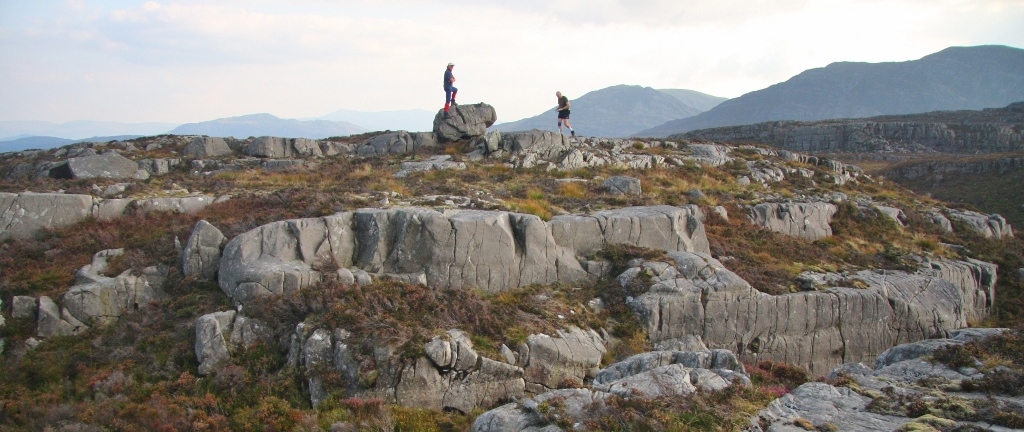
Cregrina Hill (SO 106 524)

Today was going to be a special day as Carole Engel was finishing Y Pedwarau – The Welsh 400m P30s and the opportunity to join her on her last Pedwar was one not to be missed.

As Carole’s walk was over a planned 16 miles taking in six Pedwar hills with over 3,000ft of ascent we decided to reduce our mileage and concentrate on four of these hills and plan our walk so we would be waiting for Carole on the summit of Aberedw Hill, which she had chosen as her last Pedwar.

The forecast for the day was not good as the high pressure system that had bathed Wales in glorious weather for the last couple of weeks had now been replaced by westerly lows heralding the arrival of rain.  As I drove south from Welshpool with Mark and Aled in the car the showers erupted between spells of dryness and the occasional glimpse of sunshine.  Nearing Builth Wells prolonged periods of heavy rain fell from the sky, it seemed we were going to get a good soaking.

We left the car on the grass verge of a narrow country lane just before the road end at the farm of Blaenmilo-uchaf.  Our onward route went through the farm yard and followed a track toward the remains of a small quarry before doubling back on itself and cresting the central of three ridges that make up the compact group of summits around Aberedw Hill.

I’d only been on these hills once before, two summers ago when the sun shone and I’d walked 12 miles over four Pedwar hills and one 300m Twmpau hill, before whizzing down to the Hay Festival to meet Melanie Osbourne at the stand that the Ordnance Survey had there that year.  My memory was of open hills with easy underfoot walking conditions.

The gravelled track we were on soon gave way to a green and earthen track which is one of many such paths on the Radnorshire hills.  Ahead through the dulled browns of bracken lay Cregrina Hill which was going to be my first hill of the day, but the second for Mark and Aled, as they were heading on a ‘there and back’ to visit the trig pointed summit of Wylfre (SO 116 520).  This would leave me scampering around the hills Trimbling as many as I could before they caught up with me.

I left them just before the bwlch between the two hills and headed left upto the summit of Cregrina Hill; once I had knelt on my knees and judged where the high point of the hill was placed I set the Trimble up and patiently waited until the allotted data collection was complete.

Gathering data at the summit of Cregrina Hill

By now Mark and Aled were at the summit of Wylfre, thankfully they stopped on top for quite some time which enabled me to scamper off to the bwlch connecting Cregrina Hill with the northerly part of Aberedw Hill which we currently have listed by the point notation in Y Pedwarau.  The bwlch lay on a meeting of green tracks and once data had been safely stored I whizzed off upto the next summit.

This next hill has a 432m spot height on a small ring contour and two other small ring contours at 430m.  Whilst each was Trimbled I looked out toward the three Tumuli on the summit of Aberedw Hill, from memory the central one is lower with the other two having a 451m spot height on Ordnance Survey maps, if time permitted I hoped to Trimble each in turn.

The position at SO 089 525 proved the higher of the three potential summit positions that were surveyed with the Trimble and is a summit relocation for this Pedwar hill

As I gathered data from the third potential summit of this hill, Mark and Aled were standing on the second summit and catching me up, so once the Trimble had done its stuff I packed it away, looked west at a darkening skyscape of ominous murk and quickly scampered off toward the connecting bwlch with Aberedw Hill. 

Mark and Aled on the new summit of the Pedwar at SO 089 525 as I finish off surveying the third summit

Grey murk massing out to the west

The hill I had just left is currently listed as a marginal Pedwar with just c 30m of drop so each of the three potential summits required Trimbling as did any potential point where its critical bwlch may lie.  I Trimbled two points at the bwlch, one on the edge of a green track and the other close to where the spot height for the bwlch appears on the map.  As the second bwlch data set was being gathered Mark and Aled caught up with me.  It was good to see them again after about 90 minutes on my own.

Gathering data at the critical bwlch of Pt 430.7m (SO 089 525)

We walked upto the trig point which is perched on the furthest north-westerly of the three summit tumuli of Aberedw Hill.  As the Trimble gathered its data Mark and Aled sat on the easterly side of the tumulus and waited for the arrival of Carole.  Meanwhile I headed toward the remaining two tumuli to try and get data from them before Carole bagged her last Pedwar.

Gathering data at the summit of Aberedw Hill

I decided to head for the furthest south-easterly tumulus next, leaving the central one to be Trimbled last.  As the last minute of data were being collected from this second tumulus I spotted four figures making their way up the hill from the north.  By the time I’d packed the Trimble away and re-joined Mark and Aled at the trig tumulus Carole, Anton, Alan and Alex were standing at the summit of the 451m map heighted south-easterly tumulus and were soon walking toward the trig where we waited.  The central tumulus could wait for its Trimbling until after the celebrations.

Gathering data at the south-easterly tumulus

(R - L) Anton, Carole, Alex and Alan nearing the summit of Aberedw Hill

It was great to see Carole again who I hadn’t seen for a number of years, and also good to meet Anton for the first time as well as Carole’s friend; Alan.  All had come down from Huddersfield and were accompanied by Alex who had travelled by train to Knighton and bagged hills on the way as he walked from Knighton to the pre-arranged starting point for Carole’s walk.

Although I’d met Carole before on some of the Hillwalkers’ meets in the Lakes I had only had the pleasure of one conversation with her, and this took place a number of years ago on the telephone, I’d forgotten what a fantastically ebullient person she is.  It was her day and she took over proceedings in the nicest way that one can imagine and her sheer joy and enthusiasm was a joy to behold.

As she touched the trig atop Aberedw Hill she had completed her journey around the Pedwarau hills, many of which she had visited with Anton, who was now beside her, a fitting completion for Carole as Anton had completed the Pedwarau only last year.

Carole completes Y Pedwarau - The 400m Hills of Wales.  (L - R) Aled Williams, Alex Cameron, Anton Ciritis, Carole Engel, Alan Greenwood and Mark Trengove

Lots of photographs were taken (mainly by me!) beside the trig with Carole full of smiles and laughs, before we settled down on the grass just below the trig where Alan opened the customary bottle of Champagne for a celebratory drink.


Nothing quite like meeting for a hill completion celebration

Carole had earned her Champagne having completed the 452 hills that make up Y Pedwarau

Alex, Aled and Mark celebrating Carole's completion of Y Pedwarau

It was also good to have Aled as co-author of the Pedwarau list and Mark as Editor there for the celebration, and as Carole told us about the day’s walk and some of those horrendously long tussock laden Pedwar walks that Anton had previously planned we all settled down to enjoy the moment.

By now a celebratory Curly Caterpillar cake and a box of Pringles had been given Carole and she was happily cutting the cake up between sips of Champagne, these summit celebrations really are good fun!

The Curly Caterpillar is just about ready to get devoured

We sat in the sun shielded from the breeze as darkening clouds massed in the west with lots of anecdotes being told and smiles and laughter all round.  As the last of the Caterpillar was eaten it was time to make a move, I took a few photos of Carole and Anton together, two of the three Pedwar completers, before we all packed our gear and got ready to descend the hill.  

Carole and Anton, two of the three people who have completed Y Pedwarau - The 400m Hills of Wales

Carole, Anton and Alan were heading north-west to their awaiting car whilst Alex came with us so Mark could take him from Welshpool toward Flint to catch a late train home, and we headed off south-eastward to the high narrow lane where my car waited.  Before leaving I took a few more photos to remember the day by, shook Anton’s and Alan’s hand and gave Carole a hug. 

Parting of the ways after the celebration

It was great to be with Carole as she completed the Pedwarau and many congratulations to her for becoming the third person to do so and the first female completer.


Survey Result:


Cregrina Hill

Summit Height:  415.0m (converted to OSGM15, Trimble GeoXH 6000)

Summit Grid Reference:  SO 10665 52414 (Trimble GeoXH 6000)

Bwlch Height:  382.0m (LIDAR)

Bwlch Grid Reference:  SO 10109 52453 (LIDAR)

Drop:  33.0m (Trimble GeoXH 6000 summit and LIDAR bwlch)

Dominance:  7.95% (Trimble GeoXH 6000 summit and LIDAR bwlch)


Pt. 430.7m

Summit Height:  430.7m (converted to OSGM15)

Summit Grid Reference:  SO 08911 52554 (summit relocation)

Bwlch Height:  400.6m (converted to OSGM15)

Bwlch Grid Reference:  SO 08214 51546

Drop:  30.1m

Dominance:  6.98%


Aberedw Hill

Summit Height:  451.4m (converted to OSGM15, Trimble GeoXH 6000)

Summit Grid Reference:  SO 08443 50777 (Trimble GeoXH 6000)

Bwlch Height:  221.1m (LIDAR)

Bwlch Grid Reference:  SO 08610 53400 (LIDAR)

Drop:  230.3m (Trimble GeoXH 6000 summit and LIDAR bwlch)

Dominance:  51.02% (Trimble GeoXH 6000 summit and LIDAR bwlch)


For further details please consult the Trimble survey spreadsheet click {here}


Friday, 1 May 2015

Carole Engel completes Y Pedwarau - The 400m Hills of Wales

Carole and friends at the summit of Aberedw Hill, the third person, and first female, to complete Y Pedwarau

On the 25th April Carole Engel completed Y Pedwarau and became the third person, and the first female, to do so.  The first person being Rob Woodall who completed on Moel Eithinen (SJ 167 592) in the Bryniau Clwyd range on the 9th June 2011, and the second being Carole’s good friend; Anton Ciritis who completed on Banc y Ddinas (SN 858 462) which is situated on the outskirts of Llanwrtud (Llanwrtyd Wells) in the southern part of mid Wales on the 9th September 2014.

Front cover of the 1st edition of Y Pedwarau, published May 2013 by Europeaklist

As Carole neared her last few walks to complete this list she had six Pedwar hills left to visit close to the small community of Aberedw, which is situated to the south of Llanfair-ym-Muallt (Builth Wells).  It was then that Carole decided to include these six hills as her last walk and complete her Pedwarau at the summit of Aberedw Hill (SO 084 507).  Aberedw Hill is relatively prominent and its summit is topped by three tumuli with the higher one also supporting a trig pillar.  Green tracks on open hillside give good access to these spacious hills and few fences can be found when walking their broad ridges.

The three tumuli on the summit area of Aberedw Hill (SO 084 507)

Many of the Pedwarau hills were visited in the company of Anton Ciritis, and after completing the Nuttalls and Deweys, Carole and Anton decided that their love of the Welsh hills was so strong that they wanted another hill list as a challenge.  It was the original version of Y Pedwarau that appeared on Geoff Crowder’s V-G Backpacking in Britain website that fulfilled this challenge.

First section of the original Welsh 400m P30 list as presented on Geoff Crowder's v-g.me website
Carole and Anton, the third and second people respectively to complete Y Pedwarau - The 400m Hills of Wales

The first 400m Welsh hill that Carole recorded visiting was on 6th June 2009 in the lands between the Moelwynion and Arennig, this was Craig y Garreg-lwyd (SH 730 427).  On the same day she also visited Drum, Foel Ddu and Moel Pen-y-bryn.

Carole was born in Mirfield, West Yorkshire in 1957 and has completed the Nuttalls, Deweys (1st recorded female), Wainwrights, Outlying Fells and the Birketts.  She can now add Y Pedwarau to her completed bagging exploits.

John and Anne Nuttall's two volume guide
Michael Dewey's Mountain tables book


When Carole completed Y Pedwarau she kindly sent some personal details through so that a post could appear on the Mapping Mountain Blog, part of what she sent appears below.

I just fell in love with Wales after doing the Nuttalls and Deweys and wanted another reason to walk there.  Much of Wales can be walked on a day trip from Yorkshire, so is accessible to me.  I love the solitude of the hills (as opposed to the over-walked Lakes) and the variety between the rocky north and the grassier south and that there is very little arable land making access difficult, including very few electric fences!  I’m sad to finish in many ways as nothing can fill the gap left by the beauty of Wales.


Many congratulations to Carole, the third person to complete Y Pedwarau.


Celebrations at the summit

Y Pedwarau is available in e and print booklet form and can be interactively ticked: