24.08.21 Rhinog Fawr (SH 656 290, only bwlch surveyed), Rhinog Fach (SH 664 270) and Pt. 558.3m (SN 661 267)
 |
| Rhinog Fach (SH 664 270) |
There are many upland areas in Wales that
captivate me and draw me back time and again.
The trackways of the Radnorshire hills on a bright and crisp spring
morning with skylarks singing overhead or the tranquil surrounds of the open
Elenydd in autumn, but few can compare to the quality of the northern
Rhinogydd, these hills are rugged and unforgiving and form a barrier between
the land to their east and the coastal plain to their west.
For many years my walking was dominated by the
Welsh 2,000ft hills with many repeated ascents, nowadays it is mainly on lower
heighted hills, and to an extent is led by my surveying. However, when opportunity arises to visit
those higher 2,000ft’s it is one not to miss.
Today I wanted to visit a hill I had been up on
18 previous occasions and one that was long overdue an accurate survey. The hill is Rhinog Fach which is positioned
in the northern Rhinogydd.
Rhinog Fach is currently listed with an
estimated c 148m of drop, just a tantalising 2m short of the 150m drop criterion
for Marilyn status. Over recent years
Alan Dawson; the hill list compiler of the Marilyns and author of the Relative Hills of Britain book, has
surveyed many hills marginal to the 150m drop criterion. The majority of these hills are in Scotland,
but there is one hill in Wales that also requires an accurate survey to
determine its drop value and status, and that hill is Rhinog Fach.
With a high pressure system centred over the
country giving relatively dry conditions, albeit with drizzly morning’s around
the eastern part of Mid Wales, and with a forecast of west is best and lots of
sun symbols on the Trawsfynydd Met Office web page, I headed toward Coed y
Brenin to park at the end of a narrow paved road that heads west from the busy
A470. I knew even before seeing the Rhinogydd
that their higher tops would be immersed in morning clag, as the tops of all
other hills heading west from Welshpool were cloaked in cloud. However, I was in no rush and leaving my car
I proceeded to slowly make my way through the undergrowth constituting the
public footpath toward Graigddu-isaf, an old farm house that is now an Airbnb let.
The old farmhouse is positioned in a small
clearing with the forest track leading past it; I was soon on it walking along
the forest track heading south. Overhead
the sky was grey with a constant cloud blanket that stretched the full width of
Wales. But I knew as time progressed the
cloud would rise and if the same weather condition were applicable to this part
of Wales, as to Welshpool, the sun would break through by early afternoon.
I lazily plodded up the continuation of the
forest track, eventually emerging at a sign that pointed confidently toward
Bwlch Drws Ardudwy. At this junction the
conifer infestation had been felled giving an unobstructed view of the two
Rhinog hills; Fawr and Fach; both heading skyward in to the morning murk.
 |
| The way to the bwlch with Rhinog Fach enshrouded in early morning clag |
A gravelled path led from the junction up to a
gate and the continuation of a path on to the open hillside. It was good to be back here, although this
was a route I had used in the past, my favoured route of ascent for Rhinog Fach
is from the west via Cwm Nantcol, this gives an open view of the hills from a
beautiful high valley, but the forest route has a higher start and is much
easier to get to when driving in from the east.
My first planned survey of the day was the bwlch
of Rhinog Fawr and as I walked up the path heading toward it, the open nature
of the hillside quickly closed in, with the boulder strewn slopes of Rhinog
Fawr rising upward on my right and the steep slopes of Rhinog Fach doing
likewise on my left. It was a humbling
place to find myself.
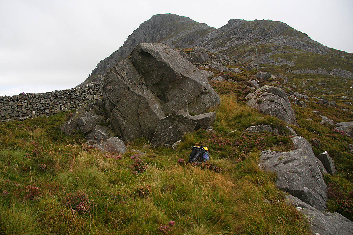
 |
| The steep path leading up Rhing Fach from Bwlch Drws Ardudwy |
The bwlch position for Rhinog Fawr was
relatively easy to pinpoint and soon the Trimble was set up atop my rucksack,
the measurement offset between its internal antenna and the ground at its base
noted and once the 0.1m accuracy level was attained before data should be
logged, I set it to gather data and sat behind a rock to wait the allotted five
minutes.
 |
| Gathering data at the bwlch of Rhinog Fawr |
Once the first data set of the day was gathered
and stored, I packed the Trimble away and peered up at the horrendously steep
slope I had somehow voluntarily chosen as my ascent route. This route is uncompromising and just heads
up through heather and rock. It looked
intimidating.
The cloud base was still relatively low and
would remain so for another 90 minutes, therefore I was in no rush and with the
steep slope immediately in front of me I made slow, but steady progress up
it. I rested frequently and looked out
east where the cloud still hung to all high hills. Behind me the cloud danced on the upper
section of Rhinog Fawr with the brisk breeze whisking it across the summit
rocks.
Eventually the steepest section of the ascent
was behind me and cresting a rise the upper part of the hill bulged up in
front. This resembles a cone of a hill
seemingly plonked on top of what is already quite a substantial land mass,
thankfully by the time I was looking up at this scene the cloud base was slowly
edging ever higher and the route ahead was clear.
The path eventually crests the northern ridge of
Rhinog Fach, at this point I had just walked up in to the mist which was being
skimmed across the hill by a strengthening breeze, so much so that I contemplated
stopping to put on my one skin jacket as my arms were getting quickly chilled,
I persevered without and continued following the path toward the summit of the
hill.
The summit of Rhinog Fach consists of a small protruding
rock about 2 metres from the base of an untidy cairn. I quickly set the Trimble up aligned with the
highest part of the rock and set it to gather data. I was thankful that the summit was easy to
identify as I wondered if I would have to take a number of data sets from
various points surrounding it. But to
compare survey results I wanted to gather a second data set with the Trimble
now positioned over the highest rock and on my rucksack. As I was setting the equipment up I was
joined by two walkers, one from Llanelli and the other from Caerffili who were
bagging hills around the Rhinogydd for a few days based in Maentwrog. As the Trimble gathered the second summit
data set we sat below the equipment chatting about the hills.
 |
| Gathering data at the summit of Rhinog Fach |
To have wanted to survey this hill for many years
and many other surveys seemingly always getting in the way, and now to finally
be here on its summit with the Trimble quietly beeping away gathering
individual datum points, was both a relief and a joy. As I sat glimmers of sunshine fed across the
land toward the coast to the west. It
felt like being on top of the world, perched on this boulder strewn hill,
sitting on a rock looking out at an ever evolving view. As I turned to close the Trimble down I
suddenly realised that the cloud base was now above the summit, which boded
well for the remainder of the walk.
I walked part of the way down toward the connecting
bwlch in the company of the two walkers from south Wales, but as I opted for my
normal descent route on the western side of the stone wall, they reversed their
inward route on its eastern side. We met
again down on leveller ground and walked to the bwlch together. They still had a long day ahead with Y
Llethr, Diffwys and a walk back in to Cwm Nantcol ahead, whilst I now
concentrated on the bwlch adjoined to Rhinog Fach.
 |
| Y Llethr rising above Llyn Hywel |
I was surprised to find that ground on the
eastern side of the stone wall that crosses the bwlch was higher than on its
western side, imagining that the wall would cross the actual bwlch. Therefore I concentrated my efforts on a
small area of land just to the east of the stone wall, taking three data sets
in all, two on the hill to hill traverse and one on the valley to valley
traverse.
I was at the bwlch for over 40 minutes and
watched the two South Walian walkers crest the upper part of Y Llethr and
disappear from view. By now the full
extent of Rhinog Fach was on view and would remain so for the remainder of the walk.
 |
| Gathering the first of three data sets on the area of the bwlch |
Happy with my efforts at the bwlch I packed the
Trimble away, scrambled back over the wall and walked a short distance back
toward Rhinog Fach to connect with the path leading down to the northern shore
of Llyn Hywel, which I’ve heard by many to be the most beautiful mountain lake
in Wales, I would not argue otherwise.
The path led to the outflow of the lake, I now
wanted to survey the small prominence hill that overlooks Llyn Hywel from the
lake’s western edge and therefore followed the continuation of the path around
the western shore, only leaving it to head up toward the connecting bwlch of
the hill. This bwlch was typical
northern Rhinogydd country as it has large boulders strewn around it, many
amongst reed grassed tussocks. I soon
picked my preferred spot and soon the Trimble was gathering its seventh data
set of the day.
 |
| Gathering data at the bwlch of Pt. 558.3m |
Once the Trimble was closed down and packed away
I followed a narrow path leading toward the summit, which is crowned by a
flattish outcrop of rock. By now the
breeze was blowing across the lake and therefore I placed the Trimble on the
ground aligned with the highest part of the summit rock. During data collection the sun finally broke
through as the cloud that had lingered all day began to break, and this gave me
wonderful colour for the remainder of the walk.
 |
| Gathering data at the summit of Pt. 558.3m (SH 661 267) |
All that remained was to follow paths back to
the forest track. I took my time and
enjoyed the wonderful mountain scenery with Rhinog Fawr looking a beast of hill
from this perspective. Its profile a
great lump of rock and heather, from this vantage point Rhinog Fawr must be one
of the most impressive hills that Wales has to offer. I savoured this view, as I did when I left
the shore of Llyn Hywel, it had been 16 years since I last stood on the summit
of Rhinog Fach and it is now reaching a point that when on a higher hill I
wonder if I will ever return. The
afternoon sunshine, with the purple of heather and the rusted tips of reed
grass just starting to turn and that stunning profile of Rhinog Fawr was to be
remembered and if this is the last time I venture to this particular domain, it
gave me a fine memory to implant in my mind’s eye, one that will remain with me
for a long time to come.
 |
| The route back toward Llyn Hywel with Y Llethr in the background |
 |
| The mountain goats of the northern Rhinogydd |
Leaving the outflow of Llyn Hywel I connected
with the good path leading down in to Cwm Nantcol, on the way I met two
backpackers heading up to the lake to overnight. They were from Cardiff and we stopped and
chatted for ten minutes or so. I enjoy
meeting people when on the hill and the conversation that ensues, this time it
also gave me a rest as my energy levels were beginning to plummet. A little lower I met a man from Manchester
who was doing the full traverse of the Rhinogydd, his father lived in Harlech
and was picking him up in Barmouth later in the evening, he still had a long
way to go.
 |
| Rhinog Fawr with Llyn Cwmhosan in the foreground |
Arriving in the upper reaches of Cwm Nantcol was
a blessing as my knees no longer had any steep descent to contend with. However, it also meant that I now had to veer
right and reclaim lost height to crest the upper part of Bwlch Drws Ardudwy,
this I found a struggle and stopped an inordinate amount of time to recover my
breath. My energy levels had completely plummeted;
I sat frequently, ate a banana and a club biscuit and struggled on, eventually
reaching a prominent cairn signifying the top of the path overlooking the bwlch.
 |
| The wall leading to Bwlch Drws Ardudwy |
Before leaving the bwlch I peered up at that
horrendously steep slope I had tackled earlier in the morning, leading toward
the summit of Rhinog Fach. I will
probably never have the misfortune to head up it again. I found this a comforting thought.
I slowly continued on the path leading back to
the felled section of forestry and the gravelled path leading down to the
junction with the forest track. On the
way I watched a multitude of butterflies feeding on buddleia plants, which
added their light purples to the bloom of heather and the red berries of the
rowan. I stopped to watch and take a few
photographs and looked back toward the hill, now free of clag and bathed in
late afternoon sunshine.
 |
| Jen, Rog and Archie Lewins |
The forest track gave an easy way back to my
car, and one that was to get easier as when I approached the forest gate across
the track there were four cars parked on the opposite side with a number of
people beside them. When I arrived I
said my hello’s and within a few minutes was sitting in a car with Jen, Rog and
Archie Lewins being driven the remaining distance on the forest track back to
my car. This was a kind gesture given to
a tired hill walker, thank you.
Survey Result:
Rhinog Fawr
Summit Height: 720.9m (LIDAR)
Summit Grid Reference: SH 65696 29009 (LIDAR)
Bwlch Height: 352.6m (Trimble GeoXH 6000)
Bwlch Grid Reference: SH 66446 28164 (Trimble GeoXH 6000)
Drop: 368.2m (LIDAR summit and Trimble GeoXH
6000 bwlch)
Dominance: 51.08% (LIDAR summit and Trimble GeoXH
6000 bwlch )
Rhinog Fach
Summit Height: 711.6m (converted to OSGM15)
Summit Grid Reference: SH 66485 27017
Bwlch Height: 560.6m (converted to OSGM15)
Bwlch Grid Reference: SH 66561 26533
Drop: 151.0m (Submarilyn reclassified to Marilyn)
Dominance: 21.22%
Pt. 558.3m
Summit Height: 558.3m (converted to OSGM15)
Summit Grid Reference: SH 66160 26783
Bwlch Height: 535.3m (converted to OSGM15)
Bwlch Grid Reference: SH 66225 26636
Drop: 23.1m
Dominance: 4.13%
For further details please consult the Trimble Survey Spreadsheet


