21.01.23 Craig Stwlan
(SH 667 446), Craig Ysgafn (SH 659 443) and Pt. 524.3m
(SH 661 457)
I drove up the narrow
road to Tanygrisiau with trepidation, but thankfully the gritters had kept it
in good condition. In front of me were
snow-covered peaks, cliffs and boulders; while behind me were the distant
profiles of other snow-clad mountains commanded by the bulk of Arenig Fawr in
full winter splendour. Having parked the
car, the rigid frames of winter boots were reluctantly fitted to cold feet,
with crampons and a walking axe strapped to my bag in preparation for any icy
ground.
 |
| Arenig Fawr (Photo: Aled Williams) |
The plan was to visit
the series of rocky tops to the east of Llyn Stwlan, before contouring around
the lake to Bwlch Stwlan, whereupon a traverse of Craig Ysgafn would take me to
the summit of Moelwyn Mawr. Three
surveys were fitted into the walk and the absence of a companion indicated that
I would have my hands full when conducting these.
 |
| View ahead from Clogwyn yr Oen (Photo: Aled Williams) |
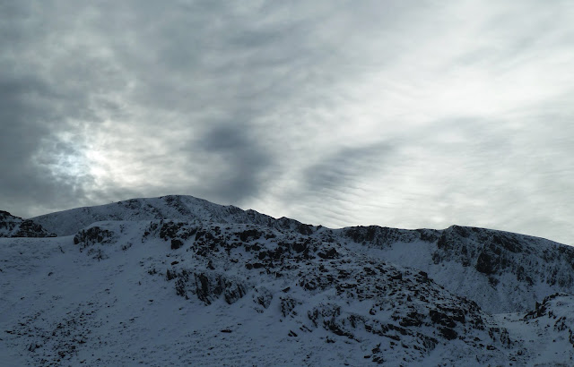
Having scrambled up to
the summit of Clogwyn yr Oen, the view ahead looked beautiful but daunting. The powder snow was deep in places and made
progress difficult as I broke trail towards Ceseiliau Moelwyn. The Welsh Highlands Sub-Top of Clogwyn y
Bustach was visited, but not surveyed given that its status within the list is
secure. Ahead stood Craig Stwlan, which I
had noted as a marginal P20, as such, I knew Myrddyn Phillips would
appreciate having the hill surveyed, given that it was a candidate for his 500m Sub-Twmpau list.
 |
| Clogwyn y Bustach (Photo: Aled Williams) |
The summit of Craig
Stwlan was first to be surveyed. This
went quickly and efficiently, no doubt benefitting from the experience of
recent surveys. The views were stunning
and I could discern the path that I would take to reach Bwlch Stwlan. The bwlch of Craig Stwlan took a bit longer
to locate. This is often dictated by the
flat topography of low points, but the winter conditions doubled the challenge
of the task. Once data had been
collected, I ploughed onwards through the snow, thankfully joining a set of
tracks that greatly eased progress.
 |
| Trimble atop Craig Stwlan (Photo: Aled Williams) |
I then joined the path
known locally as Llwybr Gaseg. This was
spectacular in the conditions, perched above the freezing waters of Llyn Stwlan
and the snow plastered slopes and gullies of Moelwyn Mawr and Craig Ysgafn
above. Care was needed in places, but no
ice was met. Upon reaching Bwlch Stwlan,
a splendid view of Traeth Mawr and Porthmadog opened out.
 |
| Along Llwybr Gaseg (Photo: Aled Williams) |
 |
| Bwlch Stwlan (Photo: Aled Williams) |
Craig Ysgafn looked
imposing from Bwlch Stwlan, but the scarcity of ice made it an easier endeavour. The south top was visited, another Sub-Top in
the Welsh Highlands list, followed by the highest summit of the ridge. However, the focus was the northern top,
which classified a marginal P10 stood a chance of being promoted to the
sub-list of The Welsh Highlands list that I co-author with Myrddyn Phillips.
 |
| Craig Ysgafn (Photo: Aled Williams) |
 |
| Summit of Craig Ysgafn looking toward Moelwyn Mawr (Photo: Aled Williams) |
The bwlch of the north
top was found to be a snug notch in the ridge, with an airy view down a gully
that led straight down to the depths of Llyn Stwlan. The survey was completed quickly and a short
climb led to the summit of the north top.
A number of rocky protuberances competed for the highest point and so
the Abney level was used to identify the correct outcrop. Three men bypassed the summit as data
collected, looking a little perplexed at the beeping noises emanating from the
Trimble!
 |
| Bwlch of the north top of Craig Ysgafn (Photo: Aled Williams) |
 |
| Surveying the bwlch of the north top of Craig Ysgafn (Photo: Aled Williams) |
Having collected data I
made my way to the base of the upper slope of Moelwyn Mawr. A determined plod progressively took me up to
the steep slope, where a surprising amount of deep snow had settled.
 |
| Climbing Moelwyn Mawr (Photo: Aled Williams) |
 |
| Summit ridge of Moelwyn Mawr (Photo: Aled Williams) |
The summit ridge of
Moelwyn Mawr looked airy and alpine-like, with Yr Wyddfa and its neighbouring
Eryri peaks looking majestic to the north.
Below was Llyn Croesor and Bwlch Rhosydd, between which was a hillock
that I had recently identified as a potential Sub-Top for the Welsh Highlands
list and as such, was the third surveying objective of the day.
 |
| Summit of Moelwyn Mawr (Photo: Aled Williams) |
 |
| Yr Wyddfa (Photo: Aled Williams) |
The steep descent from
the summit of Moelwyn Mawr was undertaken slowly and carefully. I had been warned from a Blaenau Ffestiniog
local whom I had met on the way up Moelwyn Mawr that the snow above Rhosydd was
deep. This warning was confirmed by the
appearance of a partially buried stile and fence! However, I was yet again fortunate to follow
in the footsteps of others and so quick progress was made to the shores of Llyn
Croesor.
 |
| Deep snow (Photo: Aled Williams) |
 |
| The final surveying objective (Photo: Aled Williams) |
On the other side of the
lake stood the craggy hillock that was to be surveyed, a short but enjoyable
climb led to the summit, whereupon the Trimble was placed on the highest point
of outcropping rock. The scenery was breath-taking
and I felt fortunate to be out in such a wild place. However, the serenity would soon be broken by
hard surveying work!
 |
| Surveying the summit (Photo: Aled Williams) |
The bwlch of the hill
was unexpectedly complex. I quickly
realised that the gap had been plugged by a dam that formerly held the north
side of Llyn Croesor when operating at reservoir capacity. Furthermore, an outflow leat consisting of
earth and large slabs of rock had been built on the northern side of the dam.
 |
| The bwlch (Photo: Aled Williams) |
 |
| The dam wall (Photo: Aled Williams) |
Ironically, the ice axe
strapped to my bag was finally unclipped and brought into use, with the adze
helping to displace snow so that a better assessment of the terraformed bwlch
could be made. Two sets of data were
gathered with the Trimble; one at the bottom of the dam wall and one above the
leat at the spot where remaining natural ground was identified. However, post survey, further analysis work
revealed that the natural bwlch may well be extant to the north of the wall
within the leat.
 |
| The leat (Photo: Aled Williams) |
 |
| Looking back at the final hill (Photo: Aled Williams) |
Once the surveying
equipment was packed away, a set of snow tracks sign-posted the way to Bwlch
Rhosydd and ultimately the way back to civilisation. Before I set off, a quick glance behind my
shoulder revealed beautiful cloud formations above Moelwyn Mawr, brought in
from the east and heralding a change in the weather. It had been a great day out and one no doubt
to be remembered for years to come.
 |
| Clouds above Moelwyn Mawr (Photo: Aled Williams) |
 |
| Walkers ascending Moelwyn Mawr (Photo: Aled Williams) |
 |
| Moelwyn Mawr clouds (Photo: Aled Williams) |
Aled Williams (January 2023)
Survey Result:
Craig Stwlan
Summit Height: 568.4m (converted to OSGM15)
Summit Grid Reference: SH 66736 44654
Bwlch Height: 548.3m (converted to OSGM15)
Bwlch Grid Reference: SH 66693 44717
Drop: 20.1m (500m Sub-Twmpau addition)
Dominance: 3.53%
Craig Ysgafn
Summit Height: 688.3m (converted to OSGM15)
Summit Grid Reference: SH 65973 44394
Bwlch Height: 678.0m (converted to OSGM15)
Bwlch Grid Reference: SH 65960 44382
Drop: 10.3m (Welsh Highland Sub addition)
Dominance: 1.49%
Pt. 524.3m
Summit Height: 524.3m (converted to OSGM15)
Summit Grid Reference: SH 66117 45783
Bwlch Height: 513.5m (converted to OSGM15)
Bwlch Grid Reference: SH 66131 45774
Drop: 10.7m (Welsh Highland Sub addition)
Dominance: 2.05%
For further details please consult the Trimble Survey Spreadsheet


.jpg)


