Showing posts with label Pen Twyn. Show all posts

Tuesday, 13 September 2016

Mapping Mountains – Significant Name Changes – Y Pedwarau - The 400m Hills of Wales


Pen Twyn (SN 857 463)

There has been a Significant Name Change to a hill that is listed in the Y Pedwarau, and the following details are in respect of a hill that was surveyed with the Trimble GeoXH 6000 on the 25th September 2015.

The criteria for the list that this name change applies to are:

Y Pedwarau These are the Welsh hills at and above 400m and below 500m in height that have 30m minimum drop.  The list is co-authored by Myrddyn Phillips and Aled Williams, and the introduction to the Mapping Mountains publication of this list appeared on the 30th January 2017.

The hill is a part of the Elenydd range, which forms one of the largest hill groups in the country and is situated in the central part of mid and west Wales.  The hill is on the south-eastern periphery of this hill range and is positioned above the small town of Llanwrtyd (Llanwrtyd Wells) to its east.

The Trimble GeoXH 6000 gathering data at the summit of Pen Twyn

The hill appeared in the 400m P30 list on Geoff Crowder’s v-g.me website under the name of Pen Garn-gou, which is a name that appeared close to the summit of the hill on Ordnance Survey 1:25,000 Explorer maps of the day.  During my early hill listing I paid little regard to name placement on a map, or the meaning of names and to what feature the name was appropriately applied to.  Therefore I prioritised names for listing purposes that I now understand are inappropriate, and Pen Garn-gou is such an example as this name has been consistently applied by the Ordnance Survey to land that is below and to the south of this hill’s summit, whilst the larger scale Ordnance Survey Six-Inch map is consistent in applying the name Pen Twyn to the land where the summit of the hill is situated.   


Pen Garn-gou
    477m
    SN858463
    147
  187
  

Since publication of these P30 lists on Geoff Crowder’s v-g.me website there have been a number of Ordnance Survey maps made available online, some of these are historical such as the series of Six-Inch maps on the National Library of Scotland website, whilst others are current and digitally updated such as the enlarged map on the Geograph website.  One of the historical maps now available is the Ordnance Survey One-Inch ‘Old Series’ map which was the first map made publicly available by the Ordnance Survey, and it is details on this map that formed the basis for the change in this hill’s listed name. 

Extract from the Ordnance Survey One-Inch 'Old Series' map


Extract from the series of Ordnance Survey Six-Inch maps

The One-Inch ‘Old Series’ was the first map that Ordnance Survey published, and these maps were based on the preceding Draft Surveyors map.  Their publication culminated from the whole of Britain being surveyed between 1791 and 1874 and the detail gathered therein produced at a scale of one inch to the mile and published in sheet format between 1805 and 1874.  The One-Inch ‘Old Series’ maps for the whole of Wales are now available online; they are also available in map format as enlarged and re-projected versions to match the scale and dimensions of the Ordnance Survey 1:50,000 Landranger series and are published by Cassini.  This series of maps forms another important part in the study of Welsh upland place-names and bridge the time frame leading to the production of the Ordnance Survey base map of the Six-Inch series.

Therefore the name this hill is now listed by in Y Pedwarau is Pen Twyn and this was derived from the Ordnance Survey One-Inch ‘Old Series’ map and later confirmed by the series of Ordnance Survey Six-Inch maps.


The full details for the hill are:

Group:  Elenydd

Name:  Pen Twyn

Previously Listed Name:  Pen Garn-gou
 
Summit Height:  476.6m (converted to OSGM15)

OS 1:50,000 map:  147

Summit Grid Reference:  SN 85798 46301
  
Drop:  45.1m (Trimble summit and LIDAR bwlch)


Myrddyn Phillips and Aled Williams (September 2016)


Saturday, 17 October 2015

Mapping Mountains – Trimble Surveys – Drygarn Fawr


25.09.15  Garn Wen (SN 845 459) and Pen Twyn (SN 857 463)  

Garn Wen (SN 845 459)

As I travelled south the early morning chill and clear skies foretold a good day on the hill.  I planned on doing two small walks near to Llanwrtyd, however as I neared the smallest town in Britain a large grey cloud bank emerged over the western part of the Elenydd.  This quickly pushed east and by the time I’d parked in the yard of Ty’n-y-maes farm there were spots of rain falling.

I’d been on one of the two hills I planned on visiting during my first walk once before, in July 2000, and did on that day what I hoped to do today, get permission to park at the farm and approach the hills from the south-west on a good track that leads up beside the Nant y Cae.

As I drove into the farm yard Tyssul Davies was already busy at work, once I’d introduced myself and mentioned my previous visit we chatted for ten minutes about the names of the hills and the route up to their summits.  By now the rain was falling so I thanked Tyssul and wondered if I should sit out the wet weather.  Not wanting to linger I grabbed my brolly and set off up the track.

The gravelled track soon became a green lane and pushed its way up the cwm, my brolly was up and sheltered me, my rucksack and my camera gear, an umbrella can be a great addition to hill walking kit for the lower hills.  Ahead the sky was deep grey and did not look inviting.

The green track to the hills with the deep uninviting grey cloud ahead

I left the green track before its end and jumped over the narrow stream and clambered over a fence and followed a vehicle track on the moor as it gained height adjacent to a contouring fence.  In time this led through an open gate on to the upper part of Garn Wen.

I remember this hill being rather wild from my previous visit and it didn’t disappoint today, the whole summit area is one of tussock grass, heather and bog, all leading up to its ancient cairn that has been re-fashioned into a wind shelter with its trig pillar sitting inside.  As I gained height the large ancient cairn came into view across the moor, between me and it was an unsavoury bog which proved fun to cross.

The ancient cairn at the summit of Garn Wen

Once at the summit I considered placing the Trimble just to the south-west of the cairn and trig, but I then examined inside the wind shelter and found stable ground within it which was higher than the ground just to the south-west.  This high ground could of course be made of rocks from the ancient cairn but I did not want to excavate something from antiquity so I placed the Trimble on top of my rucksack, positioned three rocks at its base, which I re-positioned afterwards, to stabilise it and once the accuracy level was attained I pressed ‘Log’.

Gathering data at the summit of Garn Wen

As I waited for the five minutes of data to be collected the first burst of sunshine shone out of a brightening sky.  Packing the equipment away I followed a vehicle track down toward the bog which proved an easier crossing that my alternative ascent route.  I then roughly re-traced my route back down to the fence and the narrow stream.

Following the vehicle track on the moor toward the second hill of the day

I had no immediate intention of gathering data from the connecting bwlch to Pen Twyn as the map indicated that it was immersed in a conifer plantation, but there was a gap between a small section of mature trees and a larger section of saplings, so I thought I’d investigate.  I stumbled my way down to this land from the open hillside, found a tree stump and positioned my rucksack on it with the Trimble placed on top and gathered another five minutes of data.

Gathering data at the bwlch area of Pen Twyn

By now the deep grey cloud had been swept away and sunshine pre-dominated as I followed the fence beside the large conifer plantation toward the summit of Pen Twyn.  This is the hill that Anton Ciritis completed the Pedwarau on, on 9th September 2014.  The summit area has a neat cairn positioned on it and I placed the Trimble on top of my rucksack approximately 1 metre from it on what I judged to be the highest part of the hill.

Gathering data at the summit of Pen Twyn

Once the allotted five minutes of data were gathered I packed the equipment away and descended the southerly part of the hill, this proved steep in places and gave views south toward the shapely profile of a 396m map heighted hill which is listed as a Sub-Pedwar with c 113m of drop.

All in a line

The shapely profile of Pt. 396m (SN 847 436)

The southerly profile of Pen Twyn

This southerly route down the hill led to a vehicle track over a field which then accessed a gate and the track back to Ty’n-y-maes.  As I arrived in the farm yard Tyssul was in conversation with three people, I stopped and chatted and showed him on the map where the next two hills on my planned second walk were situated, and he kindly suggested what farm I should park at.


Survey Result:


Garn Wen

Summit Height:  511.6m (converted to OSGM15)

Summit Grid Reference:  SN 84511 45973

Drop:  75m

Dominance:  14.66%


Summit Height:  476.6m (converted to OSGM15, Trimble GeoXH 6000)

Summit Grid Reference:  SN 85798 46301 (Trimble GeoXH 6000)

Bwlch Height:  431.5m (LIDAR)

Bwlch Grid Reference:  SN 85238 46447 (LIDAR)

Drop:  45.1m (Trimble GeoXH 6000 summit and LIDAR bwlch)

Dominance:  9.46% (Trimble GeoXH 6000 summit and LIDAR bwlch)


For further details please consult the Trimble survey spreadsheet click {here}


Tuesday, 23 September 2014

Anton Ciritis Completes Y Pedwarau


On the 9th September Anton Ciritis completed Y Pedwarau and became the second person to do so, the first being Rob Woodall who completed on Moel Eithinen (SJ 167 592) in the Bryniau Clwyd range on the 9th June 2011.
The Pedwars is available to download online
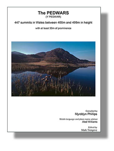
Front cover of the 1st Edition of Y Pedwarau (name now altered from The Pedwars) published May 2013 by Europeaklist

Anton chose Pen Twyn (SN 857 463) as his last Pedwar, the hill is situated on the outskirts of Llanwrtud (Llanwrtyd Wells) in the southern part of mid Wales.  Pen Twyn is rather unassuming as it is adjoined to Garn Wen, which at 511.6m is 35.0m higher.  Both hills can be easily combined in a single outing and although part of their hill sides are covered in forestry; their summits are open with the summit of Pen Twyn crowned by a small neat cairn.

Pen Twyn (SN 857 463).  Photo:  Anton Ciritis

The summit cairn on Pen Twyn.  Photo:  Anton Ciritis
Many of the Pedwar hills were visited in the company of Carole Engel, and after completing the Nuttalls and Deweys, Anton and Carole decided they loved Wales so much that they wanted another hill list as a challenge.  It was the original version of Y Pedwarau that appeared on Geoff Crowder’s V-G Backpacking in Britain website that fulfilled this challenge.

The first 400m Welsh hill that Anton recorded visiting was on 17th February 2009 in the great expanse of wilderness that makes up the Elenydd, this was Esgair Dderw.  This hill was originally listed in the Sub-List and only received full P30 Pedwar status in recent times, so even at this stage Anton was bagging hills that stood a possibility for future promotion.

First section of the original Welsh 400m P30 list as presented on Geoff Crowder's V-G website
Anton was born in Halifax, West Yorkshire, a town where he still lives; he is now aged 60 and is recorded as the 176th completer of the 2,000ft mountains listed by John and Anne Nuttall (excluding Pillar Rock), the 6th person to have completed the Deweys and the 461st completer of the Wainwrights.  He has also completed the Birketts (excluding Pillar Rock), Wainwrights Outlying Fells and Donalds.  He can now add Y Pedwarau to his completed bagging exploits.

Michael Dewey's Mountain tables book


John and Anne Nuttall' two volume guides 


When Anton informed us of his completion he kindly sent some personal details through so that a post could appear on the Mapping Mountain Blog, part of what he sent appears below.

A tough set of hills unlike the other well done list’s where there are well used tracks and paths to them, these are mainly done using the ground you are faced with on the day navigating with the natural landscape, there is something for everyone, bog, pastures, heather, rock, track, fell and the dreaded tree crawling.

As for what next, well my goal is the Donald Dewey’s and their deleted tops a natural progression after completing the Donald’s, Donald Tops, New Donald’s and all the deleted tops associated with these, the remaining Fours that I have to do are being done on a sort of as and when basis when I only have the odd day off work or when passing going to another area. When I want to do some more in Wales I think I shall continue to do the sub 490-499 hills of which I have 3 to do and the sub Pedwarau tops.

Many congratulations to Anton, the second person to complete Y Pedwarau.

Anton Ciritis, the second person to complete Y Pedwarau.  Photo:  Carole Engel


Y Pedwarau is available in e and print booklet form and can be interactively ticked:

To access the Europeaklist booklet ‘Y Pedwarau’ as an e-booklet version or print booklet version please click {here]

To Access the list of ‘Y Pedwarau’ on the Haroldstreet website for GPS Waypoints, Google mapping and on-line hill bagging tick lists please click {here}

To access the list of ‘Sub-Pedwar’ hills on the Haoldstreet website for GPS Waypoints, Google mapping and on-line hill bagging lists please click {here}

To access the list of ‘Double Sub-Pedwar’ hills on the Haroldstreet website for GPS Waypoints, Google mapping and on-line hill bagging lists please click {here}