Showing posts with label Fegla Fach. Show all posts

Tuesday, 28 August 2018

Mapping Mountains – Significant Height Revisions – 30-99m Twmpau and Y Trechol – The Dominant Hills of Wales


Fegla Fach (SH 638 153)

There has been a Significant Height Revision to a hill that is listed in the 30-99m Twmpau and Y Trechol – The Dominant Hills of Wales, with the summit height, drop, dominance and status of the hill confirmed by a combination of LIDAR analysis and a Trimble GeoXH 6000 survey conducted by Myrddyn Phillips.

The criteria for the two listings that this significant height revision applies to are:

30-99m Twmpau – Welsh hills at or above 30m and below 100m in height that have a minimum 30m of drop, with the word Twmpau being an acronym standing for thirty welsh metre prominences and upward.

Y Trechol – The Dominant Hills of Wales – Welsh P30 hills whose prominence equal or exceed half that of their absolute height.

The name of the hill is Fegla Fach and it is adjoined to the Cadair Idris group of hills, which are situated in the south-western part of North Wales (Region A, Sub-Region A3), with the hill being positioned between the Afon Mawddach to its north-west and the A 493 road to its south-east, and has the village of Y Friog (Fairbourne) to the south-west.  

As the hill is not a part of designated open access land permission to visit should be sought, for those wishing to do so access to its summit can be found from the confines of a camp site which is situated at the base of the hill to its south-west.

Prior to LIDAR analysis and the Trimble survey this hill was listed with 25m of drop based on the 28m summit spot height that appears on the Ordnance Survey 1:25,000 Explorer map and the 3m bwlch spot height that appears on the Ordnance Survey Interactive Coverage Map hosted on the Geograph website.

Extract from the Ordnance Survey Interactive Coverage Map hosted on the Geograph website

The summit height produced by LIDAR analysis is 31.5m, this is not a dramatic height revision when compared to some revised heights, but it does come within the parameters of the Significant Height Revisions used within this page heading, these parameters are:

LIDAR image of Fegla Fach (top right of photograph) and showing the Arthog bog

The term Significant Height Revisions applies to any listed hill whose interpolated height and Ordnance Survey or Harvey map summit spot height has a 2m or more discrepancy when compared to the survey result produced by the Trimble GeoXH 6000 or analysis of data produced via LIDAR, also included are hills whose summit map data is missing an uppermost ring contour when compared to the data produced by the Trimble or by LIDAR analysis.  As heights on different scaled Ordnance Survey maps are not consistent the height given on the 1:25,000 Explorer map is being prioritised in favour of the 1:50,000 Landranger map for detailing these revisions.

Therefore, this hill’s new summit height is 31.5 and this was produced by LIDAR analysis, this is 3.5m higher than its previously listed height of 28m which appears as a spot height on the Ordnance Survey 1:25,000 Explorer map.


The full details for the hill are:

Group:  Cadair Idris

Summit Height (New Height):  31.5m (LIDAR)

Name:  Fegla Fach

OS 1:50,000 map:  124

Summit Grid Reference:  SH 63818 15311 (LIDAR)   

Drop:  30.0m (LIDAR summit and Trimble bwlch)

Dominance:  95.37% (LIDAR summit and Trimble bwlch)


The summit of Fegla Fach (SH 638 153)


Myrddyn Phillips (August 2018)


Wednesday, 25 July 2018

Mapping Mountains – Hill Reclassifications – Y Trechol – The Dominant Hills of Wales


Fegla Fach (SH 638 153) – Dominant addition

There has been an addition to the listing of Y Trechol – The Dominant Hills of Wales due to LIDAR analysis, an on-site visit and a survey with the Trimble GeoXH 6000 which took place on the 17th May 2018, with the criteria for this list being:

Y Trechol – The Dominant Hills of Wales - Welsh P30 hills whose prominence equal or exceed half that of their absolute height.

This hill did not appear in the accompanying Hills to be surveyed sub list when the original Welsh P30 hills were published on Geoff Crowder’s v-g.me website as it did not meet the criteria for this sub category; however this sub list has now been standardised including the addition of interpolated drop values and heights.

Prior to LIDAR analysis, an on-site visit and the Trimble GeoXH 6000 survey this hill was listed with 25m of drop based on the 28m summit spot height that appears on the Ordnance Survey 1:25,000 Explorer map and the 3m spot height that appears on the area of this hill’s bwlch on the Ordnance Survey Interactive Coverage Map hosted on the Geograph website.

Extract from the Ordnance Survey Interactive Coverage Map hosted on the Geograph website

The name of the hill is Fegla Fach and it is adjoined to the Cadair Idris group of hills, which are situated in the south-western part of North Wales (Region A, Sub-Region A3), with the hill being positioned between the Afon Mawddach to its west and north and the A 493 road to its south-east, and has the village of Y Friog (Fairbourne) to the south-west.  

Fegla Fach from across the Afon Mawddach

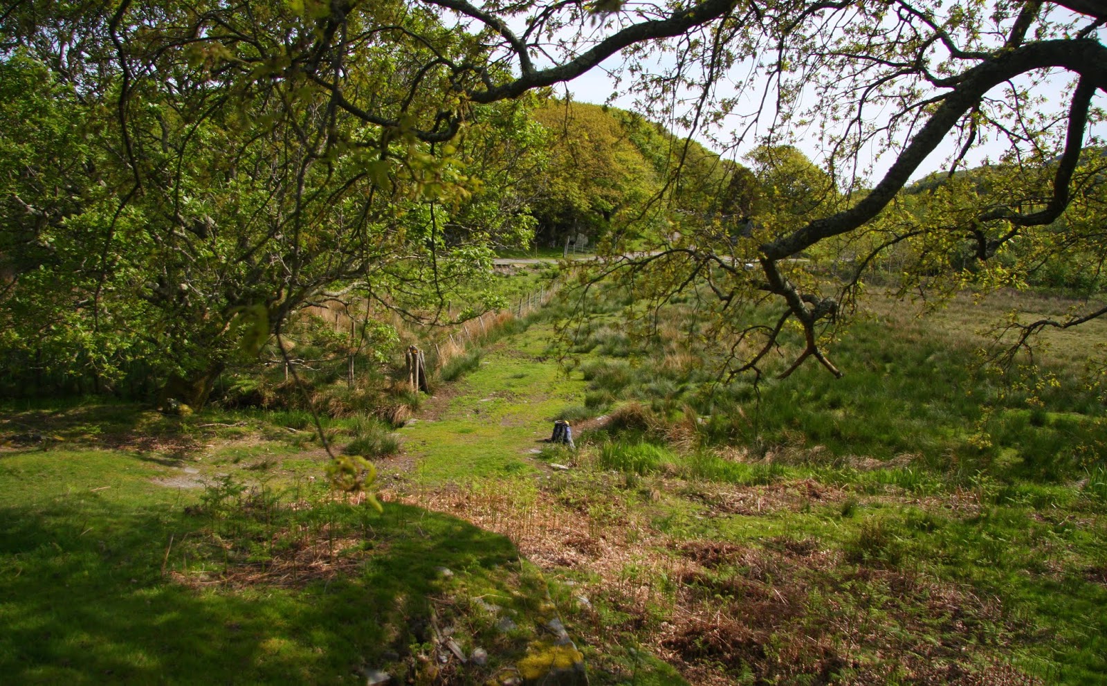
Fegla Fach from its connecting bwlch

If wanting to visit the hill permission to do so should be sought as it is not a part of designated open access land, for those wishing to do so the minor road to the south of the hill joins a public footpath that then heads toward it.

The addition of Fegla Fach to Dominant status is in part due to LIDAR analysis conducted by Myrddyn Phillips.  The LIDAR (Light Detection & Ranging) technique produced highly accurate height data that is now freely available for much of England and Wales. 

The 1m DTM LIDAR analysis gives the hill the following details:


Fegla Fach

Summit Height:  31.5m

Summit Grid Reference:  SH 63818 15311

Bwlch Height:  1.6m

Bwlch Grid Reference:  SH 63691 15131 and SH 69693 15130

Drop:  29.9m


This hill and others in the vicinity used to be tidal islands before sea defences were constructed, with the Afon Mawddach positioned to the immediate north, west and east of the hill, this has resulted in this hill now being landlocked by its connecting bwlch which is a part of the larger Arthog Bog. 

The area of the connecting bwlch of this hill is complicated to analyse via LIDAR as it is low lying and the land has been terraformed with embankments and drainage ditches.  However, extensive LIDAR analysis pinpoints the position of what can be construed as this hill’s remaining natural bwlch to be on or just below what is now a small land bridge.

LIDAR image of Fegla Fach (top right corner) and the land making up the Arthog Bog

This land bridge crosses one of many drainage ditches in the Arthog Bog and this position was surveyed using the Trimble GeoXH 6000, with three measurement offsets noted, the first to ground making up the land bridge, the second to water level in the drainage ditch and the third to ground mid-way between the land bridge and the water level, the survey results appear below:


1st survey, land bridge:  1.577m

2nd survey, water level in drainage ditch:  1.337m

3rd survey, mid-point between land bridge and water level:  1.457m


The Trimble GeoXH 6000 gathering data at the bwlch of Fegla Fach

When these survey results are combined with the LIDAR result for the summit of this hill the drop values for each of the three points at the bwlch are:


1st survey, land bridge:  29.912m

2nd survey, water level in drainage ditch:  30.152m

3rd survey, mid-point between land bridge and water level:  30.032m


The summit of this hill was analysed using the 1m DTM LIDAR model and as the high point consists of a large rock with a number of trees growing directly beside it, it is probable that the LIDAR technique did not model the very highest part of this rock, and when coupled with the result produced by the Trimble bwlch survey it is deemed sufficient to list this hill with a drop value of 30m, which when coupled with the summit height produced by LIDAR analysis gives this hill 95.37% Dominance.

The summit of Fegla Fach

The full details for the hill are:

Group:  Cadair Idris

Name:  Fegla Fach

Dominance:  95.37%

OS 1:50,000 map:  124

Summit Grid Reference:  SH 63818 15311 (LIDAR)

Summit Height:  31.5m (LIDAR)

Drop Summit to Bwlch:  30.0m (LIDAR summit and Trimble bwlch)

Drop Bwlch to ODN:  1.5m (LIDAR summit and Trimble bwlch)


Myrddyn Phillips (July 2018)


Sunday, 22 July 2018

Mapping Mountains – Trimble Surveys – Cadair Idris


17.05.18  Fegla Fawr (SH 629 146) and Fegla Fach (SH 638 153 [only bwlch surveyed SH 636 151])

Fegla Fawr (SH 629 146)

Over the preceding few weeks I had been drawn to this area when analysing LIDAR and had created a multitude of cascading shaped colour highlighting the intricacies of Fegla Fawr, Fegla Fach and near hills as they stood in what is now reclaimed land from tidal surge from the Afon Mawddach which is positioned to their immediate north.  It had proved a fascinating area to LIDAR, but now I wanted to visit and Trimble as many points adjoined to these two hills as the landlocked bog and wooded summits would allow.

These two hills can be easily combined via the Mawddach Trail which is an eight mile cycle path connecting Dolgellau with Morfa Mawddach railway station, I walked this route many years ago but had not had the pleasure of visiting Fegla Fawr and Fegla Fach.

Heading toward the hill over one of many footbridges that span drainage ditches in the Arthog Bog

I left my car in the large car park adjoined to the railway  station and headed toward the higher of the two hills on a wide green path that on this morning was bathed in early sunshine, it was a pleasure to be out heading toward what for me were two new hills.

The wide path continued on the upper side of the hill with a narrower path skirting from it on what I presumed to be a route toward the summit.  I soon reached the high point which consists of a large rock with a lump of thin metal a few metres away sticking up from the ground.

Gathering data at the summit of Fegla Fawr

After positioning the Trimble aligned with the high point of the hill I left it gathering data and succumbed to the watery view, as dappled sand banks and the forever tide ebb of the Afon Mawddach dominated a tranquil scene below.  Beyond the Mawddach the southern bulk of the Rhinogydd rose out of the Victorian houses of Abermaw (Barmouth) and all was bathed in the blue of early summer.

Abermaw (Barmouth) with Pen Llŷn beyond

The Trimble GeoXH 6000 set-up position at the summit of Fegla Fawr with the Afon Mawddach in the background

Once the Trimble had gathered its allotted data I followed the wide path down through beautiful woodland to the Mawddach Crescent, with its lined houses looking northward on to the inland estuary and the depths of the near river below.  It seemed a tranquil scene set and lived at a leisurely pace where life somewhat stood still.

Looking across the Afon Mawddach to Fegla Fach

The Mawddach Crescent

A public footpath connects Fegla Fawr with the lower slopes of Fegla Fach where a caravan park is placed, this footpath skirts a large bull rushed area of watery bog.  Sea defences have created this, as once the surge of the river would have cast these hills as tidal islands, they are now landlocked with drainage ditches and bog and raised tarmacked and gravel inroads as embankments.

I wanted to take at least two data sets from the area that now constitutes the connecting bwlch between these two hills and chose my first spot at the base of a paved road embankment leading to one of the secluded houses to the east of the Mawddach Crescent, and proceeded to set my rucksack down on a clump of reed grass amongst a watery bog, the Trimble was positioned on top of it to give it a semblance of elevation and I waited for the allotted data to be gathered.

Gathering data in the Arthog Bog

The next point to survey was where extensive LIDAR analysis led me to believe the natural connecting bwlch between Fegla Fach and Fegla Fawr was once positioned, this land now has a flat bedded foot bridge that crosses one of many drainage ditches in the area, as the Trimble gathered data I sat on the lower slopes of another and smaller grassed and rocky and tree covered lump just to the west of the foot bridge, I’d studied this connection in depth with LIDAR and it felt unusual to now put an image and reality to landscape, that I had only previously looked at in computer software whose detail had been generated from the LIDAR technique.

Gathering data at the bwlch of Fegla Fach

Fegla Fach from its connecting bwlch

During this time I watched a number of people in the adjacent caravan site going about their early morning business and wondered if I could just walk up through the wooded slopes of Fegla Fach to its summit, signs proclaiming the caravan site to be private were not encouraging.

The signs are not encouraging to any budding visitor

After packing the Trimble away I asked a small group of people on the caravan site if I could visit the summit in the wood and was told that I would have to get permission to do so as it was private land, they kindly directed me to the Fegla Fach Farm where I met the local farmer and the warden of the site, we chatted about the name of the hills, the history of the land, the sea defences and the summit of the hill.  I asked for permission to visit the summit and left after thanking them for their time.

A number of paths lead toward the top of Fegla Fach, some are narrow and others broad and gravelled.  The upper part of the hill has a variety of structures on top, including a wooden hut, rope-bridge, a large awning resembling a tipi and a high climbing wall.  I judged the summit to be a large rock embedded amongst stunted trees.

The summit of Fegla Fach is amongst the trees on the left

The large rock at the summit of Fegla Fach

I spent a number of minutes walking between the various structures close to the summit and visited all high points before descending one of the broad paths and then coming across the high climbing wall; all were unexpected and rather surreal.

Rope-bridge

Just one of many things in the Fegla Fach wood

Climbing wall

Leaving the wooded surrounds I re-entered the caravan site and followed the land beside the river for a short distance westward, watching a wind-surfer float in to a tiny bay and enjoying a different perspective of Fegla Fawr.  I felt a little sad that such a beautiful place had to place private signs on gates and the residents were cautious in relation to me, as even when emerging out of the wood and greeting a man beside one of the caravans with a cheery; ‘good morning’ I was greeted back with ‘who are you and what are you doing here’.

Windsurfer with Fegla Fach in the background

Fegla Fawr with the Mawddach Crescent as foreground

After taking a number of photographs I headed back to my awaiting car on the continuation of the public footpath and then on the tracked section of the Mawddach Trail, it was then time to visit a number of farmers in the Abertrinant and Dysynni area making further place-name enquiries of hills I had visited a few days earlier.     


Survey Result:


Fegla Fawr

Summit Height:  59.5m (converted to OSGM15) (significant height revision)

Summit Grid Reference:  SH 62966 14665

Bwlch Height:  1.9m (LIDAR)

Bwlch Grid Reference:  SH 62599 14119 (LIDAR)

Drop:  57.6m (Trimble summit and LIDAR bwlch)

Dominance:  96.81%


Fegla Fach

Summit Height:  31.5m (LIDAR) (significant height revision)

Summit Grid Reference:  SH 63818 15311 (LIDAR)

Bwlch Height:  1.5m (converted to OSGM15)

Bwlch Grid Reference:  SH 63692 15129

Drop:  30.0m (LIDAR summit and Trimble bwlch) (Double Sub-Twmpau reclassified to 30-99m Twmpau)

Dominance:  95.37% (Dominant addition)


Thursday, 5 July 2018

Mapping Mountains – Hill Reclassifications – 30-99m Twmpau


Fegla Fach (SH 638 153) – Double Sub-Twmpau reclassified to 30-99m Twmpau

There has been a reclassification to the 30-99m Twmpau list due to LIDAR analysis, an on-site visit and a survey with the Trimble GeoXH 6000 which took place on the 17th May 2018, with the criteria for this list being:

30-99m TwmpauWelsh hills at or above 30m and below 100m in height with 30m minimum drop, this height band of hills has two accompanying sub lists, the first of which is entitled the 30-99m Sub-Twmpau with the criteria for this sub category being all Welsh hills at or above 30m and below 100m in height with 20m or more and below 30m of drop, and the second sub category which this hill is a part of is entitled the Double Sub-Twmpau with the criteria for this sub category being all Welsh hills at or above 20m and below 30m in height with 20m or more and below 30m of drop, with the word Twmpau being an acronym standing for thirty welsh metre prominences and upward.

This hill did not appear in the accompanying Hills to be surveyed sub list when the original Welsh P30 hills were published on Geoff Crowder’s v-g.me website as it did not meet the criteria for this sub category; however this sub list has now been standardised including the addition of interpolated drop values and heights.

Prior to LIDAR analysis, an on-site visit and the Trimble GeoXH 6000 survey this hill was listed with 25m of drop based on the 28m summit spot height that appears on the Ordnance Survey 1:25,000 Explorer map and the 3m spot height that appears on the area of this hill’s bwlch on the Ordnance Survey Interactive Coverage Map hosted on the Geograph website.


Extract from the Ordnance Survey Interactive Coverage Map hosted on the Geograph website

The name of the hill is Fegla Fach and it is adjoined to the Cadair Idris group of hills, which are situated in the south-western part of North Wales (Region A, Sub-Region A3), with the hill being positioned between the Afon Mawddach to its west and north and the A 493 road to its south-east, and has the village of Y Friog (Fairbourne) to the south-west.  

Fegla Fach from across the Afon Mawddach


Fegla Fach from its connecting bwlch

If wanting to visit the hill permission to do so should be sought as it is not a part of designated open access land, for those wishing to do so the minor road to the south of the hill joins a public footpath that then heads toward it.

The addition of Fegla Fach to 30-99m Twmpau status is in part due to LIDAR analysis conducted by Myrddyn Phillips.  The LIDAR (Light Detection & Ranging) technique produced highly accurate height data that is now freely available for much of England and Wales. 

The 1m DTM LIDAR analysis gives the hill the following details:


Fegla Fach

Summit Height:  31.5m

Summit Grid Reference:  SH 63818 15311

Bwlch Height:  1.6m

Bwlch Grid Reference:  SH 63691 15131 and SH 69693 15130

Drop:  29.9m


This hill and others in the vicinity used to be tidal islands before sea defences were constructed, with the Afon Mawddach positioned to the immediate north, west and east of the hill, this has resulted in this hill now being landlocked by its connecting bwlch which is a part of the larger Arthog Bog. 

The area of the connecting bwlch of this hill is complicated to analyse via LIDAR as it is low lying and the land has been terraformed with embankments and drainage ditches.  However, extensive LIDAR analysis pinpoints the position of what can be construed as this hill’s remaining natural bwlch to be on or just below what is now a small land bridge.

LIDAR image of Fegla Fach (top right corner) and the land making up the Arthog Bog

This land bridge crosses one of many drainage ditches in the Arthog Bog and this position was surveyed using the Trimble GeoXH 6000, with three measurement offsets noted, the first to ground making up the land bridge, the second to water level in the drainage ditch and the third to ground mid-way between the land bridge and the water level, the survey results appear below:


1st survey, land bridge:  1.577m

2nd survey, water level in drainage ditch:  1.337m

3rd survey, mid-point between land bridge and water level:  1.457m


The Trimble GeoXH 6000 gathering data at the bwlch of Fegla Fach

When these survey results are combined with the LIDAR result for the summit of this hill the drop values for each of the three points at the bwlch are:


1st survey, land bridge:  29.912m

2nd survey, water level in drainage ditch:  30.152m

3rd survey, mid-point between land bridge and water level:  30.032m


The summit of this hill was analysed using the 1m DTM LIDAR model and as the high point consists of a large rock with a number of trees growing directly beside it, it is probable that the LIDAR technique did not model the very highest part of this rock, and when coupled with the result produced by the Trimble bwlch survey it is deemed sufficient to list this hill with a drop value of 30m, which is sufficient for 30-99m Twmpau status.


The summit of Fegla Fach

The full details for the hill are:

Group:  Cadair Idris

Name:  Fegla Fach

Summit Height:  31.5m (LIDAR)

Summit Grid Reference:  SH 63818 15311 (LIDAR)

Bwlch Height:  1.5m (converted to OSGM15)

Bwlch Grid Reference:  SH 63692 15129

OS 1:50,000 map:  124

Drop:  30.0m (LIDAR summit and Trimble bwlch)


Myrddyn Phillips (July 2018)