The Welsh P15s – Hill Reclassifications
The Welsh P15s are all Welsh hills that have a minimum of 15m of drop, irrespective of their height. Accompanying the main P15 list is a sub list entitled; The Welsh Sub-P15s, with the qualification to this sub category being all Welsh hills with 14m or more and below 15m of drop.
The list is authored by Myrddyn Phillips and the posts that have appeared on Mapping Mountains detailing the additions, reclassifications and deletions to the main P15 list and the sub list that are below P20 and therefore documented in other lists, appear below presented chronologically in receding order.
Mapping Mountains - Hill Reclassifications - The Welsh P15s
Coed Felin Lodge (SN 663 932) – Welsh P15 addition (70th reclassification)
Significant Height Revisions post for Coed Felin Lodge
Significant Name Changes post for Coed Felin Lodge
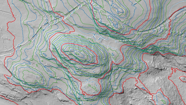
There has been an addition to the list of The Welsh P15s, with the summit height, bwlch height and their locations, the drop and status of the hill derived from LIDAR analysis conducted by Myrddyn Phillips.
%20-%20LIDAR%20hill%201.jpg) |
| LIDAR image of Coed Felin Lodge (SN 663 932) |
The criteria for the list that this addition applies to are:
The Welsh P15s – Welsh hills with 15m minimum drop, irrespective of their height, with an accompanying sub list entitled the Welsh Sub-P15s, with the criteria for this sub category being all Welsh hills with 14m or more and below 15m of drop. The list is authored by Myrddyn Phillips, with the Introduction to the list appearing on Mapping Mountains on the 10th May 2019.
 |
| The Welsh P15s by Myrddyn Phillips |
The name the hill is listed by is Coed Felin Lodge, and it is adjoined to the Banc Llechwedd Mawr group of hills, which are situated in the north-western part of South Wales (Region B, Sub-Region B1), and it is positioned with the B4353 road to its south-west and the A487 road to its east, and has the town of Machynlleth towards the north-east.
When the listing that became known as The Welsh P15s was being compiled, this hill was not included in either the main list or the accompanying sub list, and was subsequently documented with an estimated c 12m of drop, based on an estimated c 66m summit height and an estimated c 54m bwlch height, with both heights based on interpolation of 10m contouring that appears on the Ordnance Survey 1:25,000 Explorer map.
%20-%201%2025000.jpg) |
| Extract from the Ordnance Survey 1:25,000 Explorer map |
However, it was not until LIDAR became available that the details for this hill could be accurately re-assessed. The LIDAR (Light Detection & Ranging) technique produced highly accurate height data that is now freely available for much of England and Wales.
Therefore, the addition of this hill to Welsh P15 status is due to LIDAR analysis, resulting in a 70.9m summit height and a 52.1m bwlch height, with these values giving this hill 18.8m 0f drop, which is sufficient for it to be classified as a Welsh P15.
The full details for the hill are:
Group: Banc Llechwedd Mawr
Name: Coed Felin Lodge
OS 1:50,000 map: 135
Summit Height: 70.9m (LIDAR)
Summit Grid Reference: SN 66384 93253 (LIDAR)
Bwlch Height: 52.1m (LIDAR)
Bwlch Grid Reference: SN 66457 93532 (LIDAR)
Drop: 18.8m (LIDAR)
Myrddyn Phillips (October 2025)
Mapping Mountains - Hill Reclassifications - The Welsh P15s
Allt y Brain (SN 660 927) – Welsh P15 addition (69th reclassification)
Significant Height Revisions post for Allt y Brain
Significant Name Changes post for Allt y Brain
There has been an addition to the list of The Welsh P15s, with the summit height, bwlch height and their locations, the drop and status of the hill derived from LIDAR analysis conducted by Myrddyn Phillips.
%20-%20LIDAR%20hill%201.jpg) |
| LIDAR image of Allt y Brain (SN 660 927) |
The criteria for the list that this addition applies to are:
The Welsh P15s – Welsh hills with 15m minimum drop, irrespective of their height, with an accompanying sub list entitled the Welsh Sub-P15s, with the criteria for this sub category being all Welsh hills with 14m or more and below 15m of drop. The list is authored by Myrddyn Phillips, with the Introduction to the list appearing on Mapping Mountains on the 10th May 2019.
 |
| The Welsh P15s by Myrddyn Phillips |
The name the hill is listed by is Allt y Brain, and this was derived from the Ordnance Survey series of Six-Inch maps, and it is adjoined to the Banc Llechwedd Mawr group of hills, which are situated in the north-western part of South Wales (Region B, Sub-Region B1), and it is positioned with the B4353 road to its south-west and the A487 road to its east, and has the town of Machynlleth towards the north-east.
When the listing that became known as The Welsh P15s was being compiled, this hill was not included in either the main list or the accompanying sub list, and was subsequently documented with an estimated c 8m of drop, based on an estimated c 27m summit height and an estimated c 19m bwlch height, with both heights based on interpolation of 10m contouring that appears on the Ordnance Survey 1:25,000 Explorer map.
%20-%201%2025000.jpg) |
| Extract from the Ordnance Survey 1:25,000 Explorer map |
However, it was not until LIDAR became available that the details for this hill could be accurately re-assessed. The LIDAR (Light Detection & Ranging) technique produced highly accurate height data that is now freely available for much of England and Wales.
Therefore, the addition of this hill to Welsh P15 status is due to LIDAR analysis, resulting in a 35.4m summit height and an 18.5m bwlch height, with these values giving this hill 16.9m 0f drop, which is sufficient for it to be classified as a Welsh P15.
The full details for the hill are:
Group: Banc Llechwedd Mawr
Name: Allt y Brain
OS 1:50,000 map: 135
Summit Height: 35.4m (LIDAR)
Summit Grid Reference: SN 66012 92718 (LIDAR)
Bwlch Height: 18.5m (LIDAR)
Bwlch Grid Reference: SN 66123 92883 (LIDAR)
Drop: 16.9m (LIDAR)
Myrddyn Phillips (October 2025)
Mapping Mountains - Hill Reclassifications - The Welsh P15s
Gamallt (SN 968 714) – Welsh P15 deletion (68th reclassification)
Significant Name Changes post for Gamallt
There has been a deletion to the list of The Welsh P15s, with the summit height, bwlch height and their locations, the drop and status of the hill derived from LIDAR analysis conducted by Myrddyn Phillips.
%20-%20LIDAR%20hill%201.jpg) |
| LIDAR image of Gamallt (SN 968 714) |
The criteria for the list that this deletion applies to are:
The Welsh P15s – Welsh hills with 15m minimum drop, irrespective of their height, with an accompanying sub list entitled the Welsh Sub-P15s, with the criteria for this sub category being all Welsh hills with 14m or more and below 15m of drop. The list is authored by Myrddyn Phillips, with the Introduction to the list appearing on Mapping Mountains on the 10th May 2019.
 |
| The Welsh P15s by Myrddyn Phillips |
The name the hill is now listed by is Gamallt, and this was derived from the Tithe map, and it is adjoined to the Hirddywel group of hills, which are situated in the northern part of South Wales (Region B, Sub-Region B2), and it is positioned with minor roads to its north, west and east, and the A470 road farther to its west, and has the town of Rhaeadr Gwy (Rhayader) towards the south.
When the listing that became known as The Welsh P15s was being compiled, this hill was included in the main list with 15m of drop, based on the 398m summit spot height that appears on the Ordnance Survey 1:25,000 Explorer map and the 383m bwlch spot height that appeared on the Ordnance Survey Vector Map Local hosted on the Geograph website and which was entitled the Interactive Coverage Map.
%20-%201%2025000.jpg) |
| Extract from the Ordnance Survey 1:25,000 Explorer map |
However, it was not until LIDAR became available that the details for this hill could be accurately re-assessed. The LIDAR (Light Detection & Ranging) technique produced highly accurate height data that is now freely available for much of England and Wales.
Therefore, the deletion of this hill from Welsh P15 status is due to LIDAR analysis, resulting in a 397.4m summit height and a 383.5m bwlch height, with these values giving this hill 13.9m 0f drop, which is insufficient for it to be classified as a Welsh P15.
The full details for the hill are:
Group: Hirddywel
Name: Gamallt
OS 1:50,000 map: 136, 147
Summit Height: 397.4m (LIDAR)
Summit Grid Reference: SN 96811 71472 (LIDAR)
Bwlch Height: 383.5m (LIDAR)
Bwlch Grid Reference: SN 96756 71262 (LIDAR)
Drop: 13.9m (LIDAR)
Myrddyn Phillips (September 2025)
Mapping Mountains - Hill Reclassifications - The Welsh P15s
Foel Fach (SN 688 955) – Welsh P15 addition (67th reclassification)
Significant Height Revisions post for Foel Fach
Significant Name Changes post for Foel Fach
There has been an addition to the list of The Welsh P15s, with the summit height, bwlch height and their locations, the drop and status of the hill derived from LIDAR analysis conducted by Myrddyn Phillips.
%20-%20LIDAR%20hill%201.jpg) |
| LIDAR image of Foel Fach (SN 688 955) |
The criteria for the list that this addition applies to are:
The Welsh P15s – Welsh hills with 15m minimum drop, irrespective of their height, with an accompanying sub list entitled the Welsh Sub-P15s, with the criteria for this sub category being all Welsh hills with 14m or more and below 15m of drop. The list is authored by Myrddyn Phillips, with the Introduction to the list appearing on Mapping Mountains on the 10th May 2019.
 |
| The Welsh P15s by Myrddyn Phillips |
The name the hill is listed by is Foel Fach, and this was derived from the Ordnance Survey series of Six-Inch maps, and it is adjoined to the Banc Llechwedd Mawr group of hills, which are situated in the north-western part of South Wales (Region B, Sub-Region B1), and it is positioned with minor roads to its north and south, and the A487 road to its west, and has the town of Machynlleth towards the north-east.
When the listing that became known as The Welsh P15s was being compiled, this hill was not included in either the main list or the accompanying sub list, and was subsequently documented with an estimated c 9m of drop, based on an estimated c 58m summit height and an estimated c 49m bwlch height, with both heights based on interpolation of 10m contouring that appears on the Ordnance Survey 1:25,000 Explorer map.
%20-%201%2025000.jpg) |
| Extract from the Ordnance Survey 1:25,000 Explorer map |
However, it was not until LIDAR became available that the details for this hill could be accurately re-assessed. The LIDAR (Light Detection & Ranging) technique produced highly accurate height data that is now freely available for much of England and Wales.
Therefore, the addition of this hill to Welsh P15 status is due to LIDAR analysis, resulting in a 65.4m summit height and a 46.1m bwlch height, with these values giving this hill 19.3m 0f drop, which is sufficient for it to be classified as a Welsh P15.
The full details for the hill are:
Group: Banc Llechwedd Mawr
Name: Foel Fach
OS 1:50,000 map: 135
Summit Height: 65.4m (LIDAR)
Summit Grid Reference: SN 68831 95574 (LIDAR)
Bwlch Height: 46.1m (LIDAR)
Bwlch Grid Reference: SN 68880 95570 (LIDAR)
Drop: 19.3m (LIDAR)
Myrddyn Phillips (September 2025)
Mapping Mountains - Hill Reclassifications - The Welsh P15s
Ynys Greigiog (SN 672 946) – Welsh P15 addition (66th reclassification)
Significant Height Revisions post for Ynys Greigiog
Significant Name Changes post for Ynys Greigiog
There has been an addition to the list of The Welsh P15s, with the summit height, bwlch height and their locations, the drop and status of the hill derived from LIDAR analysis conducted by Myrddyn Phillips.
%20-%20LIDAR%20hill%203.jpg) |
| LIDAR image of Ynys Greigiog (SN 672 946) |
The criteria for the list that this addition applies to are:
The Welsh P15s – Welsh hills with 15m minimum drop, irrespective of their height, with an accompanying sub list entitled the Welsh Sub-P15s, with the criteria for this sub category being all Welsh hills with 14m or more and below 15m of drop. The list is authored by Myrddyn Phillips, with the Introduction to the list appearing on Mapping Mountains on the 10th May 2019.
 |
| The Welsh P15s by Myrddyn Phillips |
The name the hill is listed by is Ynys Greigiog, and this was derived from the Tithe map, and it is adjoined to the Banc Llechwedd Mawr group of hills, which are situated in the north-western part of South Wales (Region B, Sub-Region B1), and it is positioned with the A487 road to its south-east, and has the town of Machynlleth towards the north-east.
When the listing that became known as The Welsh P15s was being compiled, this hill was not included in either the main list or the accompanying sub list, and was subsequently documented with an estimated c 5m of drop, based on an estimated c 19m summit height and an estimated c 14m bwlch height, with both heights based on interpolation of 10m contouring that appears on the Ordnance Survey 1:25,000 Explorer map.
%20-%201%2025000.jpg) |
| Extract from the Ordnance Survey 1:25,000 Explorer map |
However, it was not until LIDAR became available that the details for this hill could be accurately re-assessed. The LIDAR (Light Detection & Ranging) technique produced highly accurate height data that is now freely available for much of England and Wales.
Therefore, the addition of this hill to Welsh P15 status is due to LIDAR analysis, resulting in a 25.2m summit height and a 9.5m bwlch height, with these values giving this hill 15.7m 0f drop, which is sufficient for it to be classified as a Welsh P15.
The full details for the hill are:
Group: Banc Llechwedd Mawr
Name: Ynys Greigiog
OS 1:50,000 map: 135
Summit Height: 25.2m (LIDAR)
Summit Grid Reference: SN 67268 94660 (LIDAR)
Bwlch Height: 9.5m (LIDAR)
Bwlch Grid Reference: SN 67379 94463 (LIDAR)
Drop: 15.7m (LIDAR)
Myrddyn Phillips (September 2025)
Mapping Mountains - Hill Reclassifications - The Welsh P15s
Ffridd Bella (SH 757 013) – Welsh Sub-P15 reclassified to Welsh P15 (65th reclassification)
Significant Name Changes post for Ffridd Bella
There has been a reclassification to the list of The Welsh P15s, with the summit height, bwlch height and their locations, the drop and status of the hill derived from LIDAR analysis conducted by Myrddyn Phillips.
%20-%20LIDAR%20hill%202.jpg) |
| LIDAR image of Ffridd Bella (SH 757 013) |
The criteria for the list that this reclassification applies to are:
The Welsh P15s – Welsh hills with 15m minimum drop, irrespective of their height, with an accompanying sub list entitled the Welsh Sub-P15s, with the criteria for this sub category being all Welsh hills with 14m or more and below 15m of drop. The list is authored by Myrddyn Phillips, with the Introduction to the list appearing on Mapping Mountains on the 10th May 2019.
 |
| The Welsh P15s by Myrddyn Phillips |
The name the hill is now listed by is Ffridd Bella, and this was derived from the Tithe map, and it is adjoined to the Banc Llechwedd Mawr group of hills, which are situated in the north-western part of South Wales (Region B, Sub-Region B1), and it is positioned with the B4404 to its north, the A487 road to its west and the A489 road to its south, and has the town of Machynlleth towards the west south-west.
When the listing that became known as The Welsh P15s was being compiled, this hill was included in the accompanying sub list with an estimated c 14m of drop, based on an estimated c 50m summit height and an estimated c 36m bwlch height, with both heights based on interpolation of 10m contouring that appear on the Ordnance Survey 1:25,000 Explorer map.
%20-%201%2025000.jpg) |
| Extract from the Ordnance Survey 1:25,000 Explorer map |
However, it was not until LIDAR became available that the details for this hill could be accurately re-assessed. The LIDAR (Light Detection & Ranging) technique produced highly accurate height data that is now freely available for much of England and Wales.
Therefore, the reclassification of this hill from Welsh Sub-P15 status is due to LIDAR analysis, resulting in a 50.8m summit height and a 32.0m bwlch height, with these values giving this hill 18.8m 0f drop, which is sufficient for it to be classified as a Welsh P15.
The full details for the hill are:
Group: Banc Llechwedd Mawr
Name: Ffridd Bella
OS 1:50,000 map: 135
Summit Height: 50.8m (LIDAR)
Summit Grid Reference: SH 75754 01373 (LIDAR)
Bwlch Height: 32.0m (LIDAR)
Bwlch Grid Reference: SH 75674 01458 & SH 75676 01457 (LIDAR)
Drop: 18.8m (LIDAR)
Myrddyn Phillips (August 2025)
Mapping Mountains - Hill Reclassifications - The Welsh P15s
Pen yr Allt (SH 748 011) – Welsh Sub-P15 addition (64th reclassification)
There has been an addition to the list of The Welsh P15s, with the summit height, bwlch height and their locations, the drop and status of the hill derived from LIDAR analysis conducted by Myrddyn Phillips.
%20-%20LIDAR%20hill%202.jpg) |
| LIDAR image of Pen yr Allt (SH 748 011) |
The criteria for the list that this addition applies to are:
The Welsh P15s – Welsh hills with 15m minimum drop, irrespective of their height, with an accompanying sub list entitled the Welsh Sub-P15s, with the criteria for this sub category being all Welsh hills with 14m or more and below 15m of drop. The list is authored by Myrddyn Phillips, with the Introduction to the list appearing on Mapping Mountains on the 10th May 2019.
 |
| The Welsh P15s by Myrddyn Phillips |
The name the hill is listed by is Pen yr Allt, and it is adjoined to the Banc Llechwedd Mawr group of hills, which are situated in the north-western part of South Wales (Region B, Sub-Region B1), and it is positioned with the A487 road to its west and the A489 road to its south, and has the town of Machynlleth towards the south.
When the listing that became known as The Welsh P15s was being compiled, this hill was not included in either the main list or the accompanying sub list, and was documented with an estimated c 13m of drop, based on an estimated c 74m summit height and an estimated c 61m bwlch height, with both heights based on interpolation of 10m contouring that appears on the Ordnance Survey 1:25,000 Explorer map.
%20-%201%2025000.jpg) |
| Extract from the Ordnance Survey 1:25,000 Explorer map |
However, it was not until LIDAR became available that the details for this hill could be accurately re-assessed. The LIDAR (Light Detection & Ranging) technique produced highly accurate height data that is now freely available for much of England and Wales.
Therefore, the addition of this hill to Welsh Sub-P15 status is due to LIDAR analysis, resulting in a 73.8m summit height and a 59.7m bwlch height, with these values giving this hill 14.1m 0f drop, which is sufficient for it to be classified as a Welsh Sub-P15.
The full details for the hill are:
Group: Banc Llechwedd Mawr
Name: Pen yr Allt
OS 1:50,000 map: 135
Summit Height: 73.8m (LIDAR)
Summit Grid Reference: SH 74846 01144 (LIDAR)
Bwlch Height: 59.7m (LIDAR)
Bwlch Grid Reference: SH 74986 01253 (LIDAR)
Drop: 14.1m (LIDAR)
Myrddyn Phillips (August 2025)
Mapping Mountains - Hill Reclassifications - The Welsh P15s
Parc (SN 758 997) – Welsh P15 reclassified to Welsh Sub-P15 (63rd reclassification)
Significant Name Changes post for Parc
There has been a reclassification to the list of The Welsh P15s, with the summit height, bwlch height and their locations, the drop and status of the hill derived from LIDAR analysis conducted by Myrddyn Phillips.
%20-%20LIDAR%20hill%202.jpg) |
| LIDAR image of Parc (SN 758 997) |
The criteria for the list that this reclassification applies to are:
The Welsh P15s – Welsh hills with 15m minimum drop, irrespective of their height, with an accompanying sub list entitled the Welsh Sub-P15s, with the criteria for this sub category being all Welsh hills with 14m or more and below 15m of drop. The list is authored by Myrddyn Phillips, with the Introduction to the list appearing on Mapping Mountains on the 10th May 2019.
 |
| The Welsh P15s by Myrddyn Phillips |
The name the hill is now listed by is Parc, and this was derived from the Ordnance Survey series of Six-Inch maps, and it is adjoined to the Banc Llechwedd Mawr group of hills, which are situated in the north-western part of South Wales (Region B, Sub-Region B1), and it is positioned with minor roads to its north, west and east, and the A489 road farther to its north and the A487 road farther to its west, and has the town of Machynlleth towards the north-west.
When the listing that became known as The Welsh P15s was being compiled, this hill was included in the main list with an estimated c 15m of drop, based on the 182m summit spot height that appeared on the Ordnance Survey Vector Map Local hosted on the Geograph website and which was entitled the Interactive Coverage Map and an estimated c 167m bwlch height, based on interpolation of 10m contouring between 160m – 170m.
%20-%201%2025000.jpg) |
| Extract from the Ordnance Survey 1:25,000 Explorer map |
However, it was not until LIDAR became available that the details for this hill could be accurately re-assessed. The LIDAR (Light Detection & Ranging) technique produced highly accurate height data that is now freely available for much of England and Wales.
Therefore, the reclassification of this hill to Welsh Sub-P15 status is due to LIDAR analysis, resulting in a 181.6m summit height and a 167.4m bwlch height, with these values giving this hill 14.2m 0f drop, which is insufficient for it to be classified as a Welsh P15.
The full details for the hill are:
Group: Banc Llechwedd Mawr
Name: Parc
OS 1:50,000 map: 135
Summit Height: 181.6m (LIDAR)
Summit Grid Reference: SN 75832 99761 (LIDAR)
Bwlch Height: 167.4m (LIDAR)
Bwlch Grid Reference: SN 75778 99680 (LIDAR)
Drop: 14.2m (LIDAR)
Myrddyn Phillips (August 2025)
Mapping Mountains - Hill Reclassifications - The Welsh P15s
Ffridd (SN 731 981) – Welsh P15 deletion (62nd reclassification)
Significant Height Revisions post for Ffridd
Significant Name Changes post for Ffridd
There has been a deletion to the list of The Welsh P15s, with the summit height, bwlch height and their locations, the drop and status of the hill derived from LIDAR analysis conducted by Myrddyn Phillips.
%20-%20LIDAR%20hill%203.jpg) |
| LIDAR image of Ffridd (SN 731 981) |
The criteria for the list that this deletion applies to are:
The Welsh P15s – Welsh hills with 15m minimum drop, irrespective of their height, with an accompanying sub list entitled the Welsh Sub-P15s, with the criteria for this sub category being all Welsh hills with 14m or more and below 15m of drop. The list is authored by Myrddyn Phillips, with the Introduction to the list appearing on Mapping Mountains on the 10th May 2019.
 |
| The Welsh P15s by Myrddyn Phillips |
The name the hill is now listed by is Ffridd, and this was derived from the Tithe map, and it is adjoined to the Banc Llechwedd Mawr group of hills, which are situated in the north-western part of South Wales (Region B, Sub-Region B1), and it is positioned with minor roads to its west, south and east, and the A487 road to its north-west, and has the town of Machynlleth towards the north north-east.
When the listing that became known as The Welsh P15s was being compiled, this hill was included in the main list with an estimated c 18m of drop, based on the twin 216m spot heights that appeared on the Ordnance Survey Vector Map Local hosted on the Geograph website and which was entitled the Interactive Coverage Map and an estimated c 198m bwlch height, based on interpolation of 10m contouring between 190m – 200m.
%20-%201%2025000.jpg) |
| Extract from the Ordnance Survey 1:25,000 Explorer map |
However, it was not until LIDAR became available that the details for this hill could be accurately re-assessed. The LIDAR (Light Detection & Ranging) technique produced highly accurate height data that is now freely available for much of England and Wales.
Therefore, the deletion of this hill from Welsh P15 status is due to LIDAR analysis, resulting in a 206.6m summit height and a 199.5m bwlch height, with these values giving this hill 7.1m 0f drop, which is insufficient for it to be classified as a Welsh P15.
The full details for the hill are:
Group: Banc Llechwedd Mawr
Name: Ffridd
OS 1:50,000 map: 135
Summit Height: 206.6m (LIDAR)
Summit Grid Reference: SN 73124 98128 (LIDAR)
Bwlch Height: 199.5m (LIDAR)
Bwlch Grid Reference: SN 73065 98032 (LIDAR)
Drop: 7.1m (LIDAR)
Myrddyn Phillips (July 2025)
Mapping Mountains - Hill Reclassifications - The Welsh P15s
Y Foel (SN 730 992) – Welsh P15 reclassified to Welsh Sub-P15 (61st reclassification)
Summit Relocations post for Y Foel
Significant Name Changes post for Y Foel
There has been a reclassification to the list of The Welsh P15s, with the summit height, bwlch height and their locations, the drop and status of the hill derived from LIDAR analysis conducted by Myrddyn Phillips.
%20-%20LIDAR%20hill%202.jpg) |
| LIDAR image of Y Foel (SN 730 992) |
The criteria for the list that this reclassification applies to are:
 |
| The Welsh P15s by Myrddyn Phillips |
The name the hill is now listed by is Y Foel, and this was derived from the Tithe map, and it is adjoined to the Banc Llechwedd Mawr group of hills, which are situated in the north-western part of South Wales (Region B, Sub-Region B1), and it is positioned with the A487 road to its north-west and minor roads to its south and east, and has the town of Machynlleth towards the north-east.
When the listing that became known as The Welsh P15s was being compiled, this hill was included in the main list with an estimated c 15m of drop, based on the 143m summit spot height that appeared on the Ordnance Survey Vector Map Local hosted on the Geograph website and which was entitled the Interactive Coverage Map and an estimated c 128m bwlch height, based on interpolation of 10m contouring between 120m – 130m.
%20-%201%2025000.jpg) |
| Extract from the Ordnance Survey 1:25,000 Explorer map |
However, it was not until LIDAR became available that the details for this hill could be accurately re-assessed. The LIDAR (Light Detection & Ranging) technique produced highly accurate height data that is now freely available for much of England and Wales.
Therefore, the reclassification of this hill to Welsh Sub-P15 status is due to LIDAR analysis, resulting in a 143.8m summit height and a 129.1m bwlch height, with these values giving this hill 14.7m 0f drop, which is insufficient for it to be classified as a Welsh P15.
The full details for the hill are:
Group: Banc Llechwedd Mawr
Name: Y Foel
OS 1:50,000 map: 135
Summit Height: 143.8m (LIDAR)
Summit Grid Reference: SN 73037 99236 (LIDAR)
Bwlch Height: 129.1m (LIDAR)
Bwlch Grid Reference: SN 73017 99102 (LIDAR)
Drop: 14.7m (LIDAR)
Myrddyn Phillips (June 2025)
Mapping Mountains - Hill Reclassifications - The Welsh P15s
R’allt (SH 717 028) – Welsh P15 addition (60th reclassification)
Significant Name Changes post for R'allt
There has been an addition to the list of The Welsh P15s, with the summit height, bwlch height and their locations, the drop and status of the hill derived from LIDAR analysis conducted by Myrddyn Phillips.
%20-%20LIDAR%20hill%201.jpg) |
| LIDAR image of R'allt (SH 717 028) |
The criteria for the list that this addition applies to are:
 |
| The Welsh P15s by Myrddyn Phillips |
The name the hill is listed by is R’allt, and this was derived from the Tithe map, and it is adjoined to the Tarren y Gesail group of hills, which are situated in the south-western part of North Wales (Region A, Sub-Region A3), and it is positioned with the A493 road to its south and the A487 road to its east, and has the town of Machynlleth towards the south-east.
When the listing that became known as The Welsh P15s was being compiled, this hill was not included in the main P15 or Sub P14 list, as with an uppermost 210m ring contour and bwlch contouring between 200m – 210m that appear on the Ordnance Survey 1:50,000 Landranger and 1:25,000 Explorer map, it was deemed not to have sufficient prominence to be listed.
%20-%201%2025000.jpg) |
| Extract from the Ordnance Survey 1:25,000 Explorer map |
However, it was not until LIDAR became available that the details for this hill could be accurately re-assessed. The LIDAR (Light Detection & Ranging) technique produced highly accurate height data that is now freely available for much of England and Wales.
Therefore, the addition of this hill to Welsh P15 status is due to LIDAR analysis, resulting in a 216.4m summit height and a 201.0m bwlch height, with these values giving this hill 15.4m 0f drop, which is sufficient for it to be classified as a Welsh P15.
The full details for the hill are:
Group: Tarren y Gesail
Name: R’allt
OS 1:50,000 map: 135
Summit Height: 216.4m (LIDAR)
Summit Grid Reference: SH 71732 02845 & SH 71735 02846 (LIDAR)
Bwlch Height: 201.0m (LIDAR)
Bwlch Grid Reference: SH 71653 02894 (LIDAR)
Drop: 15.4m (LIDAR)
Myrddyn Phillips (June 2025)
Mapping Mountains - Hill Reclassifications - The Welsh P15s
Cae’r Coed (SH 718 002) – Welsh P15 reclassified to Welsh Sub-P15 (59th reclassification)
Significant Name Changes post for Cae'r Coed
There has been a reclassification to the list of The Welsh P15s, with the summit height, bwlch height and their locations, the drop and status of the hill derived from LIDAR analysis conducted by Myrddyn Phillips.
%20-%20LIDAR%20hill%201.jpg) |
| LIDAR mage of Cae'r Coed (SH 718 002) |
The criteria for the list that this reclassification applies to are:
 |
| The Welsh P15s by Myrddyn Phillips |
The name the hill is now listed by is Cae’r Coed, and this was derived from the Tithe map, and it is adjoined to the Tarren y Gesail group of hills, which are situated in the south-western part of North Wales (Region A, Sub-Region A3), and it is positioned with the A493 road to its north and the A487 road to its south, and has the town of Machynlleth towards the east.
When the listing that became known as The Welsh P15s was being compiled, this hill was included in the main list with an estimated c 15m of drop, based on the 103m summit spot height that appeared on the Ordnance Survey Vector Map Local hosted on the Geograph website and which was entitled the Interactive Coverage Map and an estimated c 88m bwlch height, based on interpolation of 10m contouring between 80m – 90m.
%20-%201%2025000.jpg) |
| Extract from the Ordnance Survey 1:25,000 Explorer map |
However, it was not until LIDAR became available that the details for this hill could be accurately re-assessed. The LIDAR (Light Detection & Ranging) technique produced highly accurate height data that is now freely available for much of England and Wales.
Therefore, the reclassification of this hill to Welsh Sub-P15 status is due to LIDAR analysis, resulting in a 102.6m summit height and an 87.7m bwlch height, with these values giving this hill 14.9m 0f drop, which is insufficient for it to be classified as a Welsh P15.
The full details for the hill are:
Group: Tarren y Gesail
Name: Cae’r Coed
OS 1:50,000 map: 135
Summit Height: 102.6m (LIDAR)
Summit Grid Reference: SH 71846 00220 (LIDAR)
Bwlch Height: 87.7m (LIDAR)
Bwlch Grid Reference: SH 71932 00341 (LIDAR)
Drop: 14.9m (LIDAR)
Myrddyn Phillips (May 2025)
Mapping Mountains - Hill Reclassifications - The Welsh P15s
Ffridd (SH 727 005) – Welsh Sub-P15 reclassified to Welsh P15 (58th reclassification)
Significant Name Changes post for Ffridd
There has been a reclassification to the list of The Welsh P15s, with the summit height, bwlch height and their locations, the drop and status of the hill derived from LIDAR analysis conducted by Myrddyn Phillips.
%20-%20LIDAR%20hill%202.jpg) |
| LIDAR image of Ffridd (SH 727 005) |
The criteria for the list that this reclassification applies to are:
 |
| The Welsh P15s by Myrddyn Phillips |
The name the hill is now listed by is Ffridd, and this was derived from the Tithe map, and it is adjoined to the Tarren y Gesail group of hills, which are situated in the south-western part of North Wales (Region A, Sub-Region A3), and it is positioned with the A493 road to its north and the A487 road to its south-east, and has the town of Machynlleth towards the east.
When the listing that became known as The Welsh P15s was being compiled, this hill was included in the accompanying sub list with an estimated c 14m of drop, based on the 107m summit spot height that appeared on the Ordnance Survey Vector Map Local hosted on the Geograph website and which was entitled the Interactive Coverage Map and an estimated c 93m bwlch height, based on interpolation of 10m contouring between 90m – 100m.
%20-%201%2025000.jpg) |
| Extract from the Ordnance Survey 1:25,000 Explorer map |
However, it was not until LIDAR became available that the details for this hill could be accurately re-assessed. The LIDAR (Light Detection & Ranging) technique produced highly accurate height data that is now freely available for much of England and Wales.
Therefore, the reclassification of this hill from Welsh Sub-P15 status is due to LIDAR analysis, resulting in a 108.0m summit height and a 90.1m bwlch height, with these values giving this hill 18.0m 0f drop, which is sufficient for it to be classified as a Welsh P15.
The full details for the hill are:
Group: Tarren y Gesail
Name: Ffridd
OS 1:50,000 map: 135
Summit Height: 108.0m (LIDAR)
Summit Grid Reference: SH 72710 00582 (LIDAR)
Bwlch Height: 90.1m (LIDAR)
Bwlch Grid Reference: SH 72437 00590 (LIDAR)
Drop: 18.0m (LIDAR)
Myrddyn Phillips (May 2025)
Mapping Mountains - Hill Reclassifications - The Welsh P15s
Ten Covers (ST 317 999) – Welsh P15 deletion (57th reclassification)
Significant Name Changes post for Ten Covers
There has been a deletion to the list of The Welsh P15s, with the summit height, bwlch height and their locations, the drop and status of the hill derived from LIDAR analysis conducted by Myrddyn Phillips.
%20-%20LIDAR%20hill%203.jpg) |
| LIDAR image of Ten Covers (ST 317 999) |
The criteria for the list that this deletion applies to are:
 |
| The Welsh P15s by Myrddyn Phillips |
The name the hill is now listed by is Ten Covers, and this was derived from the Tithe map, and it is adjoined to the Cefn yr Ystrad group of hills, which are situated in the southern part of South Wales (Region B, Sub-Region B5), and it is positioned encircled by minor roads, with the A4042 farther road to its west, and has the town of Pont-y-pŵl (Pontypool) towards the west north-west.
When the listing that became known as The Welsh P15s was being compiled, this hill was included in the main list with an estimated c 15m of drop, based on an estimated c 118m summit height and an estimated c 103m bwlch height, with both heights based on interpolation of 5m contouring.
%20-%201%2025000.jpg) |
| Extract from the Ordnance Survey 1:25,000 Explorer map |
However, it was not until LIDAR became available that the details for this hill could be accurately re-assessed. The LIDAR (Light Detection & Ranging) technique produced highly accurate height data that is now freely available for much of England and Wales.
Therefore, the deletion of this hill from Welsh P15 status is due to LIDAR analysis, resulting in a 116.5m summit height and a 104.9m bwlch height, with these values giving this hill 11.6m 0f drop, which is insufficient for it to be classified as a Welsh P15.
The full details for the hill are:
Group: Cefn yr Ystrad
Name: Ten Covers
OS 1:50,000 map: 171
Summit Height: 116.5m (LIDAR)
Summit Grid Reference: ST 31791 99957 (LIDAR)
Bwlch Height: 104.9m (LIDAR)
Bwlch Grid Reference: SO 31583 00118 (LIDAR)
Drop: 11.6m (LIDAR)
Myrddyn Phillips (May 2025)
Mapping Mountains - Hill Reclassifications - The Welsh P15s
Ffridd Mathrafal (SJ 114 102) – Welsh P15 addition (56th reclassification)
Significant Height Revisions post for Ffridd Mathrafal
Significant Name Changes post for Ffridd Mathrafal
There has been an addition to the list of The Welsh P15s, with the summit height, bwlch height and their locations, the drop and status of the hill derived from LIDAR analysis conducted by Myrddyn Phillips.
%20-%20LIDAR%20hill%203.jpg) |
| LIDAR image of Ffridd Mathrafal (SJJ 114 102) |
The criteria for the list that this addition applies to are:
 |
| The Welsh P15s by Myrddyn Phillips |
The name the hill is listed by is Ffridd Mathrafal, and this was derived from the Tithe map, and it is adjoined to the Esgeiriau Gwynion group of hills, which are situated in the southern part of North Wales (Region A, Sub-Region A3), and it is positioned with the A495 road to its immediate south, and has the town of Llanfair Caereinion towards the south south-west.
When the listing that became known as The Welsh P15s was being compiled, this hill was not included in the main P15 or Sub P14 list, as with an uppermost 140m ring contour and bwlch contouring between 130m – 140m that appear on the Ordnance Survey 1:50,000 Landranger and 1:25,000 Explorer map, it was deemed not to have sufficient prominence to be listed.
%20-%201%2025000.jpg) |
| Extract from the Ordnance Survey 1:25,000 Explorer map |
However, it was not until LIDAR became available that the details for this hill could be accurately re-assessed. The LIDAR (Light Detection & Ranging) technique produced highly accurate height data that is now freely available for much of England and Wales.
Therefore, the addition of this hill to Welsh P15 status is due to LIDAR analysis, resulting in a 150.0m summit height and a 132.8m bwlch height, with these values giving this hill 17.2m 0f drop, which is sufficient for it to be classified as a Welsh P15.
The full details for the hill are:
Group: Esgeiriau Duon
Name: Ffridd Mathrafal
OS 1:50,000 map: 125
Summit Height: 150.0m (LIDAR)
Summit Grid Reference: SJ 11408 10233 (LIDAR)
Bwlch Height: 132.8m (LIDAR)
Bwlch Grid Reference: SJ 11315 10265 (LIDAR)
Drop: 17.2m (LIDAR)
Myrddyn Phillips (May 2025)
Mapping Mountains - Hill Reclassifications - The Welsh P15s
Tŷ Boeth (SJ 107 111) – Welsh P15 reclassified to Welsh Sub-P15 (55th reclassification)
Significant Name Changes post for Tŷ Boeth
There has been a reclassification to the list of The Welsh P15s, with the summit height, bwlch height and their locations, the drop and status of the hill derived from LIDAR analysis conducted by Myrddyn Phillips.
%20-%20LIDAR%20hill%202.jpg) |
| LIDAR image of Tŷ Boeth (SJ 107 111) |
The criteria for the list that this reclassification applies to are:
 |
| The Welsh P15s by Myrddyn Phillips |
The name the hill is now listed by is Tŷ Boeth, and this was derived from the Tithe map, and it is adjoined to the Esgeiriau Gwynion group of hills, which are situated in the southern part of North Wales (Region A, Sub-Region A3), and it is positioned with minor roads to its north and west, with the B4382 road and the A495 road to its south, and has the town of Llanfair Caereinion towards the south.
When the listing that became known as The Welsh P15s was being compiled, this hill was included in the main list with 15m of drop, based on the 193m summit spot height that appears on the Ordnance Survey 1:25,000 Explorer map, and the 178m bwlch spot height that appeared on the Ordnance Survey Vector Map Local hosted on the Geograph website and which was entitled the Interactive Coverage Map.
%20-%201%2025000.jpg) |
| Extract from the Ordnance Survey 1:25,000 Explorer map |
However, it was not until LIDAR became available that the details for this hill could be accurately re-assessed. The LIDAR (Light Detection & Ranging) technique produced highly accurate height data that is now freely available for much of England and Wales.
Therefore, the reclassification of this hill to Welsh Sub-P15 status is due to LIDAR analysis, resulting in a 193.5m summit height and a 178.9m bwlch height, with these values giving this hill 14.6m 0f drop, which is insufficient for it to be classified as a Welsh P15.
The full details for the hill are:
Group: Esgeiriau Duon
Name: Tŷ Boeth
OS 1:50,000 map: 125
Summit Height: 193.5m (LIDAR)
Summit Grid Reference: SJ 10787 11179 (LIDAR)
Bwlch Height: 178.9m (LIDAR)
Bwlch Grid Reference: SJ 10981 11189 (LIDAR)
Drop: 14.6m (LIDAR)
Myrddyn Phillips (May 2025)
Mapping Mountains - Hill Reclassifications - The Welsh P15s
Cae Tŷ (SJ 077 107) – Welsh Sub-P15 deletion (54th reclassification)
Summit Relocations post for Cae Tŷ
Significant Name Changes post for Cae Tŷ
There has been a deletion to the list of The Welsh P15s, with the summit height, bwlch height and their locations, the drop and status of the hill derived from LIDAR analysis conducted by Myrddyn Phillips.
%20-%20LIDAR%20hill%203.jpg) |
| LIDAR image of Cae Tŷ (SJ 077 107) |
The criteria for the list that this deletion applies to are:
 |
| The Welsh P15s by Myrddyn Phillips |
The name the hill is now listed by is Cae Tŷ, and this was derived from the Tithe map, and it is adjoined to the Esgeiriau Gwynion group of hills, which are situated in the southern part of North Wales (Region A, Sub-Region A3), and it is positioned encircled by minor roads, with the B4382 road farther to its north-east, the A458 road farther to its south-west and the A495 road farther to its south-east and has the town of Llanfair Caereinion towards the south-east.
When the listing that became known as The Welsh P15s was being compiled, this hill was included in the P14 sub list with an estimated c 14m of drop, based on the 208m summit spot height that appears on the Ordnance Survey 1:50,000 Landranger and 1:25,000 Explorer map, and an estimated c 194m bwlch height, based on interpolation of 10m contouring between 190m – 200m.
%20-%201%2025000.jpg) |
| Extract from the Ordnance Survey 1:25,000 Explorer map |
However, it was not until LIDAR became available that the details for this hill could be accurately re-assessed. The LIDAR (Light Detection & Ranging) technique produced highly accurate height data that is now freely available for much of England and Wales.
Therefore, the deletion of this hill from Welsh Sub-P15 status is due to LIDAR analysis, resulting in a 208.5m summit height and a 196.7m bwlch height, with these values giving this hill 11.8m 0f drop, which is insufficient for it to be classified as a Welsh Sub-P15.
The full details for the hill are:
Group: Esgeiriau Duon
Name: Cae Tŷ
OS 1:50,000 map: 125
Summit Height: 208.5m (LIDAR)
Summit Grid Reference: SJ 07741 10751 (LIDAR)
Bwlch Height: 196.7m (LIDAR)
Bwlch Grid Reference: SJ 07212 10935 (LIDAR)
Drop: 11.8m (LIDAR)
Myrddyn Phillips (May 2025)
Mapping Mountains - Hill Reclassifications - The Welsh P15s
Pt. 377.3m (SO 046 365) – Welsh Sub-P15 reclassified to Welsh P15 (53rd reclassification)
There has been a reclassification to the list of The Welsh P15s, with the summit height, bwlch height and their locations, the drop and status of the hill derived from LIDAR analysis conducted by Myrddyn Phillips.
%20-%20LIDAR%20hill%202.jpg) |
| LIDAR image of Pt. 377.3m (SO 046 365) |
The criteria for the list that this reclassification applies to are:
 |
| The Welsh P15s by Myrddyn Phillips |
The hill is being listed by the point (Pt. 377.3m) notation, and it is adjoined to the Mynydd Epynt group of hills, which are situated in the central part of South Wales (Region B, Sub-Region B1), and it is positioned with the B4520 road to its west and a minor road to its east, and has the small community of Capel Uchaf (Upper Chapel) towards the north-west.
When the listing that became known as The Welsh P15s was being compiled, this hill was included in the accompanying sub list with 14m of drop, based on the 379m summit spot height that appears on the Ordnance Survey 1:50,000 Landranger and 1:25,000 Explorer map and the 365m bwlch spot height that appeared on the Ordnance Survey Vector Map Local hosted on the Geograph website and which was entitled the Interactive Coverage Map.
%20-%201%2025000.jpg) |
| Extract from the Ordnance Survey 1:25,000 Explorer map |
However, it was not until LIDAR became available that the details for this hill could be accurately re-assessed. The LIDAR (Light Detection & Ranging) technique produced highly accurate height data that is now freely available for much of England and Wales.
Therefore, the reclassification of this hill from Welsh Sub-P15 status is due to LIDAR analysis, resulting in a 377.3m summit height and a 362.0m bwlch height, with these values giving this hill 15.3m 0f drop, which is sufficient for it to be classified as a Welsh P15.
The full details for the hill are:
Group: Mynydd Epynt
Name: Pt. 377.3m
OS 1:50,000 map: 160
Summit Height: 377.3m (LIDAR)
Summit Grid Reference: SO 04681 36518 (LIDAR)
Bwlch Height: 362.0m (LIDAR)
Bwlch Grid Reference: SO 04855 36755 (LIDAR)
Drop: 15.3m (LIDAR)
Myrddyn Phillips (May 2025)
Mapping Mountains - Hill Reclassifications - The Welsh P15s
Pt. 244.4m (SJ 088 130) – Welsh P15 reclassified to Welsh Sub-P15 (52nd reclassification)
There has been a reclassification to the list of The Welsh P15s, with the summit height, bwlch height and their locations, the drop and status of the hill derived from LIDAR analysis conducted by Myrddyn Phillips.
%20-%20LIDAR%20hill%201.jpg) |
| LIDAR image of Pt. 244.4m (SJ 088 130) |
The criteria for the list that this reclassification applies to are:
 |
| The Welsh P15s by Myrddyn Phillips |
The hill is being listed by the point (Pt. 244.4m) notation, and it is adjoined to the Esgeiriau Gwynion group of hills, which are situated in the southern part of North Wales (Region A, Sub-Region A3), and it is positioned with a minor road to its east and the B4382 road to its south-west, and has the town of Llanfair Caereinion towards the south.
When the listing that became known as The Welsh P15s was being compiled, this hill was included in the main list with an estimated c 18m of drop, based on the 246m summit spot height that appeared on the Ordnance Survey Vector Map Local hosted on the Geograph website and which was entitled the Interactive Coverage Map and an estimated c 228m bwlch height, based on interpolation of 10m contouring between 220m – 230m.
%20-%201%2025000.jpg) |
| Extract from the Ordnance Survey 1:25,000 Explorer map |
However, it was not until LIDAR became available that the details for this hill could be accurately re-assessed. The LIDAR (Light Detection & Ranging) technique produced highly accurate height data that is now freely available for much of England and Wales.
Therefore, the reclassification of this hill to Welsh Sub-P15 status is due to LIDAR analysis, resulting in a 244.4m summit height and a 229.8m bwlch height, with these values giving this hill 14.6m 0f drop, which is insufficient for it to be classified as a Welsh P15.
The full details for the hill are:
Group: Esgeiriau Gwynion
Name: Pt. 244.4m
OS 1:50,000 map: 125
Summit Height: 244.4m (LIDAR)
Summit Grid Reference: SJ 08853 13092 (LIDAR)
Bwlch Height: 229.8m (LIDAR)
Bwlch Grid Reference: SJ 08494 13105 (LIDAR)
Drop: 14.6m (LIDAR)
Myrddyn Phillips (May 2025)
Mapping Mountains - Hill Reclassifications - The Welsh P15s
Graig Pen y Bont (SO 349 055) – Welsh Sub-P15 addition (51st reclassification)
Significant Height Revisions post for Graig Pen y Bont
Significant Name Changes post for Graig Pen y Bont
There has been an addition to the list of The Welsh P15s, with the summit height, bwlch height and their locations, the drop and status of the hill derived from LIDAR analysis conducted by Myrddyn Phillips.
%20-%20LIDAR%20hill%203.jpg) |
| LIDAR image of Graig Pen y Bont (SO 349 055) |
The criteria for the list that this addition applies to are:
 |
| The Welsh P15s by Myrddyn Phillips |
The name the hill is now listed by is Graig Pen y Bont, and this was derived from the Tithe map, and it is adjoined to the Ysgyryd Fawr group of hills, which are situated in the south-eastern part of South Wales (Region B, Sub-Region B4), and it is positioned with minor roads to its north and east, and the B4598 road to its west, and has the town of Brynbuga (Usk) towards the south-east.
When the listing that became known as The Welsh P15s was being compiled, this hill was not included as with an uppermost 60m contour and bwlch contouring between 50m – 60m that appear on the contemporary Ordnance Survey 1:50,000 Landranger and 1:25,000 Explorer map, it was judged not to meet the criterion for the main P15 or the accompanying P14 sub list.
%20-%201%2025000.jpg) |
| Extract from the Ordnance Survey 1:25,000 Explorer map |
However, it was not until LIDAR became available that the details for this hill could be accurately re-assessed. The LIDAR (Light Detection & Ranging) technique produced highly accurate height data that is now freely available for much of England and Wales.
Therefore, the addition of this hill to Welsh Sub-P15 status is due to LIDAR analysis, resulting in a 70.3m summit height and a 55.9m bwlch height, with these values giving this hill 14.4m 0f drop, which is sufficient for it to be classified as a Welsh Sub-P15.
The full details for the hill are:
Group: Ysgyryd Fawr
Name: Graig Pen y Bont
OS 1:50,000 map: 161
Summit Height: 70.3m (LIDAR)
Summit Grid Reference: SO 34901 05538 (LIDAR)
Bwlch Height: 55.9m (LIDAR)
Bwlch Grid Reference: SO 34994 05530 (LIDAR)
Drop: 14.4m (LIDAR)
Myrddyn Phillips (May 2025)
Mapping Mountains - Hill Reclassifications - The Welsh P15s
Upper Field (SO 354 059) – Welsh Sub-P15 deletion (50th reclassification)
Significant Name Changes post for Upper Field
There has been a deletion to the list of The Welsh P15s, with the summit height, bwlch height and their locations, the drop and status of the hill derived from LIDAR analysis conducted by Myrddyn Phillips.
%20-%20LIDAR%20hill%202.jpg) |
| LIDAR image of Upper Field (SO 354 059) |
The criteria for the list that this deletion applies to are:
 |
| The Welsh P15s by Myrddyn Phillips |
The name the hill is now listed by is Upper Field, and this was derived from the Tithe map, and it is adjoined to the Ysgyryd Fawr group of hills, which are situated in the south-eastern part of South Wales (Region B, Sub-Region B4), and it is positioned with a minor road to its immediate south and the B4598 road to its west, and has the town of Brynbuga (Usk) towards the south south-east.
When the listing that became known as The Welsh P15s was being compiled, this hill was included in the P14 sub list with an estimated c 14m of drop, based on an estimated c 106m summit height based on interpolation of the uppermost 105m ring contour, and the 92m bwlch spot height, with both appearing on the Ordnance Survey Vector Map Local hosted on the Geograph website and which was entitled the Interactive Coverage Map.
%20-%201%2025000.jpg) |
| Extract from the Ordnance Survey 1:25,000 Explorer map |
However, it was not until LIDAR became available that the details for this hill could be accurately re-assessed. The LIDAR (Light Detection & Ranging) technique produced highly accurate height data that is now freely available for much of England and Wales.
Therefore, the deletion of this hill from Welsh Sub-P15 status is due to LIDAR analysis, resulting in an 105.4m summit height and a 93.7m bwlch height, with these values giving this hill 11.65m 0f drop, which is insufficient for it to be classified as a Welsh Sub-P15.
The full details for the hill are:
Group: Ysgyryd Fawr
Name: Upper Field
OS 1:50,000 map: 161
Summit Height: 105.4m (LIDAR)
Summit Grid Reference: SO 35492 05982 (LIDAR)
Bwlch Height: 93.7m (LIDAR)
Bwlch Grid Reference: SO 35620 05997 & SO 35621 05995 (LIDAR)
Drop: 11.65m (LIDAR)
Myrddyn Phillips (May 2025)
Mapping Mountains - Hill Reclassifications - The Welsh P15s
Pt. 322.6m (SN 329 350) – Welsh P15 deletion (49th reclassification)
There has been a deletion to the list of The Welsh P15s, with the summit height, bwlch height and their locations, the drop and status of the hill derived from LIDAR analysis conducted by Myrddyn Phillips.
%20-%20LIDAR%20hill%201.jpg) |
| LIDAR image of Pt. 322.6m (SN 329 350) |
The criteria for the list that this deletion applies to are:
 |
| The Welsh P15s by Myrddyn Phillips |
The hill is being listed by the point (Pt. 322.6m) notation, and it is adjoined to the Mynydd Pencarreg group of hills, which are situated in the south-western part of South Wales (Region B, Sub-Region B1), and it is positioned with minor roads to its north, west and south, and the B4333 road to its east, and has the town of Castellnewydd Emlyn (Newcastle Emlyn) towards the north north-west.
When the listing that became known as The Welsh P15s was being compiled, this hill was included in the main list with an estimated c 15m of drop, based on the 323m summit spot height that appears on the Ordnance Survey 1:25,000 Explorer map, and an estimated c 308m bwlch height, based on interpolation of 5m contouring between 305m – 310m.
%20-%201%2025000.jpg) |
| Extract from the Ordnance Survey 1:25,000 Explorer map |
However, it was not until LIDAR became available that the details for this hill could be accurately re-assessed. The LIDAR (Light Detection & Ranging) technique produced highly accurate height data that is now freely available for much of England and Wales.
Therefore, the deletion of this hill from Welsh P15 status is due to LIDAR analysis, resulting in a 322.6m summit height and a 308.8m bwlch height, with these values giving this hill 13.8m 0f drop, which is insufficient for it to be classified as a Welsh P15.
The full details for the hill are:
Group: Mynydd Pencarreg
Name: Pt. 322.6m
OS 1:50,000 map: 145
Summit Height: 322.6m (LIDAR)
Summit Grid Reference: SN 32934 35049 (LIDAR)
Bwlch Height: 308.8m (LIDAR)
Bwlch Grid Reference: SN 32770 34496 (LIDAR)
Drop: 13.8m (LIDAR)
Myrddyn Phillips (May 2025)
Mapping Mountains - Hill Reclassifications - The Welsh P15s
Parc Gwastod (SN 300 359) – Welsh P15 reclassified to Welsh Sub-P15 (48th reclassification)
Summit Relocations post for Parc Gwastod
Significant Name Changes post for Parc Gwastod
There has been a reclassification to the list of The Welsh P15s, with the summit height, bwlch height and their locations, the drop and status of the hill derived from LIDAR analysis conducted by Myrddyn Phillips.
%20-%20LIDAR%20hill%202.jpg) |
| LIDAR image of Parc Gwastod (SN 300 359) |
The criteria for the list that this reclassification applies to are:
 |
| The Welsh P15s by Myrddyn Phillips |
The name the hill is now listed by is Parc Gwastod, and this was derived from the Tithe map, and it is adjoined to the Mynydd Pencarreg group of hills, which are situated in the south-western part of South Wales (Region B, Sub-Region B1), and it is positioned encircled by minor roads with the B4333 road farther to its east, and has the town of Castellnewydd Emlyn (Newcastle Emlyn) towards the north.
When the listing that became known as The Welsh P15s was being compiled, this hill was included in the main list with 15m of drop, based on the 208m summit spot height that appears on the Ordnance Survey 1:50,000 Landranger and 1:25,000 Explorer map, and the 193m bwlch spot height that appeared on the Ordnance Survey Vector Map Local hosted on the Geograph website and which was entitled the Interactive Coverage Map.
%20-%201%2025000.jpg) |
| Extract from the Ordnance Survey 1:25,000 Explorer map |
However, it was not until LIDAR became available that the details for this hill could be accurately re-assessed. The LIDAR (Light Detection & Ranging) technique produced highly accurate height data that is now freely available for much of England and Wales.
Therefore, the reclassification of this hill to Welsh Sub-P15 status is due to LIDAR analysis, resulting in a 208.0m summit height and a 193.9m bwlch height, with these values giving this hill 14.2m 0f drop, which is insufficient for it to be classified as a Welsh P15.
The full details for the hill are:
Group: Mynydd Pencarreg
Name: Parc Gwastod
OS 1:50,000 map: 145
Summit Height: 208.0m (LIDAR)
Summit Grid Reference: SN 30059 35918 & SN 30061 35921 & SN 30070 35947 & SN 30073 35949 & SN 30076 35949 (LIDAR)
Bwlch Height: 193.9m (LIDAR)
Bwlch Grid Reference: SN 30543 35784 (LIDAR)
Drop: 14.2m (LIDAR)
Myrddyn Phillips (April 2025)
Mapping Mountains - Hill Reclassifications - The Welsh P15s
Cae Cwar y Tŷ (SN 907 499) – Welsh Sub-P15 reclassified to Welsh P15 (47th reclassification)
Significant Height Revisions post for Cae Cwar y Tŷ
Summit Relocations post for Cae Cwar y Tŷ
Significant Name Changes post for Cae Cwar y Tŷ
There has been a reclassification to the list of The Welsh P15s, with the summit height, bwlch height and their locations, the drop and status of the hill derived from LIDAR analysis conducted by Myrddyn Phillips.
%20-%20LIDAR%20hill%201.jpg) |
| LIDAR image of Cae Cwar y Tŷ (SN 907 499) |
The criteria for the list that this reclassification applies to are:
 |
| The Welsh P15s by Myrddyn Phillips |
The name the hill is now listed by is Cae Cwar y Tŷ, and this was derived from the Tithe map, and it is adjoined to the Drygarn Fawr group of hills, which are situated in the central part of South Wales (Region B, Sub-Region B1), and it is positioned with the A483 road to its north and a minor road to its south-west and east, and has the town of Llanwrtyd towards the south-west.
When the listing that became known as The Welsh P15s was being compiled, this hill was included in the accompanying sub list with 14m of drop, based on the 257m summit spot height and the 243m bwlch spot height that appeared on the Ordnance Survey Vector Map Local hosted on the Geograph website and which was entitled the Interactive Coverage Map.
%20-%201%2025000.jpg) |
| Extract from the Ordnance Survey 1:25,000 Explorer map |
However, it was not until LIDAR became available that the details for this hill could be accurately re-assessed. The LIDAR (Light Detection & Ranging) technique produced highly accurate height data that is now freely available for much of England and Wales.
Therefore, the reclassification of this hill from Welsh Sub-P15 status is due to LIDAR analysis, resulting in a 259.0m summit height and a 243.4m bwlch height, with these values giving this hill 15.6m 0f drop, which is sufficient for it to be classified as a Welsh P15.
The full details for the hill are:
Group: Drygarn Fawr
Name: Cae Cwar y Tŷ
OS 1:50,000 map: 147
Summit Height: 259.0m (LIDAR)
Summit Grid Reference: SN 90705 49957 (LIDAR)
Bwlch Height: 243.4m (LIDAR)
Bwlch Grid Reference: SN 90715 49674 & SN 90716 49675 (LIDAR)
Drop: 15.6m (LIDAR)
Myrddyn Phillips (March 2025)
Mapping Mountains - Hill Reclassifications - The Welsh P15s
Cae Plu (SN 562 035) – Welsh Sub-P15 reclassified to Welsh P15 (46th reclassification)
Summit Relocations post for Cae Plu
Significant Name Changes post for Cae Plu
There has been a reclassification to the list of The Welsh P15s, with the summit height, bwlch height and their locations, the drop and status of the hill derived from LIDAR analysis conducted by Myrddyn Phillips.
%20-%20LIDAR%20hill%202.jpg) |
| LIDAR image of Cae Plu (SN 562 035) |
The criteria for the list that this reclassification applies to are:
 |
| The Welsh P15s by Myrddyn Phillips |
The name the hill is now listed by is Cae Plu, and this was derived from the Tithe map, and it is adjoined to the Mynydd Sylen group of hills, which are situated in the southern part of South Wales (Region B, Sub-Region B5), and it is positioned with a minor road to its north, the A4138 road to its south and the M4 motorway to its east, and has the town of Llanelli towards the south-west.
When the listing that became known as The Welsh P15s was being compiled, this hill was included in the accompanying sub list with an estimated c 14m of drop, based on the 106m summit spot height that appeared on the Ordnance Survey Vector Map Local hosted on the Geograph website and which was entitled the Interactive Coverage Map, and an estimated c 92m bwlch height based on interpolation of 5m contouring between 90m – 95m.
%20-%201%2025000.jpg) |
| Extract from the Ordnance Survey 1:25,000 Explorer map |
However, it was not until LIDAR became available that the details for this hill could be accurately re-assessed. The LIDAR (Light Detection & Ranging) technique produced highly accurate height data that is now freely available for much of England and Wales.
Therefore, the reclassification of this hill from Welsh Sub-P15 status is due to LIDAR analysis, resulting in a 106.65m summit height and a 91.5m bwlch height, with these values giving this hill 15.15m 0f drop, which is sufficient for it to be classified as a Welsh P15.
The full details for the hill are:
Group: Mynydd Sylen
Name: Cae Plu
OS 1:50,000 map: 159
Summit Height: 106.65m (LIDAR)
Summit Grid Reference: SN 56249 03517 (LIDAR)
Bwlch Height: 91.5m (LIDAR)
Bwlch Grid Reference: SN 56274 03613 (LIDAR)
Drop: 15.15m (LIDAR)
Myrddyn Phillips (January 2025)
Mapping Mountains - Hill Reclassifications - The Welsh P15s
Pt. 32.8m (SN 531 017) – Welsh P15 deletion (45th reclassification)
There has been a deletion to the list of The Welsh P15s, with the summit height, bwlch height and their locations, the drop and status of the hill derived from LIDAR analysis conducted by Myrddyn Phillips.
%20-%20LIDAR%20hill%201.jpg) |
| LIDAR image of Pt. 32.8m (SN 531 017) |
The criteria for the list that this deletion applies to are:
 |
| The Welsh P15s by Myrddyn Phillips |
The hill is being listed by the point (Pt. 32.8m) notation, and it is adjoined to the Mynydd Sylen group of hills, which are situated in the southern part of South Wales (Region B, Sub-Region B5), and it is positioned with the B4303 road to its north, a minor road to its south-west and the A4138 road to its south-east, and has the town of Llanelli towards the south-west.
When the listing that became known as The Welsh P15s was being compiled, this hill was included in the main P15 list with an estimated c 15m of drop, based on an estimated c 34m summit height and an estimated c 19m bwlch heights, with both heights based on interpolation of 5m contouring that appears on the Ordnance Survey 1:25,000 Explorer map.
%20-%201%2025000.jpg) |
| Extract from the Ordnance Survey 1:25,000 Explorer map |
However, it was not until LIDAR became available that the details for this hill could be accurately re-assessed. The LIDAR (Light Detection & Ranging) technique produced highly accurate height data that is now freely available for much of England and Wales.
Therefore, the deletion of this hill from Welsh P15 status is due to LIDAR analysis, resulting in a 32.8m summit height and a 21.4m bwlch height, with these values giving this hill 11.4m 0f drop, which is insufficient for it to be classified as a Welsh P15.
The full details for the hill are:
Group: Mynydd Sylen
Name: Pt. 32.8m
OS 1:50,000 map: 159
Summit Height: 32.8m (LIDAR)
Summit Grid Reference: SN 53114 01761 (LIDAR)
Bwlch Height: 21.4m (LIDAR)
Bwlch Grid Reference: SN 53089 02006 (LIDAR)
Drop: 11.4m (LIDAR)
Myrddyn Phillips (January 2025)
Mapping Mountains - Hill Reclassifications - The Welsh P15s
Pt. 83.1m (SN 539 026) – Welsh Sub-P15 deletion (44th reclassification)
Significant Height Revisions post for Pt. 83.1m
There has been a deletion to the list of The Welsh P15s, with the summit height, bwlch height and their locations, the drop and status of the hill derived from LIDAR analysis conducted by Myrddyn Phillips.
%20-%20LIDAR%20hill%201.jpg) |
| LIDAR image of Pt. 83.1m (SN 539 026) |
The criteria for the list that this deletion applies to are:
 |
| The Welsh P15s by Myrddyn Phillips |
The hill is being listed by the point (Pt. 83.1m) notation, and it is adjoined to the Mynydd Sylen group of hills, which are situated in the southern part of South Wales (Region B, Sub-Region B5), and it is positioned with the A476 road to its north-west and minor roads to its immediate south and east, and has the town of Llanelli towards the south-west.
When the listing that became known as The Welsh P15s was being compiled, this hill was included in the P14 sub list with an estimated c 14m of drop, based on an estimated c 86m summit height based on interpolation of the uppermost 85m ring contour that appears on the Ordnance Survey 1:25,000 Explorer map, and the 72m bwlch spot height that appeared on the Ordnance Survey Vector Map Local hosted on the Geograph website and which was entitled the Interactive Coverage Map.
%20-%201%2025000.jpg) |
| Extract from the Ordnance Survey 1:25,000 Explorer map |
However, it was not until LIDAR became available that the details for this hill could be accurately re-assessed. The LIDAR (Light Detection & Ranging) technique produced highly accurate height data that is now freely available for much of England and Wales.
Therefore, the deletion of this hill from Welsh Sub-P15 status is due to LIDAR analysis, resulting in an 83.1m summit height and a 70.6m bwlch height, with these values giving this hill 12.6m 0f drop, which is insufficient for it to be classified as a Welsh Sub-P15.
The full details for the hill are:
Group: Mynydd Sylen
Name: Pt. 83.1m
OS 1:50,000 map: 159
Summit Height: 83.1m (LIDAR)
Summit Grid Reference: SN 53910 02627 (LIDAR)
Bwlch Height: 70.6m (LIDAR)
Bwlch Grid Reference: SN 54258 03092 (LIDAR)
Drop: 12.6m (LIDAR)
Myrddyn Phillips (January 2025)
Mapping Mountains - Hill Reclassifications - The Welsh P15s
Y Dinas Ucha (SH 818 826) – Welsh P15 deletion (43rd reclassification)
Significant Name Changes post for Y Dinas Ucha
There has been a deletion to the list of The Welsh P15s, with the summit height, bwlch height and their locations, the drop and status of the hill derived from LIDAR analysis conducted by Myrddyn Phillips.
%20-%20LIDAR%20hill%201.jpg) |
| LIDAR image of Y Dinas Ucha (SH 818 826) |
The criteria for the list that this deletion applies to are:
The Welsh P15s – Welsh hills with 15m minimum drop, irrespective of their height, with an accompanying sub list entitled the Welsh Sub-P15s, with the criteria for this sub category being all Welsh hills with 14m or more and below 15m of drop. The list is authored by Myrddyn Phillips, with the Introduction to the list appearing on Mapping Mountains on the 10th May 2019.
 |
| The Welsh P15s by Myrddyn Phillips |
The name the hill is now listed by is Y Dinas Ucha and this was derived from the Tithe map, and it is adjoined to the Mynydd Hiraethog group of hills, which are situated in the northern part of North Wales (Region A, Sub-Region A2), and it is positioned with the coast to its immediate north-east and the B5115 road to its south-west, and has the town of Llandudno towards the west.
When the listing that became known as The Welsh P15s was being compiled, this hill was included in the main list with an estimated c 15m of drop, based on an estimated c 42m summit height and an estimated c 27m bwlch height, with both heights based on interpolation of 5m contouring.
%20-%201%2025000.jpg) |
| Extract from the Ordnance Survey 1:25,000 Explorer map |
However, it was not until LIDAR became available that the details for this hill could be accurately re-assessed. The LIDAR (Light Detection & Ranging) technique produced highly accurate height data that is now freely available for much of England and Wales.
Therefore, the deletion of this hill from Welsh P15 status is due to LIDAR analysis, resulting in a 41.8m summit height and a 28.2m bwlch height, with these values giving this hill 13.6m 0f drop, which is insufficient for it to be classified as a Welsh P15.
The full details for the hill are:
Group: Mynydd Hiraethog
Name: Y Dinas Ucha
OS 1:50,000 map: 116
Summit Height: 41.8m (LIDAR)
Summit Grid Reference: SH 81890 82674 (LIDAR)
Bwlch Height: 28.2m (LIDAR)
Bwlch Grid Reference: SH 81903 82535 (LIDAR)
Drop: 13.6m (LIDAR)
Myrddyn Phillips (December 2024)
Mapping Mountains - Hill Reclassifications - The Welsh P15s
Y Faerdre (SH 784 795) – Welsh Sub-P15 deletion (42nd reclassification)
Significant Height Revisions post for Y Faerdre
Significant Name Changes post for Y Faerdre
There has been a deletion to the list of The Welsh P15s, with the summit height, bwlch height and their locations, the drop and status of the hill derived from LIDAR analysis conducted by Myrddyn Phillips.
%20-%20LIDAR%20hill%201.jpg) |
| LIDAR image of Y Faerdre (SH 784 795) |
The criteria for the list that this deletion applies to are:
 |
| The Welsh P15s by Myrddyn Phillips |
The name the hill is now listed by is Y Faerdre and this was derived from the Tithe map, and it is adjoined to the Mynydd Hiraethog group of hills, which are situated in the northern part of North Wales (Region A, Sub-Region A2), and it is positioned with the A546 road to its west and the B5115 road and the A470 road to its east, and has the town of Llandudno towards the south-east.
When the listing that became known as The Welsh P15s was being compiled, this hill was included in the P14 sub list with an estimated c 14m of drop, based on an estimated c 97m summit height and an estimated c 83m bwlch height, with both heights based on interpolation of 5m contouring.
%20-%201%2025000.jpg) |
| Extract from the Ordnance Survey 1:25,000 Explorer map |
However, it was not until LIDAR became available that the details for this hill could be accurately re-assessed. The LIDAR (Light Detection & Ranging) technique produced highly accurate height data that is now freely available for much of England and Wales.
Therefore, the deletion of this hill from Welsh Sub-P15 status is due to LIDAR analysis, resulting in a 93.2m summit height and an 81.1m bwlch height, with these values giving this hill 12.2m 0f drop, which is insufficient for it to be classified as a Welsh Sub-P15.
The full details for the hill are:
Group: Mynydd Hiraethog
Name: Y Faerdre
OS 1:50,000 map: 115
Summit Height: 93.2m (LIDAR)
Summit Grid Reference: SH 78472 79515 (LIDAR)
Bwlch Height: 81.1m (LIDAR)
Bwlch Grid Reference: SH 78520 79419 (LIDAR)
Drop: 12.2m (LIDAR)
Myrddyn Phillips (November 2024)
Mapping Mountains - Hill Reclassifications - The Welsh P15s
Bryn (SH 802 814) – Welsh Sub-P15 deletion (41st reclassification)
Significant Name Changes post for Bryn
There has been a deletion to the list of The Welsh P15s, with the summit height, bwlch height and their locations, the drop and status of the hill derived from LIDAR analysis conducted by Myrddyn Phillips.
%20-%20LIDAR%20hill%202.jpg) |
| LIDAR image of Bryn (SH 802 814) |
The criteria for the list that this deletion applies to are:
 |
| The Welsh P15s by Myrddyn Phillips |
The name the hill is now listed by is Bryn and this was derived from the Tithe map, and it is adjoined to the Mynydd Hiraethog group of hills, which are situated in the northern part of North Wales (Region A, Sub-Region A2), and it is positioned with the B5115 road to its north, the A470 road to its south-west and a minor road to its south, and has the town of Llandudno towards the west north-west.
When the listing that became known as The Welsh P15s was being compiled, this hill was included in the P14 sub list with an estimated c 14m of drop, based on the 122m summit spot height that appears on the Ordnance Survey 1:25,000 Explorer map and an estimated c 108m bwlch height, based on interpolation of 5m contouring between 105m – 110m.
%20-%201%2025000.jpg) |
| Extract from the Ordnance Survey 1:25,000 Explorer map |
However, it was not until LIDAR became available that the details for this hill could be accurately re-assessed. The LIDAR (Light Detection & Ranging) technique produced highly accurate height data that is now freely available for much of England and Wales.
Therefore, the deletion of this hill from Welsh Sub-P15 status is due to LIDAR analysis, resulting in a 121.0m summit height and a 107.2m bwlch height, with these values giving this hill 13.75m 0f drop, which is insufficient for it to be classified as a Welsh Sub-P15.
The full details for the hill are:
Group: Mynydd Hiraethog
Name: Bryn
OS 1:50,000 map: 116
Summit Height: 121.0m (LIDAR)
Summit Grid Reference: SH 80242 81475 (LIDAR)
Bwlch Height: 107.2m (LIDAR)
Bwlch Grid Reference: SH 80175 81398 (LIDAR)
Drop: 13.75m (LIDAR)
Myrddyn Phillips (October 2024)
Mapping Mountains - Hill Reclassifications - The Welsh P15s
Y Boncyn (SH 532 398) – Welsh P15 addition (40th reclassification)
Significant Height Revisions post for Y Boncyn
There has been an addition to the list of The Welsh P15s, with the summit height, bwlch height and their locations, the drop and status of the hill derived from LIDAR analysis conducted by Myrddyn Phillips.
%20-%20LIDAR%20hill%201.jpg) |
| LIDAR image of Y Boncyn (SH 532 398) |
The criteria for the list that this addition applies to are:
 |
| The Welsh P15s by Myrddyn Phillips |
The name the hill is listed by is Y Boncyn, and it is adjoined to the Moel Hebog group of hills, which are situated in the north-western part of North Wales (Region A, Sub-Region A1), and it is positioned with the A487 road to its north and the A497 road to its south, and has the town of Porthmadog towards the east south-east.
When the listing that became known as The Welsh P15s was being compiled, this hill was not included in the main P15 or Sub P14 list, as with no significant contours of note on the Ordnance Survey 1:50,000 Landranger and 1:25,000 Explorer map it was difficult to know whether any hill of note existed.
%20-%201%2025000.jpg) |
| Extract from the Ordnance Survey 1:25,000 Explorer map |
However, it was not until LIDAR became available that the details for this hill could be accurately re-assessed. The LIDAR (Light Detection & Ranging) technique produced highly accurate height data that is now freely available for much of England and Wales.
Therefore, the addition of this hill to Welsh P15 status is due to LIDAR analysis, resulting in a 66.3m summit height and a 51.0m bwlch height, with these values giving this hill 15.3m of drop, which is sufficient for it to be included in the main list of The Welsh P15s.
The full details for the hill are:
Group: Moel Hebog
Name: Y Boncyn
OS 1:50,000 map: 124
Summit Height: 66.3m (LIDAR)
Summit Grid Reference: SH 53275 39885 (LIDAR)
Bwlch Height: 51.0m (LIDAR)
Bwlch Grid Reference: SH 53321 39934 (LIDAR)
Drop: 15.3m (LIDAR)
Myrddyn Phillips (September 2024)
Mapping Mountains - Hill Reclassifications - The Welsh P15s
Cae’r Lloi Mawr (SH 507 390) – Welsh P15 reclassified to Welsh Sub-P15 (39th reclassification)
Significant Name Changes post for Cae'r Lloi Mawr
There has been a reclassification to the list of The Welsh P15s, with the summit height, bwlch height and their locations, the drop and status of the hill derived from LIDAR analysis conducted by Myrddyn Phillips.
%20-%20LIDAR%20hill%201.jpg) |
| LIDAR image of Cae'r Lloi Mawr (SH 507 390) |
The criteria for the list that this reclassification applies to are:
 |
| The Welsh P15s by Myrddyn Phillips |
The name the hill is listed by is Cae’r Lloi Mawr and this was derived from the Tithe map, and it is adjoined to the Moel Hebog group of hills, which are situated in the north-western part of North Wales (Region A, Sub-Region A1), and it is positioned with a minor road and the B4411 road to its west and the A497 road to its south, and has the town of Cricieth towards the south-west.
When the listing that became known as The Welsh P15s was being compiled, this hill was included in the main list with an estimated c 15m of drop, based on the 122m summit spot height that appears on the Ordnance Survey 1:25,000 Explorer map and an estimated c 107m bwlch height, based on interpolation of 5m contouring between 105m – 110m that appeared on the OS Maps website.
%20-%201%2025000.jpg) |
| Extract from the Ordnance Survey 1:25,000 Explorer map |
However, it was not until LIDAR became available that the details for this hill could be accurately re-assessed. The LIDAR (Light Detection & Ranging) technique produced highly accurate height data that is now freely available for much of England and Wales.
Therefore, the reclassification of this hill to Welsh Sub-P15 status is due to LIDAR analysis, resulting in a 121.4m summit height and a 106.6m bwlch height, with these values giving this hill 14.7m of drop, which is insufficient for it to be included in the main list of The Welsh P15s.
The full details for the hill are:
Group: Moel Hebog
Name: Cae’r Lloi Mawr
OS 1:50,000 map: 124
Summit Height: 121.4m (LIDAR)
Summit Grid Reference: SH 50771 39098 (LIDAR)
Bwlch Height: 106.6m (LIDAR)
Bwlch Grid Reference: SH 50865 39392 (LIDAR)
Drop: 14.7m (LIDAR)
Myrddyn Phillips (August 2024)
Mapping Mountains - Hill Reclassifications - The Welsh P15s
March Mynydd Ucha (SO 097 282) – Welsh Sub-P15 deletion (38th reclassification)
Significant Height Revisions post for March Mynydd Ucha
Significant Name Changes post for March Mynydd Ucha
There has been a deletion to the list of The Welsh P15s, with the summit height, bwlch height and their locations, the drop and status of the hill derived from LIDAR analysis conducted by Myrddyn Phillips.
%20-%20LIDAR%20hill%201.jpg) |
| LIDAR image of March Mynydd Ucha (SO 097 282) |
The criteria for the list that this deletion applies to are:
 |
| The Welsh P15s by Myrddyn Phillips |
The name the hill is now listed by is March Mynydd Ucha and this was derived from the Tithe map, and it is adjoined to the Mynydd Epynt group of hills, which are situated in the central part of South Wales (Region B, Sub-Region B1), and it is positioned enclosed by minor roads, with the A470 road farther to its west and the A40 road farther to its south-west, and has the town of Aberhonddu (Brecon) towards the west.
When the listing that became known as The Welsh P15s was being compiled, this hill was included in the P14 sub list with an estimated c 14m of drop, based on the 270m summit spot height that appeared on the Ordnance Survey Vector Map Local hosted on the Geograph website and which was entitled the Interactive Coverage Map and an estimated c 256m bwlch height, based on interpolation of 10m contouring between 250m – 260m.
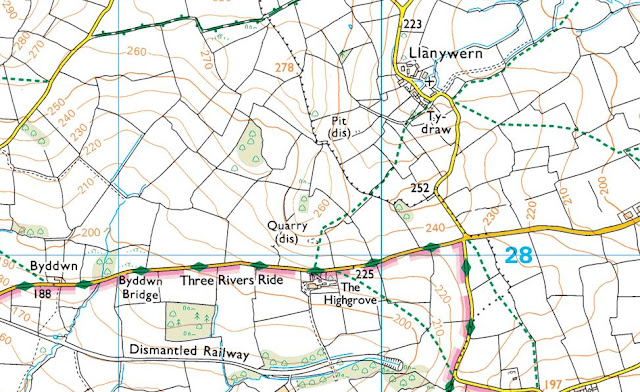%20-%201%2025000.jpg) |
| Extract from the Ordnance Survey 1:25,000 Explorer map |
However, it was not until LIDAR became available that the details for this hill could be accurately re-assessed. The LIDAR (Light Detection & Ranging) technique produced highly accurate height data that is now freely available for much of England and Wales.
Therefore, the deletion of this hill from Welsh Sub-P15 status is due to LIDAR analysis, resulting in a 271.1m summit height and a 257.4m bwlch height, with these values giving this hill 13.7m 0f drop, which is insufficient for it to be classified as a Welsh Sub-P15.
The full details for the hill are:
Group: Mynydd Epynt
Name: March Mynydd Ucha
OS 1:50,000 map: 161
Summit Height: 271.1m (LIDAR)
Summit Grid Reference: SO 09744 28233 (LIDAR)
Bwlch Height: 257.4m (LIDAR)
Bwlch Grid Reference: SO 09741 28417 (LIDAR)
Drop: 13.7m (LIDAR)
Myrddyn Phillips (July 2024)
Mapping Mountains - Hill Reclassifications - The Welsh P15s
Allt y Geifr (SN 762 284) – Welsh P15 reclassified to Welsh Sub-P15 (37th reclassification)
Significant Height Revisions post for Allt y Geifr
There has been a reclassification to the list of The Welsh P15s, with the summit height, bwlch height and their locations, the drop and status of the hill derived from LIDAR analysis conducted by Myrddyn Phillips.
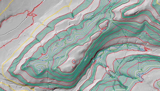%20-%20LIDAR%20hill%202.jpg) |
| LIDAR image of Allt y Geifr (SN 762 284) |
The criteria for the list that this reclassification applies to are:
 |
| The Welsh P15s by Myrddyn Phillips |
The name the hill is listed by is Allt y Geifr, and it is adjoined to the Mynydd Du group of hills, which are situated in the southern part of South Wales (Region B, Sub-Region B5), and it is positioned encircled by minor roads with the A4069 road farther to its north-west and south-west, and has the village of Llangadog towards the west.
When the listing that became known as The Welsh P15s was being compiled, this hill was included in the main P15 list with an estimated c 16m of drop, based on the 174m summit spot height that appeared on the Ordnance Survey Vector Map Local hosted on the Geograph website and which was entitled the Interactive Coverage Map and an estimated c 158m bwlch height, based on interpolation of 5m contouring between 155m – 160m that appeared on the OS Maps website.
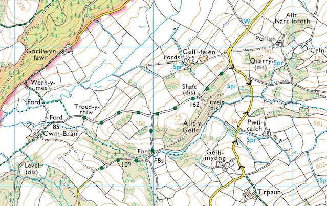%20-%201%2025000.jpg) |
| Extract from the Ordnance Survey 1:25,000 Explorer map |
However, it was not until LIDAR became available that the details for this hill could be accurately re-assessed. The LIDAR (Light Detection & Ranging) technique produced highly accurate height data that is now freely available for much of England and Wales.
Therefore, the reclassification of this hill to Welsh Sub-P15 status is due to LIDAR analysis, resulting in a 171.1m summit height and a 156.9m bwlch height, with these values giving this hill 14.2m of drop, which is insufficient for it to be included in the main list of The Welsh P15s.
The full details for the hill are:
Group: Mynydd Du
Name: Allt y Geifr
OS 1:50,000 map: 146, 160
Summit Height: 171.1m (LIDAR)
Summit Grid Reference: SN 76221 28491 (LIDAR)
Bwlch Height: 156.9m (LIDAR)
Bwlch Grid Reference: SN 76558 28873 (LIDAR)
Drop: 14.2m (LIDAR)
Myrddyn Phillips (June 2024)
Mapping Mountains - Hill Reclassifications - The Welsh P15s
Pt. 181.4m (SN 731 303) – Welsh Sub-P15 reclassified to Welsh P15 (36th reclassification)
There has been a reclassification to the list of The Welsh P15s, with the summit height, bwlch height and their locations, the drop and status of the hill derived from LIDAR analysis conducted by Myrddyn Phillips.
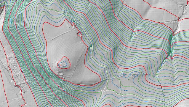%20-%20LIDAR%20hill%202.jpg) |
| LIDAR image of Pt. 181.4m (SN 731 303) |
The criteria for the list that this reclassification applies to are:
 |
| The Welsh P15s by Myrddyn Phillips |
The hill is being listed by the point (Pt. 181.4m) notation as an appropriate name for it either through local enquiry and/or historic research has not been found by the author, and it is adjoined to the Mynydd Du group of hills, which are situated in the southern part of South Wales (Region B, Sub-Region B5), and it is positioned with the A4069 road to its west and a minor road to its south-east, and has the village of Llangadog towards the south-west.
When the listing that became known as The Welsh P15s was being compiled, this hill was included in the P14 sub list with an estimated c 14m of drop, based on the 181m summit spot height that appears on the Ordnance Survey 1:25,000 Explorer map and an estimated c 167m bwlch height, based on interpolation of 5m contouring between 165m – 170m that appeared on the OS Maps website.
%20-%201%2025000.jpg) |
| Extract from the Ordnance Survey 1:25,000 Explorer map |
However, it was not until LIDAR became available that the details for this hill could be accurately re-assessed. The LIDAR (Light Detection & Ranging) technique produced highly accurate height data that is now freely available for much of England and Wales.
Therefore, the reclassification of this hill from Welsh Sub-P15 status is due to LIDAR analysis, resulting in a 181.4m summit height and a 166.2m bwlch height, with these values giving this hill 15.2m of drop, which is sufficient for it to be included in the main list of The Welsh P15s.
The full details for the hill are:
Group: Mynydd Du
Name: Pt. 181.4m
OS 1:50,000 map: 146, 160
Summit Height: 181.4m (LIDAR)
Summit Grid Reference: SN 73163 30392 (LIDAR)
Bwlch Height: 166.2m (LIDAR)
Bwlch Grid Reference: SN 73315 30299 (LIDAR)
Drop: 15.2m (LIDAR)
Myrddyn Phillips (June 2024)


%20-%20LIDAR%20hill%201.jpg)

%20-%201%2025000.jpg)
%20-%20LIDAR%20hill%201.jpg)

%20-%201%2025000.jpg)
%20-%20LIDAR%20hill%201.jpg)

%20-%201%2025000.jpg)
%20-%20LIDAR%20hill%201.jpg)

%20-%201%2025000.jpg)
%20-%20LIDAR%20hill%203.jpg)

%20-%201%2025000.jpg)
%20-%20LIDAR%20hill%202.jpg)

%20-%201%2025000.jpg)
%20-%20LIDAR%20hill%202.jpg)

%20-%201%2025000.jpg)
%20-%20LIDAR%20hill%202.jpg)

%20-%201%2025000.jpg)
%20-%20LIDAR%20hill%203.jpg)

%20-%201%2025000.jpg)
%20-%20LIDAR%20hill%202.jpg)

%20-%201%2025000.jpg)
%20-%20LIDAR%20hill%201.jpg)

%20-%201%2025000.jpg)
%20-%20LIDAR%20hill%201.jpg)

%20-%201%2025000.jpg)
%20-%20LIDAR%20hill%202.jpg)

%20-%201%2025000.jpg)
%20-%20LIDAR%20hill%203.jpg)

%20-%201%2025000.jpg)
%20-%20LIDAR%20hill%203.jpg)

%20-%201%2025000.jpg)
%20-%20LIDAR%20hill%202.jpg)

%20-%201%2025000.jpg)
%20-%20LIDAR%20hill%203.jpg)

%20-%201%2025000.jpg)
%20-%20LIDAR%20hill%202.jpg)

%20-%201%2025000.jpg)
%20-%20LIDAR%20hill%201.jpg)

%20-%201%2025000.jpg)
%20-%20LIDAR%20hill%203.jpg)

%20-%201%2025000.jpg)
%20-%20LIDAR%20hill%202.jpg)

%20-%201%2025000.jpg)
%20-%20LIDAR%20hill%201.jpg)

%20-%201%2025000.jpg)
%20-%20LIDAR%20hill%202.jpg)

%20-%201%2025000.jpg)
%20-%20LIDAR%20hill%201.jpg)

%20-%201%2025000.jpg)
%20-%20LIDAR%20hill%202.jpg)

%20-%201%2025000.jpg)
%20-%20LIDAR%20hill%201.jpg)

%20-%201%2025000.jpg)
%20-%20LIDAR%20hill%201.jpg)

%20-%201%2025000.jpg)
%20-%20LIDAR%20hill%201.jpg)

%20-%201%2025000.jpg)
%20-%20LIDAR%20hill%201.jpg)

%20-%201%2025000.jpg)
%20-%20LIDAR%20hill%202.jpg)

%20-%201%2025000.jpg)
%20-%20LIDAR%20hill%201.jpg)

%20-%201%2025000.jpg)
%20-%20LIDAR%20hill%201.jpg)

%20-%201%2025000.jpg)
%20-%20LIDAR%20hill%201.jpg)

%20-%201%2025000.jpg)
%20-%20LIDAR%20hill%202.jpg)

%20-%201%2025000.jpg)
%20-%20LIDAR%20hill%202.jpg)

%20-%201%2025000.jpg)
No comments:
Post a Comment