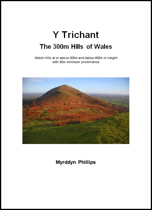
Lan Ddu Cilwenau (SN 572
371)
There has been a Summit Relocation to a hill that
is listed in the Y Trichant – The 300m
Hills of Wales and Y Trechol – The Dominant Hills of Wales, with the summit height,
bwlch height and their locations, the drop, dominance and status of the hill
derived from detail on contemporary maps produced from Ordnance Survey data and
LIDAR analysis conducted by Myrddyn Phillips.
%20-%20LIDAR%20hill%202.jpg) |
| LIDAR image of Lan Ddu Cilwenau (SN 572 371) |
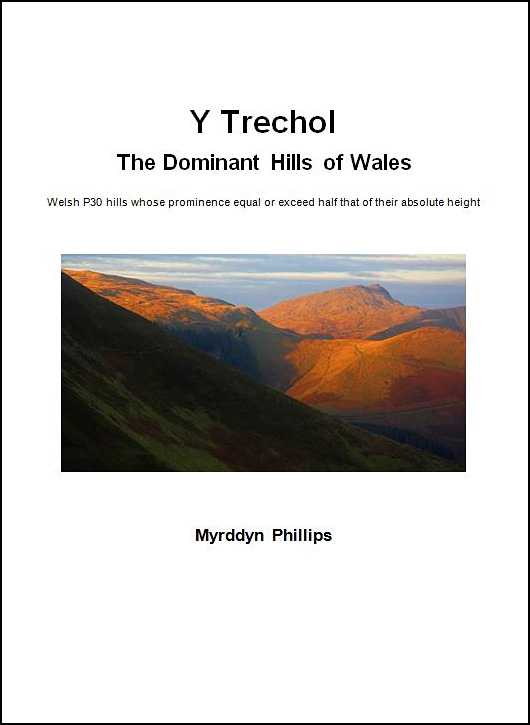
The criteria for the two listings that this summit
relocation applies to are:
 |
| Y Trichant - The 300m Hills of Wales by Myrddyn Phillips |
 |
| Y Trechol - The Dominant Hills of Wales by Myrddyn Phillips |
The name the hill is listed by is Lan Ddu Cilwenau,
and it is adjoined to the Mynydd Pencarreg group of hills, which are situated in the south-western part of South
Wales (Region B, Sub-Region B1), and
it is positioned with the B4337 road to its north-east, a minor road to its south-west
and the B4310 road to its south-east, and has the village of Llansawel towards
the east south-east.
%20IMG_0418A%20-%201%2025000.jpg) |
| Extract from the Ordnance Survey 1:25,000 Explorer map |
However, it was not until LIDAR became available
that the details for this hill could be accurately re-assessed. The LIDAR (Light Detection & Ranging)
technique produced highly accurate height data that is now freely available for
much of England and Wales.
%20-%20LIDAR%20summit%202.jpg) |
| LIDAR summit image of Lan Ddu Cilwenau (SN 572 371) |
The summit height produced by LIDAR analysis is 333.1m
and is positioned at SN 57277 37147, and this comes within the parameters of the
Summit Relocations used within this page heading, these parameters are:
The term Summit Relocations applies when the high
point of the hill is found to be positioned; in a different field, to a
different feature such as in a conifer plantation, within a different map contour, to a different
point where a number of potential summit positions are within close proximity,
when natural ground or the natural and intact summit of a hill is confirmed
compared to a higher point such as a raised field boundary or covered reservoir
that is judged to be a relatively recent man-made construct, or a relocation of
approximately 100 metres or more in distance from either the position of a map
spot height or from where the summit of the hill was previously thought to
exist.
Therefore, the summit
height produced by LIDAR analysis is 333.1m and is positioned at SN 57277 37147,
this position is not given a spot height on the contemporary Ordnance Survey
1:50,000 Landranger and 1:25,000 Explorer map, and is approximately 400 metres eastward
from where the previously listed summit is positioned.
The full details for the
hill are:
Group: Mynydd Pencarreg
Name: Lan Ddu Cilwenau
OS 1:50,000 map: 146
Summit Height: 333.1m (LIDAR)
Summit Grid Reference
(New Position): SN 57277 37147 (LIDAR)
Bwlch Height: c 211m (interpolation)
Bwlch Grid
Reference: SN 56467 37617 (interpolation)
Drop: c 122m (LIDAR summit and interpolated bwlch)
Dominance: 36.66% (LIDAR summit and interpolated bwlch)
Myrddyn Phillips (May
2022)

%20-%20LIDAR%20hill%202.jpg)
%20IMG_0418A%20-%201%2025000.jpg)
%20-%20LIDAR%20summit%202.jpg)
No comments:
Post a Comment